Country:
 City:


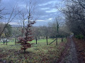
The route starts from the Parc du Grand Patural car park, near the Pont de Verdun, on the right bank of the Moselle. Accessible on foot from the town centre.
(S/E) On leaving the car park, turn right and take the bridge over the Moselle.
Red and white markings forthe GR®5F
(1) At the end of the bridge, go down a flight of steps on the right and join Avenue du Général de Gaulle. Walk along the avenue on your left-hand side until you reach the next set of traffic lights.
(2) Cross the avenue and follow it to the left, i.e. in the opposite direction to before. After about 150 m, turn right into Rue des Jardins. Follow this street to the right until you reach a junction.
(3) Follow Rue du Maréchal Foch to the left. At the next junction, turn right into Rue du Saint-Quentin.
(4) At the junction, turn left into Rue des Bénédictins. Stay on this road, which winds its way along, and cross Rue Nicolas Chaillot on your right.
(5) Just before a bend to the right, leave the street and take a path on the left called Route Stratégique. Stay on this path, heading north-west, and ignore all turn-offs to the left.
(6) You’ll come out onto Rue des Mirabelles; follow it as it continues. At the end, first turn left then right to take the path that runs alongside a small vineyard.
(7) Join Rue du Général de Gaulle and follow it to the left. Pass Rue du Petit Clos on your left, then turn right onto Rue du Général de Gaulle. Pass Rue de Lavaux on your right.
(8) At the next junction, turn right onto Rue Paul Ferry and walk past the town hall. Then take the first right onto the Sentier du Haut Chemin.
(9) You’ll come out onto Rue de Tignomont; follow it to the right. Just after a wayside cross, turn left onto Rue de Lorry.
(10) At the Fork in the road, turn left onto Chemin des Lorrains. The tarmac soon gives way to a path through the woodland. Stay on the main signposted path and ignore any side paths.
(11) After about 1.5 km, turn right at the signpost and head downhill along the Chemin du Planty. Carry on straight ahead, heading north-east.
(12) When you reach Rue des Écoles, follow it to the left, leaving the church on your right. At the end, follow the Grand’Rue to the left.
(13) Take the first right onto Route de Vigneulles. Stay on this winding road. Cross Rue Moret on the right-hand side, then turn left onto Route des Vigneulles.
(14) When Route des Vigneulles bends to the right, carry on straight ahead along Rue du Moulin. Pass the mill (a house with a stream running underneath it), then turn right onto an uphill path. At the end, turn left.
(15) Take the first path on the right, which leads towards the orchards of Haut de Vigneulles. Stay on this lovely path for about 1.2 km as it winds through the forest until you reach a crossroads.
NoGR® markings
(16) Then turn left (let theGR® trail head off to the right). Carry on straight ahead (west), ignoring the paths branching off to the left.
(17) Take the first path on the right and head downhill. At the next junction (elevation 228), turn left, keeping a field on your right and a stream on your left. Continue for 300 m until you reach a junction.
(18) At the junction that appears after about 300 m, take the old military road that climbs straight ahead (north-west). Climb, ignoring the turnings on the left, until you reach the Saint-Maurice farm.
(19) Carry on straight ahead when you reach the farm; stay on this path and ignore the turnings on the left.
(20) Cross the D51 with care and walk past the Notre-Dame du Gros Chêne Chapel. Head straight on into the forest.
(21) Turn right and head down an old military road. Finish with two sharp bends to the right.
(22) At the junction, take the left-hand hairpin bend and follow a greenway along the embankment of a former railway line. Continue straight on, heading south-southeast.
(23) Cross over Rue de Lorcy, then Route de Lessy, and continue south-east along the greenway. At the end, go down a flight of steps on the left.
(24) Cross Rue de Metz carefully and take the gravel path opposite. Walk along the right-hand side of the fence of the Serret barracks. At the corner, continue along the Chemin des Grandes Vignes (tarmac). Carry on along Rue des Moulins, using the pavement on the right, and turn left with it.
(25) At the junction, turn right (towards the church) and walk past the Robert Schuman house (Father of Europe). Join theGR®5(red and white markings), continue for about a hundred metres, and take the first path on the left. At the end, follow a road (Chemin des Noques) on the right for about fifty metres.
(26) When the street bends to the right, turn left onto a path. You’ll come out onto Rue de l’Esplanade; follow it to the right. Walk past the town hall and you’ll immediately reach a Fork in the road at the foot of the church.
(27) Turn right onto the main road. At the junction after a washhouse, go straight on along the Route de Longeville. Head downhill, passing a cemetery on your right. At the end of the road, turn left and you’ll soon reach a roundabout.
(28) Then turn right onto Rue de l’Église.
(29) At the end (with the church opposite), cross Rue du Général de Gaulle at the pedestrian crossing and follow it to the left. Stay on this street until you reach a railway line, then walk alongside it on the right-hand side.
(1) Take the Pont de Verdun to cross the Moselle again. On the other side, go straight on and you’ll immediately come back to the car park where you started (S/E).


 Visorando Member

 Easy


 Moderate