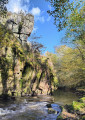
Tour des Lavières in Étivey

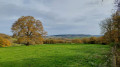
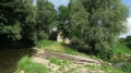
A pleasant and easy circular route along the paths, with sections through the forest and undergrowth.

Details

17077120
Creation:
Last update:
Last review:
  • Walking
    Activity: Walking
  • ↔
    Distance: 3.13 mi
  • ◔
    Average duration: 1h 30 
  • ▲
    Difficulty: Easy

  • ⚐
    Back to start: Yes
  • ↗
    Ascent: + 98 ft
  • ↘
    Descent: - 102 ft

  • ▲
    Highest point: 935 ft
  • ▼
    Lowest point: 794 ft
  • ⚐ Country: France
  • ⚐ City: Étivey (89310)
  • ⚑
    Start/End: N 47.677504° / E 4.144615°
  • ❏
    IGN map(s): Ref. 2821SB
  • Hour-by-hour weather

Photos

Description of the walk

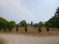
Park in the church square.

(S/E) Take Rue de la Poste on the left and continue along the D115.

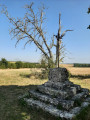
(1) About a hundred metres after leaving the village, leave the road and take the dirt track on the left, passing the Croix Pierrot Porrain.

(2) At the fork in the road, stay on the main track on the left and carry on towards the TGV bridge.

(3) Head straight down the same track without going under the TGV bridge and head due north.

(4) Stay on the path running alongside the field on the left, passing the Croix Maladière and the cemetery.

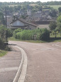
(5) When you reach the village, take thesecond road on the left, Rue du Château, and you’ll arrive at the church square (S/E).


Waypoints

  1. S/E : mi 0 - alt. 856 ft - Église Saint-Phal (Étivey)
  2. 1 : mi 0.27 - alt. 866 ft - Road-path junction
  3. 2 : mi 0.8 - alt. 879 ft - Fork in the road
  4. 3 : mi 1.51 - alt. 909 ft - TGV bridge
  5. 4 : mi 2.18 - alt. 814 ft - Sèche-Bouteille junction
  6. 5 : mi 3.03 - alt. 843 ft - Junction after the cemetery
  7. S/E : mi 3.13 - alt. 856 ft - Église Saint-Phal (Étivey)

Worth a visit

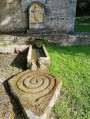
You’ll pass close to two ‘Croix Maladières’.
Keep an eye out – you might spot some roe deer!

Reviews and comments

4.4 / 5
Based on 3 reviews

Reliability of the description
4.7 / 5
Ease of following the route
5 / 5
Route interest
3.7 / 5
HansN
HansN

Overall rating : 4.7 / 5

Date of your route : Aug 18, 2025
Reliability of the description : ★★★★★ Very good
Ease of following the route : ★★★★★ Very good
Route interest : ★★★★☆ Good
Very busy route : No

Nice route

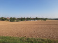
This was my first proper hike after two years of injuries that prevented me from going out, so I was very happy with this route. A good part of it is in the shade of the forest. The first part is in the middle of fields. It's a nice route, even with children, but be careful with your shoes because the stones are sometimes quite large.

Machine-translated

DEUTSCH
DEUTSCH

Overall rating : 4.7 / 5

Date of your route : Aug 03, 2023
Reliability of the description : ★★★★★ Very good
Ease of following the route : ★★★★★ Very good
Route interest : ★★★★☆ Good
Very busy route : No

As I was on holiday, the aim was to keep fit. It was a pleasant walk, with plenty of shade along much of the route.

Machine-translated

cedwinks
cedwinks

Overall rating : 4 / 5

Date of your route : Jul 15, 2023
Reliability of the description : ★★★★☆ Good
Ease of following the route : ★★★★★ Very good
Route interest : ★★★☆☆ Average
Very busy route : No

A easy route, but not particularly interesting. The first section is on stony ground and runs alongside fields, with little shade. The second section, on the other hand, is more interesting as it passes through a larger wooded area.

One downside, as I mentioned, is that the path runs alongside fields, and we found ourselves facing a field on fire, which forced us to turn back, so do take care during the burning season to avoid any difficulties.

Machine-translated

Other walks in the area

For more walks, use our search engine .

The GPS track and description are the property of this route's author. Please do not copy them without permission.