The north side of the Hervaux Forest

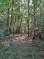
A short, easy walk through the forest, entirely under the canopy, ideal for a hike with young children on a sunny day. You’ll be able to admire all sorts of rather majestic tree species. Please note: there are no signposts along the route.

Details

103134059
Creation:
Last update:
Last review:
  • Walking
    Activity: Walking
  • ↔
    Distance: 2.99 mi
  • ◔
    Average duration: 1h 30 
  • ▲
    Difficulty: Easy

  • ⚐
    Back to start: Yes
  • ↗
    Ascent: + 125 ft
  • ↘
    Descent: - 98 ft

  • ▲
    Highest point: 1,194 ft
  • ▼
    Lowest point: 1,076 ft
  • ⚐ Country: France
  • ⚐ City: Coutarnoux (89440)
  • ⚑
    Start/End: N 47.611927° / E 3.925722°
  • ❏
    IGN map(s): Ref. 2721SB
  • Hour-by-hour weather

Description of the walk

Approach via the D11 and park below the hunting lodge (Sommière de la Jonction).

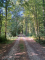
(S/E) Head due north towards the forest along the long straight stretch of road.

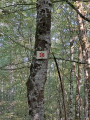
(1) Ignore the return path on the left and continue straight on along the Sommière de la Jonction. Pass the 295-metre mark (signpost 38).

(2) Turn left onto the dirt track and emerge onto the Sommière de la Réserve.

(3) Turn left onto the gravel track and continue through the woodland until you approach the D11.

(4) Without joining it, turn left just before the picnic area onto the dirt track to reach the forest track and the original junction.

(1) Turn right and head back to the car park (S/E).

Waypoints

  1. S/E : mi 0 - alt. 1,168 ft - Car park below the hunting lodge
  2. 1 : mi 0.1 - alt. 1,168 ft - Junction of the circular loop
  3. 2 : mi 1.01 - alt. 1,102 ft - Signpost 38
  4. 3 : mi 1.4 - alt. 1,096 ft - Arrival on a stony track
  5. 4 : mi 2.46 - alt. 1,175 ft - picnic area
  6. S/E : mi 2.99 - alt. 1,194 ft - Car park below the hunting lodge

Other walks in the area

For more walks, use our search engine .

The GPS track and description are the property of this route's author. Please do not copy them without permission.