Walk around the Crosagny and Beaumont ponds from Albens

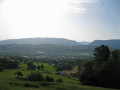
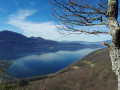
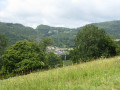
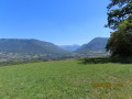
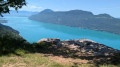
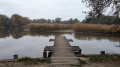
This unusual route through the small Deysse forest is full of surprises and offers the chance to explore the unspoilt shores of the Crosagny and Beaumont ponds, taking you off the beaten track along the edges of meadows and woods.

Details

n°111279434
Creation:
Last update:
Last review:
–
  • Walking
    Activity: Walking
  • ↔
    Distance: 5.73 mi
  • ◔
    Average duration: 2h 40 
  • ▲
    Difficulty: Easy

  • ⚐
    Back to start: Yes
  • ↗
    Ascent: + 52 ft
  • ↘
    Descent: - 52 ft

  • ▲
    Highest point: 1,214 ft
  • ▼
    Lowest point: 1,132 ft
  • ⚐ Country: France
  • ⚐
    Area: Alps
  • ⚐ City: Albens (73410)
  • ⚑
    Start/End: N 45.788627° / E 5.948753°
  • ❏
    IGN map(s): Ref. 3331OT, 3332OT
  • Hour-by-hour weather

Photos

Description of the walk

Park in the car park at the cemetery in Albens.

(S/E) Go round the cemetery on the right to join the Albens fitness trail.

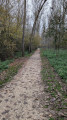
(1) Cross the bridge and follow the path to the left as it curves. Keep heading north along the Deysse and continue to the footbridge.

(2) Turn right, cross the footbridge and leave the main path. Turn left straight away, continuing to follow the river.

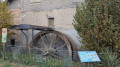
(3) Cross the bridge on the left, then head straight to the right towards the Moulin de Crosagny.

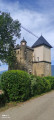
(4) At the mill, turn left and head towards the ponds.

(5) Follow the path to the right along the southern bank of the Étang de Crosagny and, at the junction, turn left, heading north.

(6) Pass under the rope blocking the path on the left and reach the start of the meadows. Go round them on the left.

(7) Cross the Nant Bresset at the ford and head uphill opposite. Resume the route to the left along the meadows and follow the northern shore of the Étang de Beaumont to reach the Route des Greppes.

(8) Turn left onto the road and continue straight on to complete the circuit of the pond and reach a car park.

(9) Head straight ahead, pass the Étang de Braille on your right and follow the path to a telecoms mast.

(10) Carry on along the path that runs alongside the railway line and, at the junction, carry on straight ahead.

(11) Cross the railway line at the level crossing, then take Route de Braille on the left. You’ll reach another mast.

(12) Cross the railway line again and follow the Chemin des Marais to return directly to the cemetery car park (S/E).

Waypoints

  1. S/E : mi 0 - alt. 1,161 ft - Cemetery car park
  2. 1 : mi 0.5 - alt. 1,135 ft - Bridge
  3. 2 : mi 1.14 - alt. 1,152 ft - Footbridge over the - Deysse (cours d'eau)
  4. 3 : mi 1.5 - alt. 1,165 ft - Crossing a small road
  5. 4 : mi 1.89 - alt. 1,171 ft - The old Crosagny mill
  6. 5 : mi 2.1 - alt. 1,194 ft - Junction - Étang de Crosagny
  7. 6 : mi 2.49 - alt. 1,204 ft - Crossroads
  8. 7 : mi 3.14 - alt. 1,194 ft - Fording point - Étang de Beaumont
  9. 8 : mi 3.5 - alt. 1,194 ft - T-junction – Route des Greppes
  10. 9 : mi 3.78 - alt. 1,191 ft - Car park - Étang de Braille
  11. 10 : mi 4.23 - alt. 1,171 ft - Outpost
  12. 11 : mi 4.66 - alt. 1,178 ft - Level crossing - Étang de la Bottière
  13. 12 : mi 5.09 - alt. 1,165 ft - Level crossing
  14. S/E : mi 5.73 - alt. 1,161 ft - Cemetery car park

Notes

At point (6), a string is stretched across the path. Make sure you stay at the edge of the meadows as you will need to cross cow pens between (6) and (7). At point (7), there is a ford.

Worth a visit

The nature trail : a discovery trail marked with information boards runs along the western bank of the Deysse.

(4) The old Crosagny Mill, the bird observatory situated on the western bank of the Étang de Crosagny.

The llama farm at Grand Salagine, on the right after the (8).

Other walks in the area

For more walks, use our search engine .

The GPS track and description are the property of this route's author. Please do not copy them without permission.