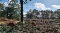
Tour of the wind turbines at Lande Verrien

La Lande Verrien is a narrow strip of land within the municipality of Muzillac, overlooking the Vilaine estuary. For the past ten years or so, six wind turbines have been turning there, harnessing the wind blowing straight in from the ocean.
The suggested route follows the various paths and small roads that wind first through wooded heathland, then through beautiful hedgerow countryside, as well as part of the coastal path between Billiers and Arzal.

Details

2812415
Creation:
Last update:
Last review:
  • Walking
    Activity: Walking
  • ↔
    Distance: 8.02 mi
  • ◔
    Average duration: 3h 55 
  • ▲
    Difficulty: Moderate

  • ⚐
    Back to start: Yes
  • ↗
    Ascent: + 262 ft
  • ↘
    Descent: - 259 ft

  • ▲
    Highest point: 135 ft
  • ▼
    Lowest point: 10 ft
  • ⚐ Country: France
  • ⚐ City: Arzal (56190)
  • ⚑
    Start/End: N 47.499203° / W 2.441259°
  • ❏
    IGN map(s): Ref. 1021SB, 1022OT
  • Hour-by-hour weather

Photos

Description of the walk

Park opposite Tréhiguier harbour, situated on the other side of the Vilaine.

(S/E) With your back to the Vilaine, walk a little over 400 metres up the road heading west towards Coëtsurho.

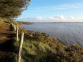
(1) Before the first right-hand bend, on the right-hand side of the road, a small path – accessed via a chicane – winds its way between two hedges and climbs up the hillside. As you gain height, you’ll be treated to lovely views of the Vilaine estuary. Further on, the path emerges amongst the houses of the hamlet of Kerantréh.
Turn right to join the road leading to the village, then continue straight on at the next junction.

(2) Let the road curve off to the left and take the main track that leads straight ahead. It winds its way past the wind turbines one by one until it reaches the isolated house at Lande Verrien.
In wet weather, the track may be impassable between the second and third wind turbines, as it is poorly drained and may be flooded. In this case, take the neighbouring field on the western side.

(3) Once past Lande Verrien, the track becomes a road. Follow it for about 350 metres, then turn right at the first junction you come to. The path winds its way through a narrow wooded strip before emerging into a more open area at the foot of a hillside. Turn left to walk up the slope. Before reaching the road leading to Trégréhen, the view opens up to the left onto the sea. Below, the massive, square tower of the former Abbaye de Prière stands out against the shoreline.
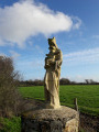
When you reach the road, turn left and follow it to the first house in the village of Trégréhen. As you pass, note the beautiful granite statue of the Virgin Mary and the curious headdress worn by the infant Jesus.

(4) Turn left onto the path before the first house. When it joins another road, turn left again, follow this road for about 150 metres, then at the first bend, turn right onto the long ridge path leading to Kervéléan.  Once again, you’ll be treated to beautiful views of the ocean and the valleys leading to Muzillac.

(5) When you reach the road after the farm, turn left, head back towards the first wind turbine, and turn right towards Billiers at the first three-way junction. Follow this road for about 300 m, turn left and, at the three-way junction immediately after, turn right towards Bourg l’Étang.

(6) Just before you reach the village, turn left, then left again. The path you’re now taking skirts a wetland area, following its edge in a wide bend to the right. As it’s not possible to reach Port Nart directly, head up the hillside to the edge of the Guernehué equestrian centre. When you see it, turn left towards a grove of pine trees overlooking the ocean to rejoin the coastal path.

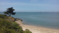
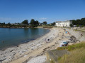
(7) Take this path, heading to the left. After passing the small cove of Port Nart and its neo-Breton villa, the path follows the coast as closely as possible, leading to Le Moustoir. Depending on the tide, the view over the Vilaine estuary is ever-changing, with the light playing across the water or the exposed foreshore.

Return to Le Moustoir along the water’s edge (S/E).

Waypoints

  1. S/E : mi 0 - alt. 13 ft - Car park at the Moustoir slipway
  2. 1 : mi 0.29 - alt. 33 ft - Start of the path towards Kerantréh
  3. 2 : mi 0.91 - alt. 62 ft - Entrance to the Chemin de la Lande Verrien
  4. 3 : mi 1.83 - alt. 75 ft - Maison de la Lande Verrien
  5. 4 : mi 2.96 - alt. 105 ft - Just before Trégréhen
  6. 5 : mi 3.96 - alt. 75 ft - Kervéléan
  7. 6 : mi 4.86 - alt. 16 ft - Before Bourg l’Étang
  8. 7 : mi 5.98 - alt. 49 ft - Junction with the coastal path
  9. S/E : mi 8.02 - alt. 10 ft - Car park at the Moustoir slipway

Notes

The small sunken path linking Le Moustoir to Kerantreh also serves as a drainage ditch. Although the ground is firm, it can nevertheless be difficult to use after heavy rain.

Before reaching Le Moustoir, the path crosses a somewhat marshy area which can be difficult to navigate at high tide and in windy conditions. It may therefore be worth checking the tide times before setting out on this route.

Worth a visit

This walk covers part of the grounds of the former Abbaye de Prière. Although only a few remains are left in Billiers (the entrance porch, the tower of the former abbey church, the prior’s house, etc.), this abbey was once one of the most important in southern Brittany. In the first part of the route, you’ll find old stone boundary markers along the path that once marked the edge of its nearby estate.

Shortly before passing the last headland before Le Moustoir (upstream of the marshy area), there are a few remains of an old lime kiln. This was built against the small cliff overlooking the coast at this point, and used the oyster shells found on the foreshore. Time and the waves have severely damaged this small monument, which had been restored some twenty years ago.

Reviews and comments

4.3 / 5
Based on 2 reviews

Reliability of the description
4.5 / 5
Ease of following the route
4 / 5
Route interest
4.5 / 5
philrandovilaine
philrandovilaine

Don’t look for signposts where there aren’t any. The routes suggested by Visorando are those discovered by the people who created them. That could be you if you feel like contributing. These routes are not officially recognised and therefore have no signposting, unless they cross paths with routes that are. The map and route descriptions should enable you to follow these routes with complete peace of mind.
Kind regards
PhilRV

Machine-translated

User 3558241

Overall rating : 4.3 / 5

Date of your route : Jun 01, 2026
Reliability of the description : ★★★★★ Very good
Ease of following the route : ★★★★☆ Good
Route interest : ★★★★☆ Good
Very busy route : No

The ground markings aren't very accurate

Machine-translated

DEDELEBRETON
DEDELEBRETON

Overall rating : 4.3 / 5

Date of your route : Mar 11, 2021
Reliability of the description : ★★★★☆ Good
Ease of following the route : ★★★★☆ Good
Route interest : ★★★★★ Very good
Very busy route : No

A really lovely route that I discovered after completing it myself in both the 12 km and 21 km versions.

Machine-translated

Other walks in the area

For more walks, use our search engine .

The GPS track and description are the property of this route's author. Please do not copy them without permission.