Country:
 City:
City:


Park in the small car park in front of the old Tréhiguier lighthouse and the Maison de la Mytiliculture.
(S/E) Turn your back on the harbour and walk up the street of the same name until it curves sharply to the right. Then leave it, turn left and cross the Place de Kerlochet. A small road, the Rue de Bel Air, leads to the residential area that extends from the old village as far as Kerascouët.
(1) When the road bends left to enter the hamlet, leave it and take the sunken path that runs off to the right between two large, tree-lined embankments. After a slight descent, the path climbs again through farmland until it reaches the Route de Berniguet. To your right, there is a lovely view of the estuary.
Cross the small road and continue straight on towards Kermouraud. You will then enter a small valley where the sight of the large oak trees lining the embankments is truly impressive. Some of these trees are over a hundred years old and have clearly never suffered any damage at the hands of man.
At the bottom of the valley, go round the far end of a pond on the left, then head uphill, once again following the beautiful rows of trees.
(2) As you reach the road leading to the Kermouraud estate, which you can see further on to the left, carry on straight ahead until you come out onto the RD 34 county road.
Cross this road carefully and take the road opposite leading to the Cénic campsite. Very soon, you can take a footpath that has been laid out on the other side of the embankment to the right of this small road. This takes you away from the traffic associated with the campsite until you reach the bottom of the valley.
Return to the road to cross the bottom of the valley and take the path that runs alongside the road on the left, once you have passed the pond. When you reach the first houses in the neighbouring housing estate, turn sharply left into the woodland. Follow an old, densely planted hedge of ancient oaks once more before reaching a cross-path. Turn right and join the Route de Bilaire in the village of Pénestin.
(3) When you come out onto the road, turn left and follow it for 80 metres, before turning right into the first street you come to (Chemin du Biolle). Carry on straight ahead until you reach the barrier blocking access to the neighbouring housing estate. A gentle path goes round it on the right. Follow the edges of the plots until you reach a crossroads.
Ignore the cycle signs pointing back towards the village and turn left, then immediately right, to walk along the back of another housing estate. At the first crossroads, take the path that veers away from the housing estate, to the right. After passing through a stretch of countryside, you’ll come to a cross-country path which you take to the left. A hundred metres further on, turn right to go round the business park. After returning to a residential area, you’ll come out onto the RD 201.
(4) Cross the departmental road with care and take the small street opposite which leads to Rue de la Plage. Cross this road and turn into Rue de l’Île du Moulin. At the first junction, leave this road and turn right onto Allée des Pluviers, following it until it curves to the right.
Ignore the first cul-de-sac on the left and continue along the one leading towards the sports ground. As you approach the gate leading to the sports facilities, turn left before the thuja hedge surrounding them. Follow the path that goes round the site until you have passed the facilities.
(5) After the sports complex, you’ll come to a rural stretch where you walk straight on until you reach a crossroads. Take the path that branches off to the left after the fitness trail’s wall bars. Fifty metres further on, turn right to reach the hamlet of Trégorvel.
(6) Turn left onto the Route de Brancelin and follow it for about a hundred metres. Turn right onto the first path you come to, which leads down into the valley towards the old salt marshes. As you reach the wetland, turn left onto the cross-path that leads to the heart of the village of Haut-Pénestin, after passing the old Brambert saltworks. On the climb up to the village, you’ll pass an old wash house and its fountain.
(7) As you leave the track, turn right twice towards Men ar Mor, then turn right onto the Chemin du Galiédais. After passing the houses, head down towards the salt marshes again; follow them to the left before reaching an old dyke. Turn right to take the path that runs along it. On the right, a few remnants of the old salt marshes remain, whilst on the left the site has been left to run wild after having been used as a tidal flat for oyster farming.
Back on dry land, the path branches off to the right, climbing up onto the plateau above the estuary. Follow the path until you reach the old Brambert manor house.
(8) At the first junction, leave the manor house on your right and turn left to head back towards the village of Pénestin. Just before reaching the denser cluster of buildings that forms the heart of the village, turn left into Rue du Lienne. This road forms a wide arc that skirts around the village to reach the estuary. Follow it until you rejoin the road leading down from the church.
(9) At the bottom of the village, cross a marshy area separated from the seashore by a coastal sandbar. Rue de la Vilaine runs through this area. Follow it until you reach a pine forest. Before reaching the forest, cut across the dune ridge to the left to reach the beach, then walk up the beach to the right until you reach the houses at Branzais.
Before setting off, check that the water level in the estuary is high enough (the mudflats should still be visible); otherwise, you will have to retrace your steps.
(10) At Le Branzais, a masonry structure crosses the foreshore. You must cross it with care (as there may be slippery seaweed) to continue your walk along the foot of the dyke that protects the marshes behind the coastal barrier. If the water reaches the foot of the dyke, turn back and take the road to complete a circular route.
Otherwise, you’ll soon reach the Logo shellfish farms, where you’ll need to step over the drainage channels to reach the sports ground and the old Logo quarry. Go round the sports ground to the left and return to the coastal road. Turn left, climb the ramp leading back up onto the plateau and turn left onto the first road you come to (Allée du Scale).
(11) A short detour to the right takes you to the Menhir de la Pierre Blanche. Alternatively, continue along the Pointe du Scal coastal road. At the junction, turn left to return to the Maison de la Mytiliculture (S/E).


 Visorando Member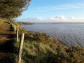

 Easy
Easy