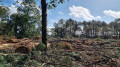
Circular route between the Arzal Dam and Ferel

This circular walk allows you to enjoy the scenery along the River Vilaine, the woodland on the way to Ferel, and finally a return journey through the countryside around Camoël.

Details

4418223
Creation:
Last update:
Last review:
  • Walking
    Activity: Walking
  • ↔
    Distance: 8.17 mi
  • ◔
    Average duration: 3h 55 
  • ▲
    Difficulty: Easy

  • ⚐
    Back to start: Yes
  • ↗
    Ascent: + 197 ft
  • ↘
    Descent: - 197 ft

  • ▲
    Highest point: 171 ft
  • ▼
    Lowest point: 7 ft
  • ⚐ Country: France
  • ⚐ City: Camoël (56130)
  • ⚑
    Start/End: N 47.496047° / W 2.386437°
  • ❏
    IGN map(s): Ref. 1021SB, 1022ET, 1022OT
  • Hour-by-hour weather

Description of the walk

The walk starts from the Arzal Dam visitor car park.

(S/E) Head towards the Vilaine, then follow it to the right. After about 400 m, take theGR®34(marked in red and white), continuing to follow the Vilaine.
Continue along the path for about 1.5 km until you reach a picnic area.

(1) Head back up to the right, away from the Vilaine, following the ‘Sentier des Coulées’ signposts.

(2) Before reaching Le Drézet, take the road on the right for 200 m, then head down the path on the right.

(3) At the bottom of the slope, turn left, skirting the marsh known as the Coulée du Bourg.

(4) At the crossroads of the paths, continue to the right then immediately to the left, following the red and whiteGR® markings.

(5) As you approach Kersauvage, continue to follow theGR®39, which turns left and then right onto the road.

(6) In the village of Kersauvage, turn right towards “Le Guerny”.

(7) At the edge of the woodland, continue to the left, following theGR®39towards the undergrowth. After 500 m, continue by turning left.

(8) At the junction with the cross-country track, turn right, staying on theGR®, towards Le Guerny.

(9) Once you reach Le Guerny, turn left for about 100 m, then take the Chemin des Écureuils on the right. After 900 m, turn right before the Cour du Moulin. Continue for 300 m, then turn left.

(10) First turn left then right and carry on towards the D34 road, which you’ll need to cross (take care!) heading towards Perrin, following the yellow signposts.

(11) Once in Perrin, continue following the yellowPR® signposts by turning left.

(12) Turn left onto the cycle path for 600 m, then turn left onto Route de Vielle Roche. Cross the D34 again (be careful!).

(13) Turn right onto Rue du Moulin, then carry on straight ahead, following the red signposting towards the village.

(14) Turn right towards Camoël, heading up Rue de la Masse. When you reach the junction with the D34, turn left onto Rue Paul Ladmirault for 150 m, then right onto Rue de l’École for 50 m, and take the first right to rejoin theGR®34and its red and white markings.

Carry on to the right along thisGR® towards the Arzal Dam. At the road, continue to the right as far as La Vielle Roche, cross the D139 (with care!), and take theGR®34to the left, which leads back to the Arzal Dam car park (S/E).

Waypoints

  1. S/E : mi 0 - alt. 30 ft - Car park, Arzal Dam - Vilaine (fleuve)
  2. 1 : mi 1.42 - alt. 20 ft - Right: GR34-GR39
  3. 2 : mi 1.74 - alt. 108 ft - turn right onto the road
  4. 3 : mi 1.99 - alt. 13 ft - La Coulée du Bourg: continue to the left
  5. 4 : mi 2.39 - alt. 20 ft - Turn right and left, following the GR39 markings
  6. 5 : mi 2.78 - alt. 82 ft - Turn left then right onto the road and follow the GR39
  7. 6 : mi 2.88 - alt. 105 ft - Turn right towards Le Guerny in Kersauvage
  8. 7 : mi 3.04 - alt. 95 ft - Turn left and stay on the signposted path
  9. 8 : mi 3.46 - alt. 112 ft - Turn right and continue on the GR
  10. 9 : mi 3.76 - alt. 138 ft - Turn left and cross the D34 road
  11. 10 : mi 4.65 - alt. 164 ft - Riegas: turn left, then right – yellow markings
  12. 11 : mi 5.12 - alt. 151 ft - Perrin: continue following the yellow markings to the left
  13. 12 : mi 5.31 - alt. 131 ft - Follow the cycle path, turning left
  14. 13 : mi 6.02 - alt. 144 ft - Turn right towards the village (green signpost)
  15. 14 : mi 6.67 - alt. 118 ft - Camoël on the right
  16. S/E : mi 8.17 - alt. 30 ft - Car park, Arzal Dam

Notes

Please note: in wet weather, the return route to Camoël can be muddy.

Always be cautious and plan ahead when you're outdoors. Visorando and the author of this route cannot be held responsible for any accidents occurring on this route.

The GR® and PR® markings are the intellectual property of the Fédération Française de Randonnée Pédestre.

Reviews and comments

4.2 / 5
Based on 3 reviews

Reliability of the description
4.3 / 5
Ease of following the route
3.7 / 5
Route interest
4.7 / 5
JLBGUADELOUPE
JLBGUADELOUPE

Overall rating : 3.7 / 5

Date of your route : Mar 04, 2021
Reliability of the description : ★★★★☆ Good
Ease of following the route : ★★☆☆☆ Disappointing
Route interest : ★★★★★ Very good
Very busy route : No

The path before Camoel was very muddy
Some of the yellow markings are missing or have been worn away

Machine-translated

mahornsolo
mahornsolo

Overall rating : 4.7 / 5

Date of your route : Mar 02, 2021
Reliability of the description : ★★★★★ Very good
Ease of following the route : ★★★★★ Very good
Route interest : ★★★★☆ Good
Very busy route : No

Machine-translated

gaelle.bouilliez
gaelle.bouilliez

Overall rating : 4.3 / 5

Date of your route : Dec 29, 2020
Reliability of the description : ★★★★☆ Good
Ease of following the route : ★★★★☆ Good
Route interest : ★★★★★ Very good
Very busy route : No

A superb walk – it was quite damp in places, but that was to be expected given the weather over the previous few days… At one point, we had to go round via the embankments or along the edges of fields.
A lovely walk!

Machine-translated

Other walks in the area

For more walks, use our search engine .

The GPS track and description are the property of this route's author. Please do not copy them without permission.