Country:
 City:
City:


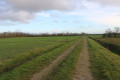
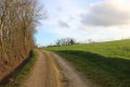
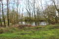
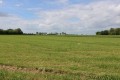
The car park is situated beside the D101 road, approximately 1.5 km before Brûlain when coming from Périgné: at this point, two grassy tracks lead off towards the north and north-east. When parking, please ensure you leave access to the fields and tracks for tractors and other agricultural machinery.
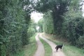
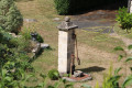
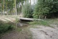
(S/E) Take the path on the right, the one furthest to the east. It is a shaded path that runs alongside the Pré Russeau area on the right-hand side. Further on, the path takes a right-angle bend to the left immediately next to a right-angle bend in the Route des Seigneuries. Shortly afterwards, the track forms an ‘S’ shape. In the first bend to the right, you will see an old masonry fountain (spring) just beside the track on your right. The track reaches a junction.
(1) Take the path on the right downhill and continue to the Route des Seigneuries, carrying on straight ahead along the path as it curves to the right. Turn right to follow this road and go round the farm at the hamlet of La Salle, where there are vicious dogs that bark loudly. As you go round the house, you’ll see a ‘small roof’ on the right-hand side of the road, with dovecotes and a pond. Continue along the road as it bends to the right and follow it until you reach a path on the left a short distance further on. Turn left and head eastwards until you reach a junction with a path on the left, at the crossing over an intermittent stream.
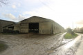
(2) Turn left onto the track that runs alongside the intermittent stream on your left. At the next T-junction, turn left. A little further on, cross Rue des Chaumes with care and continue straight ahead along a grassy, shaded track that skirts the village of Fayolle to the north-east. This sunken track may be flooded during periods of heavy rain. If this happens, climb up the embankment on the right and walk along the field beside the hedge until you reach a farm building. The path comes out onto Rue du Maréchal Ferrant. Cross it carefully and continue straight ahead into Rue des Ouches. Follow this road to the junction with Rue du Château in the hamlet of La Brissonerie. At this point, turn right and walk for about 50 metres.
(3) Turn left onto the path heading northwards on a gentle incline. Turn left onto the first path as you reach the plateau and shortly afterwards you’ll join the D304 road coming from Availle further north. Turn left and walk carefully alongside the road for a good hundred metres.
(4) Turn right onto a flat track leading towards the road from Availle to the Carrefour de la Croix Mataux. Cross this road carefully and continue straight ahead along a track. Shortly afterwards, the track turns sharply left. Continue straight ahead along the track heading north-west through the Fief Barin area. A little further on, ignore a track branching off to the right from Availle and continue along the track that turns left. Follow it until you reach the second track on the left.
(5) Turn left onto a path that climbs slightly before levelling out and leading towards the D104 road. When you reach it, turn left and follow it carefully for about 150 metres.
(6) Turn right onto a small road leading to the hamlet of Bouquétienne and pass through it.
(7) At the next crossroads, turn left and follow the Pièce du Milieu on your right. Go straight across the next four-way junction. After a bend to the right at almost a right angle, turn left onto the track which joins the D104 a short distance further on.
(8) Continue carefully along the D104 to the left before turning right onto a track that crosses the Fosse aux Prêtres area. Join the road leading from Brûlain to Fayolle.
(9) Follow the road carefully to the left for about 300 metres and turn right onto a shaded track heading south-east, then south through the Les Prés Chapeau area. The track joins the D101 road, at the side of which the car park is located (S/E).

 Visorando Member

 Easy
Easy