The Selle Viaduct

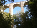
A complete change of scenery, just a stone’s throw from the town, where you can explore this viaduct, 55 metres high and 200 metres long; a truly impressive engineering feat on the railway line between Briançon and Veynes, overlooking the Selle torrent.

Details

50957239
Creation:
Last update:
Last review:
  • Walking
    Activity: Walking
  • ↔
    Distance: 3.92 mi
  • ◔
    Average duration: 2h 25 
  • ▲
    Difficulty: Easy

  • ⚐
    Back to start: Yes
  • ↗
    Ascent: + 673 ft
  • ↘
    Descent: - 696 ft

  • ▲
    Highest point: 3,173 ft
  • ▼
    Lowest point: 2,539 ft

Photos

Description of the walk

This walk is signposted as No. 4 on the ground.

(S/E) From the starting signpost, follow the road uphill to the junction with a dirt track. Turn right, then come to a second junction.

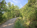
(1) Turn left. The path, which is initially flat, descends towards the Selle torrent. Pass under the viaduct, cross the torrent, and head back up the left bank. The path turns into a track. Follow this straight ahead until you reach a junction.

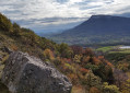
(2) You can turn right to reach a viewpoint. To do this, after turning right, stay on this side through the hairpin bend, then continue straight ahead until you reach the road. Carry on straight ahead to the viewpoint.

(3) Return to the road, continue straight ahead along the forest track, then turn right, then left until you reach the crossroads you passed earlier.

(2) Head back down the track to the right. Carry on straight ahead, cross the railway line via a bridge, and head back down to the road. Turn left and join the D47.

(4) Turn left onto the D47, then head uphill to the left. Continue along the road and soon turn off onto a good track on the right. The track climbs and joins the Chemin du Viaduc. Continue straight on to reach the starting point. (S/E)

Waypoints

  1. S/E : mi 0 - alt. 2,635 ft - Rue du Lotissement
  2. 1 : mi 0.16 - alt. 2,717 ft - Junction - Viaduc de la Selle
  3. 2 : mi 0.92 - alt. 2,959 ft - Turn-off onto the track
  4. 3 : mi 1.46 - alt. 3,166 ft - Viewpoint
  5. 4 : mi 2.8 - alt. 2,579 ft - D47
  6. S/E : mi 3.92 - alt. 2,635 ft - Rue du Lotissement

Notes

IGN map of Gap no. 3338 ET

How to get there:
From Gap town centre, head towards Marseille. Take the exit for Pelleautier, then at the Eyssagnières roundabout, continue in the same direction. Take the second right onto Rue de Chaudefeuille. At the end, turn left onto Chemin du Viaduc. Look out for the start sign.

Public transport:

Let’s minimise car journeys; consider using public transport or car-sharing.
Gap city buses (line 8 – Viaduc stop)
SNCF services from Gap station

Car park:
Chemin du Viaduc

Worth a visit

- Selle Viaduct
- Viewpoint at (3)

Reviews and comments

4.1 / 5
Based on 3 reviews

Reliability of the description
4.3 / 5
Ease of following the route
4.3 / 5
Route interest
3.7 / 5
Annick84
Annick84

Overall rating : 3.3 / 5

Date of your route : Jul 27, 2026
Reliability of the description : ★★★★☆ Good
Ease of following the route : ★★★★☆ Good
Route interest : ★★☆☆☆ Disappointing
Very busy route : No

The appeal would have been getting up close to this magnificent viaduct; unfortunately, following the Viso route, you only get a distant view of one of the bridge’s piers; we didn’t understand a previous review stating that you can go up to the first floor – it’s impossible; the information board is located on the departmental road (and not in the wasteland as the route suggests!) and is of no interest; the same goes for the final stretch along the road, apart from admiring the pretty houses in the area. For us, this outing was a disappointment

Machine-translated

Ait-Touati
Ait-Touati

Overall rating : 4.3 / 5

Date of your route : Apr 27, 2026
Reliability of the description : ★★★★☆ Good
Ease of following the route : ★★★★☆ Good
Route interest : ★★★★★ Very good
Very busy route : No

A very pleasant 3-hour circular walk through woodland and meadows. Magnificent views of Gap. An impressive passage beneath the viaduct on the Briançon–Veynes railway line.

Machine-translated

Domi C.
Domi C.

Overall rating : 4.7 / 5

Date of your route : May 12, 2025
Reliability of the description : ★★★★★ Very good
Ease of following the route : ★★★★★ Very good
Route interest : ★★★★☆ Good
Very busy route : No

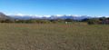
If you’ve got two or three hours to kill, for example, before setting off again from Gap, it makes for a pleasant little walk. You can climb up to the first level of the viaduct. There’s a lovely view of the Pic de Bure and the Chaillol massif from the orientation table.

Machine-translated

Other walks in the area

For more walks, use our search engine .

The GPS track and description are the property of this route's author. Please do not copy them without permission.