Circular walk through the Plaine des Cafres Forest

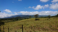
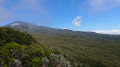
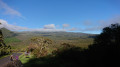
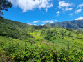
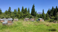
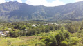
The Plaine des Cafres region is brimming with walking routes. This one is among the muddiest on the island. However, it takes you around the Forêt Départemento-Domaniale, offering magnificent views of the surrounding countryside as you pass through pastures, primary forests, cryptomeria woodlands and then branles. The slopes are sometimes steep on this circular route, and the vegetation here is exceptionally rich and still well-preserved. You should, however, set off early in the morning to avoid the clouds.

Details

n°2962440
Creation:
Last update:
Last review:
  • Walking
    Activity: Walking
  • ↔
    Distance: 10.63 mi
  • ◔
    Average duration: 7h 05 
  • ▲
    Difficulty: Difficult

  • ⚐
    Back to start: Yes
  • ↗
    Ascent: + 2,552 ft
  • ↘
    Descent: - 2,539 ft

  • ▲
    Highest point: 6,506 ft
  • ▼
    Lowest point: 4,491 ft

Photos

Description of the walk

To get there:
- From Saint-Benoît: head towards Saint-Pierre via the N3 (Route des Plaines). Pass the Col de Bellevue and take the first right towards the start of the path leading to the Piton des Neiges. At the junction with Chemin Doret, carry straight on. Park at the next car park.
- From Saint-Pierre: head towards Saint-Benoît via the N3 (Route des Plaines). Pass the village of Bourg Murat and take the first left towards the start of the path leading to the Piton des Neiges. At the junction with Chemin Doret, carry straight on. Park at the next car park.

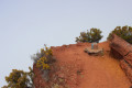
(S/E) Follow the road, leaving the GRR2 on your left, and enjoy the wonderful panoramic views. The road winds its way through pastures and passes several flat rock outcrops. Continue to the end of the road.

(1) Carry on straight ahead onto the Sentier Forestier de Bébour. This marks the start of a zigzagging route as you cross numerous ravines. You’ll come to a footbridge over a ravine.

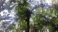
Take the footbridge; from here, the landscape changes and the path becomes quite muddy. The vegetation is typical of Réunion: this is primary forest with mosses, fanjans and other endemic species – the Plaine des Cafres Departmental and State-owned Forest. Pass close to the Piton de la Plaine des Cafres and begin a fairly steep descent towards the Col de Bébour. Do not run during this steep descent; some steps may be high. A few clearings offer views of the rampart on the other side of the road before reaching the Col de Bébour.

(3) Cross the road and, after a short descent, you’ll soon come to a Y-junction.

(4) Turn left onto the Route de Duvernay. This road passes through a forest of cryptomeria trees and a picnic area. Continue to the end of the road.

(5) Continue along the track, which climbs gently, winding its way up in a few hairpin bends at times. On the map, the track ends at the 1,480 mark. It has since been extended and now ends a little higher up. This section can be muddy.

(6) Just before the end of the track, look out for the path that starts very inconspicuously on the left. It quickly leaves the cryptomeria forest behind and gradually enters the primary forest of the Bébour Biological Reserve. Shortly afterwards, you’ll come to a ladder which may be difficult for those prone to vertigo.
Please take care here: on this section, the route shown on the IGN map is incorrect – follow the GPS route instead.
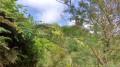
Some of the slopes are steep and the steps quite high. The path winds around a bend in the hillside. The vegetation is very dense. You will sometimes need to crouch down and step over branches or tree trunks. The path then becomes a little flatter. Just before crossing the Bras Chanson towards the 1760 mark, you may be unsure which way to go. The path then reaches a small stream that is very often dry; follow the stream downwards and then rejoin the path on the left.

(7) Cross the Bras Chanson. The vegetation begins to change slightly as you reach the first slopes. Follow the route shown on the IGN map at this point. After a fairly steep slope, cross the Bras Chanson a second time.

(8) Turn left towards the Plaine des Cafres and Mare à Boue.
Please note: the route shown on the map is incorrect; this is the old route of the path. Follow the GPS route carefully.
Then begin the climb up the ridge.

(9) You’ll reach the ridge.
Please note: There are a few ladders of varying heights which may cause discomfort for those prone to vertigo. After the ladders, begin a long, very muddy descent through the thickets, with frequent views of Mare à Boue. A very large part of the descent takes place through the thickets. Reach the edge of the forest, at the junction of the GRR2® and the Piton Tortue trail, marked by a boundary stone.

(10) Continue straight on to quickly reach the pastures, which offer remarkable views of the surrounding area. You will then cross a track and continue straight on along the path.
Next, cross a stream via a footbridge and rejoin the junction with the path leading up to Piton Bleu.

(11) Keep left on theGR® to return to the car park; keep left towards the car park.
You’ll reach your car after about 20 minutes (S/E).


Waypoints

  1. S/E : mi 0 - alt. 5,253 ft - Car park
  2. 1 : mi 1.01 - alt. 5,256 ft - End of the road
  3. 2 : mi 1.15 - alt. 5,240 ft - Footbridge
  4. 3 : mi 2.7 - alt. 4,603 ft - Col de Bébour
  5. 4 : mi 2.97 - alt. 4,491 ft - Turn left onto the Route de Duvernay
  6. 5 : mi 3.81 - alt. 4,629 ft - Continue along the track
  7. 6 : mi 4.54 - alt. 4,925 ft - Turn left onto the very inconspicuous path
  8. 7 : mi 6.06 - alt. 5,751 ft - Bras Chanson
  9. 8 : mi 6.59 - alt. 6,243 ft - Crossroads
  10. 9 : mi 6.95 - alt. 6,296 ft - Col de la Pente Crève Coeur
  11. 10 : mi 9.33 - alt. 5,568 ft - Waymarker: carry on straight ahead
  12. 11 : mi 9.9 - alt. 5,410 ft - Crossroads
  13. S/E : mi 10.63 - alt. 5,253 ft - Car park

Notes

Fanjans are tree ferns.
This walk can be very muddy: make sure you wear good walking boots.
Set off by 7 am at the latest to enjoy the best views.
Several sections involving ladders may cause problems for those prone to vertigo.
The route of the paths is not entirely accurate on IGN maps; follow the GPS route

Worth a visit

(S/E) From the starting point, be sure to take in the magnificent views of the Pitons Mare à Boue, the Pâturages de Biberon, the Piton Tortue, the Piton Lepervanche and the Piton Bleu.

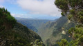
(3) Before reaching the pass, a cut through the mountain offers a view towards the Pic des Sables. Here, enjoy a sublime view of the Plaine des Marsouins and the Piton des Neiges.

(9) On the ridge, enjoy unique views over the Bras de Sainte-Suzanne valley, the Piton des Neiges and the Plaine des Marsouins.

Places to see:
- The Plaine des Cafres Departmental and State-owned Forest.
- The Bébour Biological Reserve.

Things to do:
- Visit the village of Bourg Murat and the Maison du Volcan (make sure you have some cash to hand).

Always be cautious and plan ahead when you're outdoors. Visorando and the author of this route cannot be held responsible for any accidents occurring on this route.

The GR® and PR® markings are the intellectual property of the Fédération Française de Randonnée Pédestre.

Reviews and comments

4.2 / 5
Based on 2 reviews

Reliability of the description
4.5 / 5
Ease of following the route
4 / 5
Route interest
4 / 5
GhosThoms
GhosThoms

Overall rating : 3.3 / 5

Date of your route : Oct 15, 2024
Reliability of the description : ★★★★☆ Good
Ease of following the route : ★★★☆☆ Average
Route interest : ★★★☆☆ Average
Very busy route : No

Warning! A really lovely walk, BUT...
As stated in the description, make sure you’re well prepared before setting off on a hike in this area. This means wearing suitable footwear and clothing appropriate for the local conditions: the terrain is very muddy and often misty. The ‘Mare à Boue’ car park certainly lives up to its name. Most of the path is covered in mud, and you’ll have no choice but to walk through it.

The middle section of the hike passes through a dense primary forest, with overgrown vegetation encroaching onto the path. The path is very poorly signposted, which may cause you to waste time trying to find the right direction. One section is particularly dangerous: this is a stretch where you walk alongside the bed of a dry river for several hundred metres. It is crucial not to miss the path on the right, which is also very poorly signposted. To help other walkers, I have built a small cairn (pile of stones) at this spot. Please feel free to add a stone to reinforce this landmark.

If you miss this junction, you’ll continue along the riverbed, but contrary to what’s shown on the IGN map, you won’t be able to find the path again. You’ll then come face to face with a 35-metre-high, dry waterfall that’s impossible to cross. The only option is to turn back.

If you’re planning to spend the night here, bear in mind that there are no camping spots available between km 6 and km 12.

For my part, I’d planned to spend the night there – and thank goodness I did! I set off on the hike at 2 pm and reached the dry riverbed around 9 pm, having lost a lot of time due to the numerous muddy patches. I didn’t reach my destination until 3 pm the following day. So do be mindful of your pace and take all necessary precautions.

Machine-translated

fannyfly
fannyfly

Overall rating : 5 / 5

Date of your route : Nov 14, 2023
Reliability of the description : ★★★★★ Very good
Ease of following the route : ★★★★★ Very good
Route interest : ★★★★★ Very good
Very busy route : No

A superb walk, offering great variety between pastures and primary forest. The ground wasn’t actually that wet apart from a few sections (though I did the walk in dry weather). The tarmac section isn’t a problem at all – there’s no traffic – and the cryptomeria forest is magnificent. I highly recommend this walk!!!!

Machine-translated

Other walks in the area

For more walks, use our search engine .

The GPS track and description are the property of this route's author. Please do not copy them without permission.