Piton des Songes

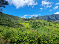
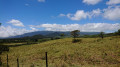
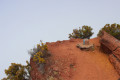
A small peak located in Plaine-des-Palmistes, the Piton des Songes is well known to Catholics, as evidenced by the presence of the Stations of the Cross, the Glorious Cross and the statue of Our Lady of Hope situated at its foot. From its summit, it offers a stunning view over Plaine-des-Palmistes. This family-friendly route takes you all the way round the hill and introduces you to birds and plant species endemic to Réunion.

Details

n°382229
Creation:
Last update:
Last review:
  • Walking
    Activity: Walking
  • ↔
    Distance: 1.84 mi
  • ◔
    Average duration: 1h 35 
  • ▲
    Difficulty: Easy

  • ⚐
    Back to start: Yes
  • ↗
    Ascent: + 804 ft
  • ↘
    Descent: - 787 ft

  • ▲
    Highest point: 4,058 ft
  • ▼
    Lowest point: 3,688 ft

Photos

Description of the walk

Access from Bourg-Murat: Head towards La Plaine-des-Palmistes. Drive to the village of Le Bras des Calumets. Park at the large car park on the outskirts of the village.

Access from Saint-Benoit: Take the RN3 towards the Col de Bellevue. Drive through the village of La Plaine-des-Palmistes. Continue towards the pass, then park at the entrance to the village of Bras des Calumets in the large car park.

(S/E) Take the road leading to Piton des Songes, which starts to the right of the car park. A few metres after the start of the road, take the path that begins on the right (a sign indicates the start of the path).

This route is straightforward: simply keep to the right at every junction you come to!

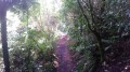
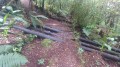
The path alternates between ascents and descents, sometimes featuring steep steps. The first few metres take you through dense undergrowth of guava trees. Following the recent rains, the path is slippery and a little muddy. The first clearings onto the Plaine-des-Palmistes appear after about 5 to 10 minutes’ walk.

(1) As the path takes a fairly long bend to skirt the south-eastern flank of Piton des Songes, you can see ahead of you the large, imposing cross that marks the summit of the piton. The path passes through an area heavily overgrown with brown grapes. Once you’ve passed this section, make the most of the panoramic views, as these will be the last of the walk. The path narrows and becomes more constricted after passing through a forest of filaos and cryptomeria. The guava trees then reappear, though only for a short distance.

(2) Next, the first endemic plants appear, marked by information boards. However, their trunks are not very visible as they are mostly covered in moss. This is a sign that it rains frequently in this part of the island.

(3) The fact that you can see the road leading to the summit of Piton des Songes on the left, and that you’re crossing over a pipe, shows that the end of the path is near: just a few more hairpin bends and we’ve reached the end of this fairly short walk (S/E).

Waypoints

  1. S/E : mi 0 - alt. 3,944 ft - Car park at the entrance to the village of Bras des Calumet
  2. 1 : mi 0.39 - alt. 3,953 ft - Keep to the right
  3. 2 : mi 1.09 - alt. 3,937 ft - Turn right
  4. 3 : mi 1.61 - alt. 4,049 ft - Turn right
  5. S/E : mi 1.84 - alt. 3,944 ft - Car park at the entrance to the village of Bras des Calumet

Notes

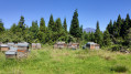
Kiosks and a water point are available at the starting point.
Come early in the morning to make the most of the weather.

Worth a visit

The cross and the viewpoint at Piton des Songes
The Stations of the Cross and the statue of Our Lady of Hope
Visit the Domaine des Tourelles.
Head to the Col de Bellevue and the Gros Piton Rond.

Reviews and comments

4 / 5
Based on 2 reviews

Reliability of the description
3.5 / 5
Ease of following the route
4.5 / 5
Route interest
4 / 5
User 3379513

Overall rating : 3.3 / 5

Date of your route : Dec 12, 2025
Reliability of the description : ★★★☆☆ Average
Ease of following the route : ★★★★☆ Good
Route interest : ★★★☆☆ Average
Very busy route : No

A magnificent view... moderate walk, lots of tarmac to climb... then we found a small, steep path on the left to go back down... but much nicer!

Machine-translated

ADDX
ADDX

Overall rating : 4.7 / 5

Date of your route : Oct 06, 2025
Reliability of the description : ★★★★☆ Good
Ease of following the route : ★★★★★ Very good
Route interest : ★★★★★ Very good
Very busy route : No

Hike completed in perfect weather conditions (not humid, not hot)
One comment, however, about the "easy" aspect: the section after point 1 is sometimes more like a slide than a walk and requires good physical condition and proper equipment. Overall, the elevation changes are quite significant.
That said, it's a very interesting hike and covers a lot of ground from the Plaine des Palmiers.

Machine-translated

Other walks in the area

For more walks, use our search engine .

The GPS track and description are the property of this route's author. Please do not copy them without permission.