Grand Bassin and the Voile de la Mariée

A beautiful hike offering stunning views of Grand Bassin in a superb setting. It begins with a 750m descent, which you then have to climb back up!
From Grand Bassin, a detour to the Voile de la Mariée waterfall and its pool is a must (swimming, picnic, etc.).

N.B. The displayed elevation gain of 1,340 metres is overestimated; the actual elevation gain is around 800 metres.

Details

330578
Creation:
Last update:
Last review:
  • Walking
    Activity: Walking
  • ↔
    Distance: 8.45 km
  • ◔
    Average duration: 5h 20 
  • ▲
    Difficulty: Difficult

  • ⚐
    Back to start: Yes
  • ↗
    Ascent: + 1,009 m
  • ↘
    Descent: - 1,008 m

  • ▲
    Highest point: 1,379 m
  • ▼
    Lowest point: 591 m

Description of the walk

Park in the car park by the water clock in Bois Court.

(S/E) From the Bois Court viewpoint, take the path heading west-southwest. Further on, the path winds downhill and turns east-northeast. After another series of bends, you will come to a pumping station with a water source.

(1) Continue along this path, which continues to wind downhill under the lift line.

(2) After this passage, further on, the path takes a general north-easterly direction, then the descent becomes gentler as you veer north-west to reach a bridge.

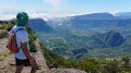
(3) Cross the bridge to discover Grand Bassin and take the opportunity to explore a little. Leave Grand Bassin heading south-west and continue along this path until you reach the "Bras de Sainte-Suzanne" river.

(4) Ford the river or balance on the rocks and turn left to follow the river. Further on, the path turns south and soon leads to the Voile de la Mariée.

(5) A beautiful spot for swimming (hard to resist). Return via the same route to the car park (S/E).

Waypoints

  1. S/E : km 0 - alt. 1,378 m - Car park at the Bois Court water clock.
  2. 1 : km 1.96 - alt. 1,039 m - Water source
  3. 2 : km 2.43 - alt. 837 m - Passage under the goods lift
  4. 3 : km 3.06 - alt. 682 m - Bridge over Bras Sec
  5. 4 : km 3.59 - alt. 652 m - Bras de Sainte-Suzanne
  6. 5 : km 4.15 - alt. 591 m - Voile de la Mariée (Grand Bassin)
  7. S/E : km 8.45 - alt. 1,379 m - Car park at the Bois Court water clock.

Notes

(1) Water source

Between (3) and (4) Grand Bassin: several small places to eat, drink and even stay (please note that you must book meals and accommodation in advance).

Reviews and comments

4.9 / 5
Based on 9 reviews

Reliability of the description
5 / 5
Ease of following the route
5 / 5
Route interest
4.8 / 5
fredchristine14
fredchristine14

I did the same as you, first the Grand Bassin in 3 hours 50 minutes and then two days later Piton des Neiges there and back in 7 hours 30 minutes.

Machine-translated

marco 85
marco 85

Overall rating : 5 / 5

Date of your route : Feb 04, 2026
Reliability of the description : ★★★★★ Very good
Ease of following the route : ★★★★★ Very good
Route interest : ★★★★★ Very good
Very busy route : Yes

I always start my hikes at 6:00 a.m. when it's cool, completing the route in 4 hours and 40 minutes at the age of 67. There are very few people around at that time of day, so I take a break on my own to admire the beautiful waterfall and eat before tackling the climb, which lives up to its reputation. That's when you start to meet people. A stop along the way to give provisions to someone who was struggling to continue. A hike cannot be improvised. Nice views.
Good preparation for the Piton des Neiges, which we did a few days later as a day trip.

Machine-translated

Eric and Marie
Eric and Marie

Overall rating : 4.7 / 5

Date of your route : Sep 08, 2025
Reliability of the description : ★★★★★ Very good
Ease of following the route : ★★★★★ Very good
Route interest : ★★★★☆ Good
Very busy route : Yes

Easy descent to the waterfall, then prepare your calves for the climb back up.
A pleasant hike.

Machine-translated

fredchristine14
fredchristine14

You'll see, it's great fun, with a fabulous view from the start and a splash in the pool before the tough climb back up. It's good for your cardio and for the ladies, it's good for your calves. Enjoy!

Machine-translated

Dion
Dion

Downloading in preparation for my trip to the island.
Therefore, I am unable to provide any feedback at this time.

Machine-translated

fredchristine14
fredchristine14

Overall rating : 5 / 5

Date of your route : Mar 15, 2025
Reliability of the description : ★★★★★ Very good
Ease of following the route : ★★★★★ Very good
Route interest : ★★★★★ Very good
Very busy route : Yes

Very beautiful hike, easy to get down to the waterfall, but the climb back up was difficult. It was already very hot, and we realised that we are getting old, because it seemed easier for the young people... Nevertheless, we are glad we did it, because a quick dip in the pool at the end was our reward.

Machine-translated

Espadon974
Espadon974

Superb 👍 hike, not suitable for beginners, or only do half the route.
A magnificent waterfall rewards you after a steep descent, followed by a short break before tackling the climb back up, which is quite strenuous, but offers some wonderful encounters along the way.
A few lodges await you in Creole houses, run by kind and welcoming people who are the pride of Réunion 😉.

Machine-translated

gilles2468
gilles2468

Overall rating : 5 / 5

Date of your route : Aug 26, 2024
Reliability of the description : ★★★★★ Very good
Ease of following the route : ★★★★★ Very good
Route interest : ★★★★★ Very good
Very busy route : No

A big WOW. The view from the lookout point at the start is magnificent, and you can see the route you have to take! The descent is difficult, and you must use walking sticks to keep your balance. You'll want to stop every 100 metres because the scenery is so beautiful. You can swim under the waterfall (but you have to be brave to get into the water!!!).
We spent the night in a lodge at the large pool and climbed back up the next morning. The climb is strenuous but less difficult than the descent.

Machine-translated

danielfr40
danielfr40

Overall rating : 5 / 5

Date of your route : Mar 15, 2022
Reliability of the description : ★★★★★ Very good
Ease of following the route : ★★★★★ Very good
Route interest : ★★★★★ Very good
Very busy route : Yes

A beautiful hike that is not too difficult.
The signs indicate a duration of 4½ hours, which is about how long it took me, plus a 30-minute stop at the waterfall.
Follow the river upstream beyond the trail to reach the basin
At the ford, as my balancing skills are not up to scratch, I decided to put on my water shoes and wade across with my legs in the water
At this time of year, set off early as the afternoons are rainy
Thank you for this walk.

Machine-translated

docteurpierron
docteurpierron

Overall rating : 5 / 5

Date of your route : Feb 12, 2021
Reliability of the description : ★★★★★ Very good
Ease of following the route : ★★★★★ Very good
Route interest : ★★★★★ Very good
Very busy route : Yes

Very beautiful views at the start and along the route. The elevation gain is actually less than advertised (but it's still a nice descent) but the route is longer. The waterfall site is very pleasant (picnic and swimming).
PS: the water point at the pumping station is there, but it's a small tap that's a bit hidden.

Machine-translated

Orando974
Orando974 ★

Overall rating : 5 / 5

Date of your route : Sep 30, 2019
Reliability of the description : Not used / Not applicable
Ease of following the route : Not used / Not applicable
Route interest : ★★★★★ Very good

I did the entire hike again on 28 September. It's still a very beautiful hike that deserves its place in the top 5 must-do hikes. Nothing much has changed since my previous review, except that the water source at the pumping station is still there. I just didn't see it last time. I also recommend bringing a hat and good sunscreen because it gets hot!

Machine-translated

Orando974
Orando974 ★

Overall rating : 5 / 5

Date of your route : Jun 15, 2019
Reliability of the description : Not used / Not applicable
Ease of following the route : Not used / Not applicable
Route interest : ★★★★★ Very good

A very beautiful hike! A must-see on the island. I did a one-way trip to Grand Bassin in 1 hour and 20 minutes with a break at the pumping station. Unfortunately, the water source at the pumping station no longer exists. The views of the surroundings of Grand Bassin are magnificent throughout the descent and the trail is in perfect condition. I didn't do the round trip to the waterfall, as that wasn't my goal. For those who want to return via an alternative route, it is possible to return via Piton Bleu, as I did, but this adds to the elevation gain, distance and time! (allow at least an extra hour and a half for an average walker).

Machine-translated

marcsejour
marcsejour
• Edited:

Okay, thank you, and we will do this hike next year, in winter 2017.

Machine-translated

sst
sst

Overall rating : 4.7 / 5

Date of your route : Nov 03, 2016
Reliability of the description : ★★★★★ Very good
Ease of following the route : ★★★★★ Very good
Route interest : ★★★★☆ Good

The elevation gain is not 1,340 metres, but certainly 800 metres.
It's a difficult walk with all the natural and artificial steps and stairways. The return trip seemed arduous to us. If you're in great shape, you can do it in 5 hours, but it took us 6 hours (that's what happens when you're old...).
Don't hesitate to go for a swim.
Our advice is to be at the viewpoint for the start between 6 and 7:00 in the morning. The weather can change quite quickly, despite fairly reliable weather forecasts.

Machine-translated

Other walks in the area

For more walks, use our search engine .

The GPS track and description are the property of this route's author. Please do not copy them without permission.