Walk around Bouconville Pond

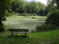
A short, easy walk along a dirt track.
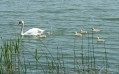
Best enjoyed early in the morning or at sunset to make the most of the abundant wildlife at these times and a sunset over the pond!

Details

n°98077
Creation:
Last update:
Last review:
  • Mountain biking
    Activity: Mountain biking
  • ↔
    Distance: 4.62 mi
  • ◔
    Duration according to the author: 30 mins 
  • ▲
    Difficulty: Easy

  • ⚐
    Back to start: Yes
  • ↗
    Ascent: + 36 ft
  • ↘
    Descent: - 36 ft

  • ▲
    Highest point: 791 ft
  • ▼
    Lowest point: 755 ft
  • ⚐ Country: France
  • ⚐ City: Bouconville-sur-Madt (55300)
  • ⚑
    Start/End: N 48.843151° / E 5.72007°

  • ◶
    Type of surface: Not specified
  • ⇧
    Bike carrying: Not specified
  • ▲
    Difficulty: Not specified
  • Hour-by-hour weather

Description of the route

Park in the church square in the village of Bouconville-sur-Madt.

(S) With your back to the church, turn right onto Rue Gabriel Bousselin.

(1) At the junction with Route d’Apremont, go straight on. Watch out for vehicles – there is a sharp bend with a significant blind spot. Ignore the next three left-hand turn-offs.

(2) Go down the dirt track on the right, towards the pond.
Follow the track and, after 50 metres, go through the gate and turn left.
From here, you’ll often see roe deer and hares in the mornings and evenings. The roe deer aren’t shy either.
The path moves away from the pond and heads north for 300 metres.

(3) At the junction, continue left, taking a 90° bend. After 600 metres, the path branches off to the right and then reaches a crossroads.

(4) At the crossroads, turn left at a 90° angle for 400 metres.

(5) At the next junction, turn left and continue along the white track for 800 metres.
Halfway along, there is a hunting lookout.

(6) At the junction, turn left. Continue for 700 metres and go through the gate.
Carry on straight ahead for 2 km until you reach the starting point.

Waypoints

  1. S/E : mi 0 - alt. 755 ft - Rupt de Mad
  2. 1 : mi 0.06 - alt. 758 ft - Junction with the Apremont road
  3. 2 : mi 0.63 - alt. 791 ft - Turn right towards the pond
  4. 3 : mi 1.49 - alt. 771 ft - Turn left at the junction
  5. 4 : mi 2.05 - alt. 774 ft - Turn left at the junction
  6. 5 : mi 2.29 - alt. 778 ft - Turn left at the junction
  7. 6 : mi 2.73 - alt. 774 ft - Turn left at the junction
  8. S/E : mi 4.62 - alt. 755 ft

Notes

The path is unpaved for 90 per cent of the route.
No shelters along the route.

Reviews and comments

4.7 / 5
Based on 1 review

Reliability of the description
4 / 5
Ease of following the route
5 / 5
Route interest
5 / 5
le petit randonneur
le petit randonneur

Overall rating : 4.7 / 5

Date of your route : Dec 09, 2020
Reliability of the description : ★★★★☆ Good
Ease of following the route : ★★★★★ Very good
Route interest : ★★★★★ Very good
Very busy route : No

A very easy walk along a pleasant dirt track. The forest is magnificent, with some beautiful oak trees. Best done at this time of year or in spring, preferably when the weather is fairly cool, as it is now
.

Machine-translated

Other walks in the area

For more walks, use our search engine .

The GPS track and description are the property of this route's author. Please do not copy them without permission.