


 Country:
 City:


From the AP7 motorway, head towards Ulldecona, stay on the bypass skirting the town to the south-east and reach the Bassa de Montsià plain via one of two possible routes:
- either from the roundabout to the east of Ulldecona, follow the signs for Bassa de Montsià; the tarmac road crosses the motorway and continues via the Colada del Ligallo de Montsià to the junction with the Cami de la Torreta
- or continue towards Tortosa for 2 km and turn right onto the Cami de la Torreta; the tarmac road crosses the railway line and the motorway before joining the Colada del Ligallo de Montsià: turn left then right to reach the official car park via an unpaved track.
(S/E) Continue straight on towards the south-east along the track, which becomes a footpath and climbs steeply up the hillside, winding its way round some rockier sections before reaching a small plateau at the point where a power line supplies a nearby mobile phone mast.
(1) Turn left to head north-east: the path alternates between flat sections and climbs and passes by Mas de Rosalea.
(2) Continue climbing, passing through the Corral and the Cova de Tabola, the lo Fornet cistern and the Coco del Fesoler, until you reach the ridge between the Mola Cima and the Torreta.
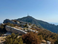
(3) At the junction on the ridge, turn left onto the gently sloping path which, passing through some sharp limestone pavements, leads to the summit of La Torreta.
(4) Continue northwards along the summit plateau and, at its northern end, head down the path that runs along the north-western slope, below the Coll de la Font del Teix, heading north towards the clearly visible Mas del Comú. This descent alternates between traverses between rocky outcrops and steeper sections where you cross the ravines.
(5) At the junction above the Mas, turn left onto theGR® 92, the Cami del Mas del Comú, which descends, initially staying on the left bank of the valley, then winding down in hairpin bends, before crossing to the right bank and joining the track leading to the Mas in the Barranc de Marcelina.
(6) Follow this gently sloping, carriageable track downwards. Pass a signposted path on the right, then a track on the left leading to the car park for a Via Ferrata.
(7) At the next junction (altitude 209 m), turn left onto the track leading back up to the car park (S/E).

 Visorando Member

 Easy


