Cornettes de Bise from Miex

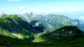
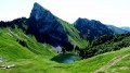
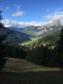
A very varied route for climbing the Cornettes de Bise from Switzerland. The summit, the highest in the region alongside the neighbouring Mont de Grange (2,432 m), offers a superb panorama. The descent through the Combe de la Chaux du Milieu takes place in a stunning, unspoilt setting, and the village of Tanay is enchanting.
A long hike with significant elevation gain, which requires a good level of fitness.

Details

3105476
Creation:
Last update:
Last review:
  • Walking
    Activity: Walking
  • ↔
    Distance: 9.83 mi
  • ◔
    Duration according to the author: 8 hrs 
  • ▲
    Difficulty: Very difficult

  • ⚐
    Back to start: Yes
  • ↗
    Ascent: + 4,721 ft
  • ↘
    Descent: - 4,705 ft

  • ▲
    Highest point: 7,940 ft
  • ▼
    Lowest point: 3,543 ft

Photos

Description of the walk

Parking is available in the large pay-and-display car park at a place called Le Flon, at the top of the village of Miex. The road to Miex starts in Vouvry, a village situated between Le Bouveret and Monthey.

Signposts at major junctions

(S/E) At the end of the car park, follow the tarmac road with restricted access heading towards Taney.

(1) At the exit of the first hairpin bend to the right, leave the road and take a path on the left. The climb through the forest is steep. Leave the forest and continue along the edge of the woodland until you reach Plan de l’Ortie.

(2) You’ll come out onto an alpine track; follow it to the right (west). Walk up a wide valley, pass the En Verne chalet and, after a few bends, reach the Chalet du Coeur.

(3) At the Fork in the road at the foot of the chalet, turn left (west-south-west) and follow a path towards the Col de Verne. The slope soon becomes steeper: take several hairpin bends to reach the pass (spelt ‘Vernaz’ in France).

(4) Head north towards La Calaz and climb a broad, grassy ridge via numerous hairpin bends (steep slope). This will take you to the Chalet de La Calaz.

(5) Head north-west and continue climbing through the mountain pastures, directly below the Saix de la Calaz and then the Rochers de Chaudin. You will reach the Pas de Chaudin, a small pass at the edge of a valley.

(6) Continue westwards towards the Cornettes de Bise. Climb amongst rocks and sharp limestone pavements to reach the base of the summit pyramid. Turn right and, after several switchbacks, reach the summit.

(7) Descend via the same route back to the Pas de Chaudin.

(6) Enter the valley on the left via a well-marked path towards Taney (there may be a snowfield in early summer). Descend through the rocky valley heading east-northeast.

(8) Veer left (east-north-east) and wind your way between small rocks. Then turn sharply left (west-north-west) to reach a sort of promontory above the Chalet de Loz (2,000m).

(9) Descend initially westwards, then quickly northwards down a steep slope towards the Loz chalet (do not follow the path running roughly along the hillside, which remains west-facing for a long time and leads to the Col d’Ugeon). Further down, turn right to reach the Loz chalet.

(10) Follow an alpine track eastwards towards Taney. Ignore a path branching off to the right and stay on the track which runs directly below Mont Gardy. Ignore a path branching off to the left towards the Grande Jumelle and follow the alpine track to a bridge.

(11) Just before the bridge, leave the track and take a path on the right. Descend alongside a stream, winding down several bends, and continue eastwards alongside the stream. Rejoin the track at the entrance to the hamlet of Tanay (sometimes spelt Taney) and follow it to the right to the centre.

(12) Take the road on the right towards Le Flon (keeping the lake on your left). Climb gently up to the Col de Tanay.

(13) Continue along the tarmac road, which descends steeply to the junction you passed at the start of the walk.

(1) Follow the route you took on the way there in the opposite direction to return to the Flon car park (S/E).


Waypoints

  1. S/E : mi 0 - alt. 3,543 ft - Le Flon – Car park
  2. 1 : mi 0.2 - alt. 3,780 ft - Junction of the circular loop
  3. 2 : mi 1.01 - alt. 4,203 ft - Map of L’Ortie
  4. 3 : mi 2.62 - alt. 5,443 ft - Le Coeur
  5. 4 : mi 3 - alt. 5,945 ft - Col de Vernaz
  6. 5 : mi 3.53 - alt. 6,768 ft - La Calaz
  7. 6 : mi 4.16 - alt. 7,451 ft - Col Chaudin
  8. 7 : mi 4.39 - alt. 7,940 ft - Cornettes de Bise
  9. 8 : mi 5.13 - alt. 6,939 ft - Chaux du Milieu
  10. 9 : mi 5.6 - alt. 6,522 ft - Promontory above the Loz chalet
  11. 10 : mi 6.15 - alt. 6,007 ft - Chalet de Loz
  12. 11 : mi 7.17 - alt. 5,374 ft - Bridge – Junction: track and path
  13. 12 : mi 8.23 - alt. 4,675 ft - Hamlet upstream of the - Lac de Tanay
  14. 13 : mi 8.75 - alt. 4,731 ft - Col de Tanay
  15. S/E : mi 9.83 - alt. 3,543 ft - Le Flon – Car park

Notes

Hiking boots and gear are essential.

Water is available in Taney, where you’ll also find places to eat, refreshments and accommodation options.

A map is essential (at the very least, the one accompanying this description). A compass never weighs down a rucksack...

Flon car park:
Parking is chargeable: take a ticket from the pay-on-arrival machine (credit cards accepted). Rate (July 2022): 8 Swiss Francs for a flat rate of 24 hours.

Alternative descent route from Taney:
To avoid the final descent on the tarmac, shortly after the Col de Taney (13), before the slope becomes really steep, turn right onto a path. You’ll soon rejoin the road; follow it to the left for a few metres, then turn right onto another path. After numerous hairpin bends, the path crosses the road. Continue down the path, which winds several times, until you reach the car park (S/E).

This route passes through a protected area, which may be subject to special regulations:

Worth a visit

- Very varied scenery.
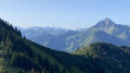
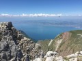
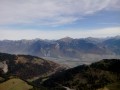
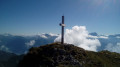
- Superb panoramic views from the summit of the Cornettes de Bises: Lake Geneva, the Chablais peaks, the Dents du Midi, the Swiss Alps, the Mont Blanc massif.
- A very wild setting in the Chaux du Milieu valley.
- In summer, it is possible to swim in Lake Tanay, provided you can tolerate a water temperature of no more than 15°…

Reviews and comments

4.7 / 5
Based on 2 reviews

Reliability of the description
4.5 / 5
Ease of following the route
4.5 / 5
Route interest
5 / 5
SCHAEFFER rudolf
SCHAEFFER rudolf

Overall rating : 5 / 5

Date of your route : Aug 21, 2021
Reliability of the description : ★★★★★ Very good
Ease of following the route : ★★★★★ Very good
Route interest : ★★★★★ Very good
Very busy route : No

A truly magnificent walk with a huge variety of landscapes and terrain.

We set off at 7:30 in the morning and reached the summit 3 hours later (with quite a few photo breaks).

We encountered no technical difficulties. The ascent is admittedly quite intense, but much more gradual than on other hikes in the area, such as Le Mont de Grange, which we found to be both more technical and more physically demanding (although we highly recommend it from Abondance).

The whole route is completely safe. You just need to take your time to climb according to your level of fitness.

The descent is probably even more beautiful, and the finish at Lac de Tanay is simply magical. Incidentally, for those with a sweet tooth, we recommend a break by the lake... a special Valais fondue (with beer) at any time.
Thanks again to the Visorando team for their fabulous work.

Machine-translated

Thierry T.
Thierry T.
• Edited:

Overall rating : 4.3 / 5

Date of your route : Aug 24, 2020
Reliability of the description : ★★★★☆ Good
Ease of following the route : ★★★★☆ Good
Route interest : ★★★★★ Very good
Very busy route : Yes

Nice walk, but it's a bit of a climb.

Machine-translated

Other walks in the area

For more walks, use our search engine .

The GPS track and description are the property of this route's author. Please do not copy them without permission.