Occitan place names in the Clapiers woods

A route through the Baillarguet massif, in Clapiers, with explanations in Occitan on the place-names of this woodland. This route is not signposted and presents no difficulty.

Details

n°34692873
Creation:
Last update:
Last review:
  • Walking
    Activity: Walking
  • ↔
    Distance: 3.61 mi
  • ◔
    Average duration: 1h 55 
  • ▲
    Difficulty: Easy

  • ⚐
    Back to start: Yes
  • ↗
    Ascent: + 282 ft
  • ↘
    Descent: - 289 ft

  • ▲
    Highest point: 417 ft
  • ▼
    Lowest point: 167 ft
  • ⚐ Country: France
  • ⚐ City: Clapiers (34830)
  • ⚑
    Start/End: N 43.663491° / E 3.879815°
  • ❏
    IGN map(s): Ref. 2743ET
  • Hour-by-hour weather

Description of the walk

Head to Clapiers, then from the media centre, take the Chemin du Martinet, which leads to the start of the route at a car park.

(S/E) Head south along the tarmac section of the Chemin du Martinet, ignore the first junction, then turn right onto a slight incline, before descending along the road through a series of bends – first to the right, then to the left. You’ll reach the hamlet of “Lous Aubrasses”, on the left, with the hamlet of “Lauriol” opposite.

(1) Continue along the unpaved track before heading uphill to the right along a wide track. Continue to the Bosses site.

(2) Stay on the main track. You’ll come across a path marked in orange – do not take this one. After a gentle descent, head uphill to the right. On the left, a sign points to a remarkable tree, the Montpellier maple.

(3) Carry on straight ahead for 100 m and, at the junction, turn right again onto the ascending track which leads to the water tower.
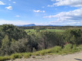
“Take in the scenery: to the right, on the southern side, you’ll see views of the sea, Palavas, Montpellier and the Gardiole massif. To the north, head towards the ‘viewpoint’ sign, with its orientation table.”

(4) “You’ll be able to admire the view of Pic Saint Loup and the Hortus, between two magnificent pine trees. Further on, discover the Séranne, Mont Baudille, and on a clear day, in the distance, the Aigoual.”

Head down the stony path leading to La Pisseirasse. At the track, walk 50 metres to the right and, as the track curves, take a small path on the left.

(5) At the junction with a clear clearing, carry on straight ahead then keep to the left. The path climbs up to the track on the ridge.
From here, you may want to use your phone’s map app, as there are plenty of paths branching off to the right and left. It’s easy to get lost.

(6) Take the second track on the right and head for the Jeanjean memorial, dedicated to a firefighter who lost his life whilst fighting a fire in this mountain range.

(7) At the crossroads, head down the track on the right, heading south, pass a water tank and, 100 metres further on, turn left onto the little Chemin de la Camille, which leads to a vineyard at Plan des Masques.

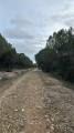
(8) Walk along the right-hand side of the vineyard until you reach a wide track. Follow this for 300 metres before reaching a tarmac section at Bois du Prieur.

(9) Take the tarmac road on the right and pass a small picnic area with tables, ‘Le jardin d’Agathe’. Continue between two olive groves and carry on along this tarmac track, the Chemin du Martinet. After the allotments on your left, you’ll reach Plan Goutier. At the next junction, turn right and head for the car park (S/E).

Waypoints

  1. S/E : mi 0 - alt. 262 ft - Car park, Chemin du Martinet
  2. 1 : mi 0.5 - alt. 210 ft - Lous Aubrasses and Lauriol
  3. 2 : mi 1 - alt. 259 ft - Les Bosses
  4. 3 : mi 1.46 - alt. 328 ft - Fork in the path, remarkable tree
  5. 4 : mi 1.74 - alt. 407 ft - Orientation board
  6. 5 : mi 1.95 - alt. 312 ft - Trail junction with an open area
  7. 6 : mi 2.12 - alt. 367 ft - Crossroads of tracks
  8. 7 : mi 2.45 - alt. 394 ft - Junction
  9. 8 : mi 2.64 - alt. 328 ft - Map of Les Masques
  10. 9 : mi 3.05 - alt. 285 ft - Bois du Prieur
  11. S/E : mi 3.61 - alt. 262 ft - Car park, Chemin du Martinet

Notes

(3) It is possible to head down to the right and rejoin the starting point after 200 m.

(4) At La Pissierrasse, you may find it a little tricky to locate the path due to the numerous trailheads. A GPS (Visorando app) is recommended for this walk.

Worth a visit

Place names along the route:

Martinet: This does not refer to the bird, but to the large water-powered hammer in a mill situated further along at the end of this old road

(1) Lous Aubrasses: ‘Los arbrasses’ in standardised Occitan – the suffix ‘-asses’ denotes the absolute superlative (very large trees)
Lauriol: ‘Auriol’, from the Latin ‘aureolus’ (golden), meaning the colour yellow. ‘Loriot’ in French.

(2) Les Bosses: In standardised Occitan: bósques (the woods), the dialectal pronunciation used in the Montpellier region.

(4) Pisseriasse: ‘Paissièira’ in standardised Occitan, meaning ‘embankment, causeway’ of a mill
Cabanis: A very common surname in the Gard, derived from ‘capana’, meaning ‘one who lived in a hut’.

(8) Plan des Masques: ‘Plan’ from the Latin ‘planum’; ‘plan’ is the Occitan term. In French, it means a plain, a plateau or a square.
Masques: ‘Mascas’ in standardised Occitan, meaning ‘wizards, witches’; ‘The plain of the wizards/witches’

(9) Bois du Prieur: A term transcribed entirely into French. ‘Le prieur’, ‘lo prior’ in Occitan. It means ‘the first’, ‘the one with priority’; here, it refers to the head of the parish.

Plan Goutier: A plausible explanation: a drainage channel in Occitan. In Occitan, ‘gotièr’. Or a surname derived from ‘Gauthier’, meaning ‘Gauthier’s Plain’.

Reviews and comments

4 / 5
Based on 2 reviews

Reliability of the description
4 / 5
Ease of following the route
4.5 / 5
Route interest
3.5 / 5
caroline34830
caroline34830

Hello,
I’m sorry, but this route in this area has lots of tracks left by many walkers, which makes it difficult to find your way. I chose to go this way to avoid the climb. I can see that finding your way is the main thing for you – the important thing is that you haven’t got lost.

Machine-translated

stef9
stef9

Overall rating : 4 / 5

Date of your route : Mar 31, 2025
Reliability of the description : ★★★★☆ Good
Ease of following the route : ★★★★☆ Good
Route interest : ★★★★☆ Good
Very busy route : No

We encountered a difficulty between points 3 and 4; as we approached the latter, the route indicated that we should turn left at an angle of 90°, … which was not the correct route, given the position of the blue arrow marker indicating our location. …several short, fruitless trips back and forth… and, having taken a path not included in the route, I only rejoined it at point 6.
A shame, because it’s a lovely route.

Machine-translated

caroline34830
caroline34830

Hello,
I’m sorry, but the app makes it perfectly clear. What’s more, I’m the one who mapped out the route you’ve set out to follow. This path is indeed signposted, unlike the other one, where you need to follow the directions and possibly use the app on your phone.
Kind regards

Machine-translated

Mathiasdepalavas
Mathiasdepalavas

I wasn’t able to go on this walk because the signposting wasn’t clear right from the start, so I ended up taking the signposted Clapiers route further up the trail.

Machine-translated

RODIER
RODIER

Overall rating : 4 / 5

Date of your route : Dec 16, 2024
Reliability of the description : ★★★★☆ Good
Ease of following the route : ★★★★★ Very good
Route interest : ★★★☆☆ Average
Very busy route : No

A pleasant route. Nothing more to it.

Machine-translated

Other walks in the area

For more walks, use our search engine .

The GPS track and description are the property of this route's author. Please do not copy them without permission.