


 Country:
 City:
City:


The starting point is at the car park opposite Parc Leenhart, on Boulevard de la Liberté, in Clapiers
(S/E) From the car park, cross the road to reach the park. Take the path through the park. Exit through the gate and take Rue Fréderic Mistral, named after the Provençal poet and 1904 Nobel Prize winner for Literature. Turn right, then left. Turn right onto Rue Georges Brassens, which continues as Traverse des Petits Enfants. You’ll arrive behind the town hall, and on the right, a small flight of steps leads you to the front of the town hall.
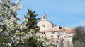
(1) Turn right onto Rue du Château, then left onto Rue de la Poste and then left again onto Rue des Pins ( Carrièira dels Pins). After 30 metres, take the small steps on the left to reach the church square . Note the three stages of its construction and reconstruction.
(2) In the small square, note a reproduction of a painting by Georges Dezeuze. Directly opposite you, take Rue du Calvaire ( Carrièira de la crotz), named after a cross that no longer stands, which was situated opposite the current school. At the top of this street, turn right onto Rue des Moulières. Go past the roundabout and take Impasse des Lauriers, then the ‘travèrsa de la còsta’ (Traverse de la Côte), until it ends at Rue de la Marjolaine. Turn left.
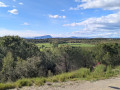
Turn right onto Montée de la Fiole. Walk uphill a little, then turn round to catch a glimpse of the sea to the right, looking south. Almost at the top of this street, level with the ‘Montée de la Fiole’ sign, turn right into a pedestrian-only passage, Rue de Genévriers. Continue along the Traverse de la Côte, the top of the hill. Enjoy the lovely view from here.
(3) When you reach Rue du Perdigal, turn left, then head right along Rue des Chênes Verts and Allée du Bois du Prieur. Turn right onto Rue des Cigales and walk up the street on the right to take the steps at the ‘Plan Jeanjean’ sign, which lead into the forest.
(4) At the bottom of the steps, turn right onto a forest track. Directly ahead lies the Plan Guirard. Continue straight on until you reach Rue de Viviers. This street leads to the Mas de Viviers, which owes its Occitan name to the springs and ponds found there. Turn right and carry on along this street. After the top of the hill, at the roundabout, turn right. Turn left onto the old Traversa le las Molièiras, then take Rue des Vignes until you reach Rue des Moulières.
(5) Carry on to the right until you reach the “Moulières” bus stop on the opposite pavement. Walk between two houses along the continuation of the Traversa de las Molièiras to reach the small Place du Castanou. This is the one where they play castagne. Head left towards the forest and then carry on to the right towards the cemetery.
(6) After the bus stop, take the steps to continue along the Corcha du Puòg Raccourci du Pioch. Walk between the houses in the housing estate to reach, after a left then a right, the Chemin de la Mort des Ânes. This is the translation of the old name “camin de la mòrt dels ases”. Head to the right to reach the castle. This is the former home of the painter Max Lennhart.
(7) Turn left towards the traffic lights, where you’ll reach Boulevard de la Liberté, then turn right. On the left is the Parc Leenhart car park (S/E).


 Association / Club / Walk leader
 Visorando Member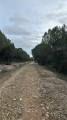
 Moderate
