Country:
 City:


Travel to Montpellier and then on to Clapiers. Park in the car park at Victor Hugo Primary School.
The walk starts from the school car park, above the tennis courts, on Rue des Moulières (Carrièira de las molièrias). This is a wetland area with frequently muddy ground.
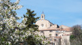
(S/E) As you leave the car park, keep to your left and head towards the top of the village. At the top of the hill, in front of the primary school, turn left and walk down Rue du Calvaire. Head towards Saint-Antoine Church, walk as far as the church square before retracing your steps a few paces to turn left onto the carrièria escura (Rue de l’Ombre). This is a side street.
On your right, you’ll come to Rue de la Cantonade (carrièira de la cantonada). Head down to the right towards the town hall, taking Grand’Rue Marie Lacroix.
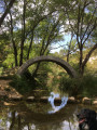
At the bottom of this street (Carrièria Màger), at the crossroads, do not continue along Avenue Charles de Gaulle – lined with plane trees directly in front of you – but head slightly to your left and take the Camin Vièlh de Montferrièr (Ancient Montferrier Path). Then cross Rue des Jardins, continuing straight on until you reach the Grand Font, its main spring and its wind turbine.
(1) Retrace your steps and turn left onto Rue du Romarin. After 150 m, turn right onto Traversa de l’Escoutaire. Continue up this road until you rejoin Rue du Romarin. You are now at the Las Courejas site.
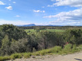
(2) Turn right and then carry on straight ahead, passing the Résidence des Pins. After the water tower, look out for the reproduction of a painting by Georges Dezeuze on your right – the Pic Saint-Loup and L’Hortus: you can catch a glimpse of them through the trees. Carry on to the first stony path, known as the Chemin de la Jassette.
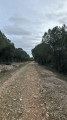
(3) Turn right. Through the trees, take in the view to the south and the sea on the horizon; below, look out for the strips of land known as ‘las correjas’. At the end of the path, turn left onto the tarmac road leading downhill. You are now on Chemin de Pescalune. Next, take the Rampa dau Peiron, a shortcut that takes you past a massive limestone outcrop (a ‘peiron’ in Occitan). It is the counterpart to the one in Montpellier known as the ‘Peyrou’.
At the bottom of the stairs, turn right to reach a dirt track, the ‘travèrsa de l’oliveda’ (the olive grove path). Carry on straight ahead along the Impasse de l’Olmière (elm grove). Continue straight on past the junction with Rue du Bosc. After 200 m, turn left onto a side street that runs alongside the school playground, known as the ‘travèrsa dau bòsc’. When you reach the police station, near the huge hackberry tree, turn left up Rue des Moulières. Cross Rue du Calvaire whilst continuing straight on, before reaching the car park a few dozen metres further on (S/E).

 Association / Club / Walk leader

 Visorando Member