Country:
 City:


To start the walk, head to the car park at the Clapiers skate park.
(S/E) Head south, go round the roundabout by the Botanic shop, and take the Chemin du Fesquet. Continue along Rue de la Grange, then turn right down towards the River Lez and the common ash tree.
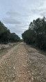
(1) Carry on and, after 100 metres, at the River Lez, turn right onto the old path from Prades-le-Lez to La Valette. Walk 800 metres along a plane-tree-lined avenue until you come to a magnificent white oak on your left.
(2) Return to the path and carry on until you reach the dual carriageway. Walk 100 metres, then turn right twice towards the underpass. Head left, then right, towards the forest. Walk past the houses on your right before climbing up to the Lauriol plateau. Walk 300 metres, then turn left to head downhill and join a small road; follow this for 100 metres to the left, before climbing the hill opposite, known as Les Bosses. In standardised Occitan: ‘bosques’ means ‘the woods’. This is a dialectal pronunciation from the Montpellier region. Join a wide track and follow it to the right for 700 metres to see the Montpellier maple.
(3) Head down the track to the right for 100 metres, then turn left onto a small path leading to a beautiful olive grove opposite. Turn left towards a picnic area where there is a strawberry tree (newly planted). The area is called ‘la Pissierasse’, which in Occitan means ‘embankment or causeway’ of a mill.
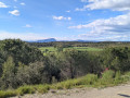
(4) Continue along the road to reach another wooded area, 400 metres further on. Go straight ahead, then turn left. Turn right onto a small, clearly marked path to reach, after 800 metres, on the right, a magnificent plain and a magnificent plane tree.
(5) Carry on to reach the tarmac section of the route. Then turn left into the Bois de la Plaine, and keep to the right until you reach the road, where you should turn left. Before the roundabout, on the left, there is a fine cork oak.
(6) Carry on straight ahead, towards the woods and the cemetery, then turn right onto Rue de Vendargues. Opposite the cemetery, after the bus stop, take the steps and look out for a holm oak.
(7) Continue through the housing estate, then keep left and right to reach Chemin de la Mort aux Anes. Look out for a painting on the left.
(8) Walk down towards the traffic lights, cross the road, and there you’ll find another painting with the artist’s name and the title of the work.
(9) Keep to the right on the cycle path towards the park opposite the car park. Enter the park and, immediately on the right, look out for the Source de Sallèles.
(10) Carry on to the right and exit on the left to see another painting by the artist Max Leenhardt.
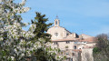
(11) Turn back and head into the village via Rue du Stade, skirting the park and the old Montpellier road. You’ll arrive opposite Rue de la Cantonnade (a dead-end alley), which you should turn right into to find yourself in front of the church. On the north side, there is a painting by Georges Dezeuze.
(12) Continue along Rue du Calvaire, then turn right onto Rue des Moulières (wetlands) and, immediately on the left, take Traverse du Pieron, then turn right onto Rue de l’Abbé Camozy, which leads to the foot of an iron staircase. Climb the steps, then take the Chemin de Pescalun (a ‘pescalune’, or ‘pescaluna’ in Occitan, is a resident of Lunel – a character so resourceful that he tried to fish out the moon, which had fallen into the Lunel canal… using a basket with holes in it. This derogatory nickname has become a source of pride for the ‘pescalunas’ as far as Clapiers). Turn right onto Chemin de la Jasette, where, at the junction, there are two paintings.
(13) Turn left onto Rue du Romarin. Further on, on the left, near a house that hides what the artist painted, are two views of Clapiers.
(14) Continue along Rue du Romarin, passing a housing estate, then turn left onto Traverse de l’EscoutaÏre (the listener). At the bottom, turn left onto Rue du Romarin, which leads to a crossroads. Turn left, pass the Jean Penso cultural centre, and head towards the fountain where a beautiful olive tree stands.
(15) Retrace your steps to see Georges Dezeuze’s painting ‘Grand’Rue’.
(16) Cross the avenue. As you look at the painting featuring the village bell tower on your right, take the old road to Montpellier. Ahead stands the symbol of Clapiers, its wind turbine; around the information boards for a lime tree, there is a painting by Max Lennhardt entitled ‘La Source’, which is housed at the Fabre Museum in Montpellier, and an explanation of the ‘Grand Font’ (‘the great spring’).
(17) After taking in all this fascinating information, continue along the esplanade for 200 metres, then look out for the small passageway on the right which leads into a housing estate via Rue Paul Cézanne. Then turn right, heading towards La Font de Reganhas (“The Reganhas Spring”).
(18) Once you’ve read the information, head back and follow the Chemin du Martinet to the media centre, where there is a poem and a painting on either side of the roundabout.
(19) Walk past the media centre, then the skate park, where the starting point is located (S/E).
 Association / Club / Walk leader
 Easy


 Visorando Member