In the footsteps of Blessed Alexandre at La Bouteille

Taking the Chemin de la Tuerie or passing through the hamlet of L’Arbalète reminds us that the Thiérache region has been involved in every war.
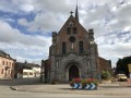
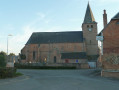
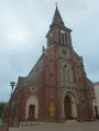
A testament to the need for defence in the 16th century, the Church of Notre-Dame de La Bouteille will impress you with its fortress-like stature.
However, if you carry on to the ruins of Foigny Abbey, you’ll discover a completely different side to the Thiérache: a haven of peace beside a babbling river.

Details

39809460
Creation:
Last update:
Last review:
  • Walking
    Activity: Walking
  • ↔
    Distance: 5.97 mi
  • ◔
    Average duration: 3h 00 
  • ▲
    Difficulty: Easy

  • ⚐
    Back to start: Yes
  • ↗
    Ascent: + 266 ft
  • ↘
    Descent: - 266 ft

  • ▲
    Highest point: 715 ft
  • ▼
    Lowest point: 436 ft
  • ⚐ Country: France
  • ⚐ City: La Bouteille (02140)
  • ⚑
    Start/End: N 49.859651° / E 3.974718°
  • ❏
    IGN map(s): Ref. 2808O, 2809O
  • Hour-by-hour weather

Photos

Description of the walk

Free parking at Place de la Mairie (junction of the D963, D75 and D751).

(S/E) Walk up the ramp at the far end of the square and follow the northern side of the church until you reach its main façade. Head down to the left, pass under a porch and join Rue de Vervins.

(1) Turn right, continue along the pavement and take the first path on the right, before the school bus shelter. You are now on theGR® 122. Walk past the cemetery and continue straight on until you reach the D751.

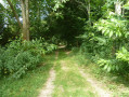
(2) Cross at the pedestrian crossing and take Rue de Foigny opposite (signposted ‘Voie sans issue’). Stay on this path, known as Chemin de la Tuerie, and walk 2,200 metres until you reach a fence blocking the old route.

(3) Turn left and join the D751 (hamlet of L’Arbalète).

(4) Leave theGR® 122. Turn right onto the D751 and continue until you cross the bridge over the River Ton.

(5) Immediately afterwards, take the first path on the right, towards Moulin de Foigny, and cross the River Ton once more (alternative route detailed in the practical information section).

(6) Turn left onto the rural track known as the ‘Chemin des Bassins’ and follow it to the farm of the same name. Cross the farmyard and continue straight ahead along the same track until you reach a junction with several paths.

(7) Turn right and take the tarmac road which climbs quite steeply towards the hamlet of Hélin. Walk through the hamlet and continue to the last house on the left-hand side of the road.

(8) A few metres past this house, turn right onto a stony track and follow it to a T-junction.

(9) Turn left onto the country lane from Foigny to Landouzy-la-Ville and carry on to the first fork.

(10) Turn right at the fork and pass through the hamlet of La Hugotterie.

(11) Return to a tarmac road, pass two industrial poultry houses and reach the centre of the village at the junction with the D751.

(12) Turn left onto this road (Rue Jean Nicolas Bouchez) and head towards the (S/E).

Waypoints

  1. S/E : mi 0 - alt. 702 ft - Free parking at the Town Hall square
  2. 1 : mi 0.07 - alt. 705 ft - Rue de Vervins
  3. 2 : mi 0.53 - alt. 696 ft - Crossroads. D 751
  4. 3 : mi 1.89 - alt. 482 ft - End of the Chemin de la Tuerie
  5. 4 : mi 2.14 - alt. 522 ft - D751 junction
  6. 5 : mi 2.58 - alt. 436 ft - Bridge over the River - Ton (rivière) - Affluent de l'Oise
  7. 6 : mi 2.76 - alt. 436 ft - Foigny Mill
  8. 7 : mi 3.77 - alt. 476 ft - Crossroads – road
  9. 8 : mi 4.43 - alt. 682 ft - Hélin. T-junction
  10. 9 : mi 4.58 - alt. 682 ft - T-junction
  11. 10 : mi 4.81 - alt. 686 ft - Junction
  12. 11 : mi 5.02 - alt. 679 ft - The hamlet of La Hugotterie
  13. 12 : mi 5.69 - alt. 709 ft - Rue Jean-Nicolas Bouchez
  14. S/E : mi 5.96 - alt. 702 ft - Free parking at the Town Hall square

Notes

In wet weather, make sure you wear suitable footwear: there is a very difficult section between (9) and (10) (ruts, mud, fallen trees across the path, etc.).
(5) Alternative route: to visit the ruins of the former Foigny Abbey, carry on straight ahead and, at the next junction (D38), turn right. The ruins are 150 m away, on the left-hand side of the road.
Return via the same route.

Worth a visit

Beautiful panoramic view over the Ton Valley between (3) and (4).

Origins of the village’s name: the village was founded following the establishment of a bottle-making factory in 1540, hence the name of the commune, La Bouteille.
La Bouteille is a village name derived from a glassworks established here, where large quantities of bottles were produced… The first houses built around the glass furnace served as homes for the glass-making gentry (the Tassars and Gaspars), their servants and merchants… (Extract from the Livre de Foigny20).
Foigny Abbey: Foigny Abbey.

Blessed Alexander: Alexander was a prince of Scotland, where he was born around 1180. For the love of Christ, he secretly fled the court on the advice of his sister Mechtilde, a young woman of twenty. They both came to France, and Mechtilde arranged for her brother to be admitted to Foigny Abbey as a cowherd. His skills as a cheesemaker were greatly appreciated there.
Later, when Alexander had taken the habit of a lay brother, Mechtilde urged him to sever their last ties so that he might gain entry to heaven. It was only on his deathbed, and on the express orders of his prior, that the good lay brother revealed his true identity. He died in 1229.
After his death, Alexandre appeared to one of the monks, with a crown on his head and another in his hands: “The crown you see in my hands,” he said, “is the one I spurned for the love of Christ; the one upon my brow is the immortal crown I have received amongst the saints.”
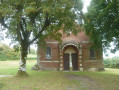
His tomb, now covered by a shrine, is still visited by many pilgrims, as is a nearby fountain, known as the Fountain of Blessed Alexander, where people come from far and wide to fetch water believed to have healing properties.
Miracles performed at his tomb led to him being honoured as Blessed Alexander. His tomb became a place of pilgrimage, which has been visited since the 13th century.

Notre Dame de La Bouteille Church: https://fr.wikipedia.org/wiki/%C3%89glis...
Open by appointment: 03 23 98 18 52 (town hall).

Always be cautious and plan ahead when you're outdoors. Visorando and the author of this route cannot be held responsible for any accidents occurring on this route.

The GR® and PR® markings are the intellectual property of the Fédération Française de Randonnée Pédestre.

Reviews and comments

4.3 / 5
Based on 2 reviews

Reliability of the description
4 / 5
Ease of following the route
4 / 5
Route interest
5 / 5
Jocelyne.duquenoy
Jocelyne.duquenoy

Overall rating : 5 / 5

Date of your route : Nov 24, 2025
Reliability of the description : ★★★★★ Very good
Ease of following the route : ★★★★★ Very good
Route interest : ★★★★★ Very good
Very busy route : No

I would like to point out that this route is known as Abbaye de Foigny. The passage is closed at point 9, but otherwise it is a very pleasant and varied hike.

Machine-translated

virgule
virgule

To be continued for holidays in Thiérache.

Machine-translated

taspavu
taspavu

Hello
Could you tell me a bit more about the problems you’ve encountered: on which sections, and before or after which checkpoints? So that we can rectify the situation if necessary.
I am aware that between points 9 and 10, the route is very difficult given the condition of the path. However, I have already notified the General Council Services, which manages this section.
Kind regards

Machine-translated

lavoisier
lavoisier

Overall rating : 3.7 / 5

Date of your route : Aug 19, 2024
Reliability of the description : ★★★☆☆ Average
Ease of following the route : ★★★☆☆ Average
Route interest : ★★★★★ Very good
Very busy route : No

Hi, everything’s fine up to point 7 – the description and the walk are absolutely lovely. After that, things go a bit wrong because the directions aren’t as clear: there’s a ‘crossroads’ that isn’t really one, and a path that’s off-limits, which we took anyway but which was very difficult to walk on (we realised why they’d blocked it off). Still, it was a brilliant walk for three-quarters of the way.

Machine-translated

Other walks in the area

For more walks, use our search engine .

The GPS track and description are the property of this route's author. Please do not copy them without permission.