A stroll through the heart of the village of Voulpaix, but that’s not all...

This walk will take you into the heart of the village of Voulpaix, winding through numerous narrow streets and passageways. It will also introduce you to a wealth of local heritage: fountains, wayside crucifixes, wash houses, and more.

Details

n°39180174
Creation:
Last update:
Last review:
  • Walking
    Activity: Walking
  • ↔
    Distance: 6.00 mi
  • ◔
    Average duration: 3h 00 
  • ▲
    Difficulty: Easy

  • ⚐
    Back to start: Yes
  • ↗
    Ascent: + 259 ft
  • ↘
    Descent: - 246 ft

  • ▲
    Highest point: 617 ft
  • ▼
    Lowest point: 397 ft
  • ⚐ Country: France
  • ⚐ City: Voulpaix (02140)
  • ⚑
    Start/End: N 49.838721° / E 3.831789°
  • ❏
    IGN map(s): Ref. 2709E
  • Hour-by-hour weather

Photos

Description of the walk

Park in front of the Voulpaix Village Hall, near the Town Hall (free).

(S/E) Walk up the street opposite the Salle des Fêtes to reach Rue des Fontaines. Turn left and follow the red-paved pavement.

(1) Cross the D960 with care and continue along the pavement towards La Vallée au Blé until you reach a junction.

(2) Turn left onto Rue du Château; ignore Impasse de la Sapinière on your left, then the end of Rue du Château on your right, and carry on straight ahead along Rue de la Motte

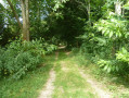
(3) Leave this street at the first junction and turn left onto a grassy track for approximately 400 m. See photo for crossing the Ruisseau de Beaurepaire.

(4) At the end of the path, turn left onto the D771 and walk along the narrow verge (watch out for traffic). Continue for 600 m until you reach the D960 (Rue des Anciens Combattants). Turn right and walk for about 100 m.

(5) Turn left onto Rue des Protestants and continue to its junction with Rue du Moulin Bleu. Turn left here, pass the fish farm and cross the Ruisseau de Beaurepaire

(6) As soon as you’ve crossed the bridge, turn left onto Impasse du Beaurepaire, pass under a brick bridge (an old railway line), and 50 metres further on, after No. 6, turn into a small lane on the right which leads onto Rue des Fontaines.

(7) Cross this street and take Rue des Silex opposite.

(8) Turn right onto Rue des Prêtres. Continue for about 150 metres and, before No. 8, turn right again into a narrow lane and follow it until you reach Rue d’Haution (tarmac road).

(9) Turn left. At the next junction with Rue Fleurie, turn left again and continue for about 500 m.

(10) After No. 10 (house on the left), turn right onto Chemin du Guet and continue along this track until you reach a junction just over a kilometre further on.

(11) Turn left onto the wind farm track until you reach the D960.

(12) Cross it carefully and follow the hard shoulder on the right. Watch out for traffic until you reach the junction with the D29. At this junction, take the gravel track right at the far left, which loops back. At the first junction, turn left.

(13) Turn left onto Rue de la Motte and follow this road carefully back up to the D960. Cross this road and turn left until you reach the next junction with Rue Fleurie.

(14) Turn right, and after No. 6 (a brick house with repointed joints), head down a narrow, sunken lane on the right, nestled between two embankments. Walk past a wash house and arrive at Place Émile Faucheux. After the first house on the right (No. 3), turn right into a narrow lane which leads out onto Rue Marcel Serent (D960).

(15) Turn left and follow the pavement.

(2) Carry on straight ahead.

(1) Turn left to return to Place Émile Faucheux. Walk up Rue des Prêtres to the right of the church. After 80 metres, turn left, then right onto Chemin du Cavin. Once back on Rue Fleurie, continue straight on until you reach a junction you passed earlier.

(10) Carry on straight ahead, turn right at a 90° angle at the next junction and head down Ruelle des Silex.

(8) At the bottom of this lane, turn right onto Rue des Prêtres. Ignore the first junction and turn left at the second. At the end of this road, turn right, then left, and return to the starting point (S/E).

Waypoints

  1. S/E : mi 0 - alt. 446 ft - Town Hall Square – Village Hall
  2. 1 : mi 0.09 - alt. 443 ft - D960, junction, Place Émile Faucheux
  3. 2 : mi 0.19 - alt. 453 ft - Rue du Château
  4. 3 : mi 0.38 - alt. 453 ft - Country lane on the left
  5. 4 : mi 0.64 - alt. 433 ft - RD771
  6. 5 : mi 1.05 - alt. 446 ft - Rue des Protestants
  7. 6 : mi 1.6 - alt. 436 ft - Impasse du Beaurepaire - Beaurepaire (cours d'eau) - Affluent du Vilpion
  8. 7 : mi 1.86 - alt. 463 ft - Crossing Rue des Fontaines (RD771)
  9. 8 : mi 1.96 - alt. 489 ft - Rue des Prêtres
  10. 9 : mi 2.21 - alt. 499 ft - Rue d’Haution
  11. 10 : mi 2.57 - alt. 522 ft - Common junction (out and return)
  12. 11 : mi 3.25 - alt. 584 ft - Turn left at the fork onto the wind farm track
  13. 12 : mi 3.85 - alt. 577 ft - RD960
  14. 13 : mi 4.69 - alt. 476 ft - Rue de la Motte
  15. 14 : mi 4.87 - alt. 515 ft - Rue Fleurie
  16. 15 : mi 5.25 - alt. 469 ft - Rue Marcel Serent (RD960)
  17. S/E : mi 6 - alt. 446 ft - Town Hall Square – Village Hall

Notes

In wet or damp weather, wear suitable footwear (wellies) to cross the Ruisseau de Beaurepaire between (3) and (4) (see photo) and the 50-metre section before reaching (12).

Worth a visit

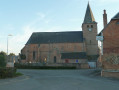
Saint-Quentin Church in Voulpaix

On the descent along Rue du Moulin Bleu, 150 metres after leaving Rue des Protestants, there is a fallow deer farm, visible from the street.

Voulpaix Castle: no longer stands today, but remains of the castle can still be found in the Bois de la Motte. These are visible in aerial photographs of the village. The castle was originally a motte. It was the residence of the lords of Voulpaix until 1438. The castle gradually fell into disrepair before being destroyed during the French Revolution. The last remaining parts of the castle were demolished in 1836.

Reviews and comments

4.8 / 5
Based on 2 reviews

Reliability of the description
5 / 5
Ease of following the route
5 / 5
Route interest
4.5 / 5
Jocelyne.duquenoy
Jocelyne.duquenoy

Overall rating : 4.7 / 5

Date of your route : Oct 26, 2026
Reliability of the description : ★★★★★ Very good
Ease of following the route : ★★★★★ Very good
Route interest : ★★★★☆ Good
Very busy route : No

A pleasant route; the first part is mainly through the village, whilst the second part is more rural. The signposted crossing of the river wasn’t difficult.

Machine-translated

User 3606334

Overall rating : 5 / 5

Date of your route : Sep 02, 2025
Reliability of the description : ★★★★★ Very good
Ease of following the route : ★★★★★ Very good
Route interest : ★★★★★ Very good
Very busy route : No

A lovely little walk to discover Voulpaix. Very well-explained route!

Machine-translated

Other walks in the area

For more walks, use our search engine .

The GPS track and description are the property of this route's author. Please do not copy them without permission.