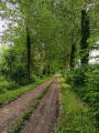
L’Arbre Joli as seen from Plomion

A circular route passing by the Gironsart farm and the hamlet of L’Arbre Joli, where you can discover one of the most beautiful fortified churches in the Thiérache region: the Church of Notre-Dame de l’Assomption in Plomion.

Details

n°39121008
Creation:
Last update:
Last review:
  • Walking
    Activity: Walking
  • ↔
    Distance: 6.65 mi
  • ◔
    Average duration: 3h 25 
  • ▲
    Difficulty: Easy

  • ⚐
    Back to start: Yes
  • ↗
    Ascent: + 404 ft
  • ↘
    Descent: - 387 ft

  • ▲
    Highest point: 712 ft
  • ▼
    Lowest point: 541 ft
  • ⚐ Country: France
  • ⚐ City: Plomion (02140)
  • ⚑
    Start/End: N 49.807513° / E 4.018468°
  • ❏
    IGN map(s): Ref. 2809O
  • Hour-by-hour weather

Description of the walk

Park on the Place de l’Église in Plomion, in front of the market hall.

GR ®122, marked in white and red

(S/E) With your back to the market hall, take the pavement running alongside the post office and the town hall. Turn right into thefirst street you come to, Rue des Casernes, cross the D36 (Rue du Général Leclerc) and take Rue des Forges opposite until you reach the next junction (D755).

(1) Immediately turn left onto a track (7.5-tonne weight limit sign). After just over 100 metres, on the right, you’ll see the war memorial known as ‘Les 14 Fusillés’ (see description below). Continue straight on.

(2) Keep right at the Croix de Vervins and carry on until you reach a four-way junction.

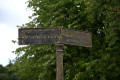
(3) Take the right-hand branch (signposted ‘Gironsart’), pass through the hamlet of the same name and carry on straight ahead to reach the hamlet known as ‘l’Arbre Joli’.

No signposting

(4) Leave theGR® by turning right onto a tarmac road, pass through part of the hamlet until you reach the D75 (Stop sign). Turn right towards some buildings, and follow the D75 for 350 m (beware of fast-moving traffic) until you reach the first road on the left which runs alongside the woodland.

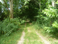
(5) Turn onto this road and follow it for about 800 m until you reach a junction with a grassy track on the right (the only one you’ll come across since leaving the D75).

(6) Turn right and continue for 600 m. Turn left at the hedge and carry on straight ahead until you reach a junction with a tarmac road.

(7) Turn right, pass the Froidmont farm, and continue along this road until you reach its junction with the D36, near a water tower.

(8) Turn slightly right and, 100 m further on, take the path down to the left, between a brick wall and a hedge, until you reach the D376.

(9) Turn right, then immediately left onto the D37, towards Besmont. Take thefirst track on the right before the ‘end of built-up area’ sign and continue for about 200 metres.

(10) Turn right onto Rue de Longanne and carry on straight ahead until you reach the first path on the right.

(11) Turn onto this track to reach Place Cochet Chaumerot and carry on straight ahead along the front of the houses until you reach Rue des Écoles.

(12) Turn left onto this street and follow it down to Ruelle des Granges.

(13) Turn right and you’ll come out onto the D747, Rue du Professeur Jean Minne (a native of Plomion, 1902–1994).

(14) Turn left and walk down this street for about fifty metres, then turn left towards Place de l’Église.

(15) Turn right, then right again at the church and follow the street down until you reach the car park (S/E).

Waypoints

  1. S/E : mi 0 - alt. 574 ft - Free car park at Place de l’Église
  2. 1 : mi 0.22 - alt. 633 ft - D755
  3. 2 : mi 0.73 - alt. 686 ft - Vervins Cross
  4. 3 : mi 1.61 - alt. 594 ft - Gironsart path. Towards the - Vilpion (rivière) - Affluent de la Serre
  5. 4 : mi 2.95 - alt. 663 ft - The hamlet of L’Arbre Joli
  6. 5 : mi 3.33 - alt. 666 ft - Road running alongside the woodland
  7. 6 : mi 3.81 - alt. 709 ft - Grassy country lane
  8. 7 : mi 4.8 - alt. 692 ft - Junction with the tarmac road
  9. 8 : mi 5.62 - alt. 689 ft - Junction with the D36
  10. 9 : mi 5.86 - alt. 640 ft - - Junction with the D376
  11. 10 : mi 6.03 - alt. 591 ft - On the right – Rue de Longanne
  12. 11 : mi 6.21 - alt. 581 ft - Country lane
  13. 12 : mi 6.36 - alt. 614 ft - Rue des Écoles
  14. 13 : mi 6.41 - alt. 597 ft - Ruelle des Granges
  15. 14 : mi 6.53 - alt. 587 ft - Rue du Professeur Jean Minne
  16. 15 : mi 6.59 - alt. 577 ft - Notre-Dame Church
  17. S/E : mi 6.65 - alt. 571 ft - Free car park at Place de l’Église

Worth a visit

War memorial known as ‘the 14 who were shot’.
A report by the Vervins (Aisne) gendarmerie station was drawn up on 26 September 1944, based in particular on the testimony of eyewitnesses to the events: Mrs Delaby and Mrs Boutillier.
Captain Couraux stated the following:
On 31 August 1944 at 5.30 pm, acts of atrocity as barbaric as they were savage were committed by a German ‘SS’ unit, which massacred and stoned 14 men and set fire to 36 houses.
Having arrived in Plomion at 4.30 pm, this unit, claiming to have come under fire at a place known as La Comtesse, two kilometres to the west of the village, broke into the houses to loot them and then set them alight.
The SS soldiers, who wore the inscription ‘Adolf Hitler’ on their sleeves, then searched for local men; having found 14, they took them to a pasture.
There, despite the pleas of these innocent victims, they machine-gunned them, then slashed them with zigzags and also finished them off with a blunt instrument, striking them specifically on the skull. These barbaric soldiers then stripped their victims of any valuables and possessions they had. The terrified eyewitnesses to these atrocities were Mrs Delaby and Mrs Boutillier, who were hiding behind a hedge.

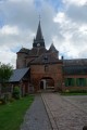
The fortified church of Notre-Dame de l’Assomption in Plomion.
Opening hours: from 25 June 2023 to 31 December 2023, from 9.00 am to 7.00 pm.
Telephone: +33 3 23 98 80 02.

Plomion Market Hall: the only surviving market hall in Thiérache. Listed in the supplementary inventory of historic monuments in 1998.
The rectangular building is imposing. The side aisles are separated by wooden posts resting on stone blocks. Its brick base is surmounted by half-timbering. The gables are covered with slate. The long-pitched roof ends in two half-hipped sections and a lean-to on the east side.

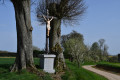
A small chapel in the crossroads of the hamlet of Gironsart (the last building on the route, to the left, situated on private land but accessible for a walk around it).

Former wash house to the right of the church’s main façade.

Always be cautious and plan ahead when you're outdoors. Visorando and the author of this route cannot be held responsible for any accidents occurring on this route.

The GR® and PR® markings are the intellectual property of the Fédération Française de Randonnée Pédestre.

Reviews and comments

5 / 5
Based on 1 review

Reliability of the description
5 / 5
Ease of following the route
5 / 5
Route interest
5 / 5
Rando axo 2
Rando axo 2

Overall rating : 5 / 5

Date of your route : Oct 01, 2023
Reliability of the description : ★★★★★ Very good
Ease of following the route : ★★★★★ Very good
Route interest : ★★★★★ Very good
Very busy route : No

A very pleasant and easily accessible route.
Don’t miss a visit to the recently renovated fortified church at Plomion, the monument to the 14 Executed Men and the little chapel at Gironsart, which is, unfortunately, somewhat neglected.

Machine-translated

Other walks in the area

For more walks, use our search engine .

The GPS track and description are the property of this route's author. Please do not copy them without permission.