The Blonde Valley

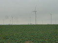
A route through Thiérache, taking in fields, hills and valleys. It passes through charming little villages such as Saint-Clément, Cuiry-lès-Iviers and Corneaux. The route largely follows theGR®®122.

Details

47914249
Creation:
Last update:
Last review:
  • Walking
    Activity: Walking
  • ↔
    Distance: 7.03 mi
  • ◔
    Average duration: 3h 40 
  • ▲
    Difficulty: Moderate

  • ⚐
    Back to start: Yes
  • ↗
    Ascent: + 509 ft
  • ↘
    Descent: - 535 ft

  • ▲
    Highest point: 725 ft
  • ▼
    Lowest point: 495 ft
  • ⚐ Country: France
  • ⚐ City: Coingt (02360)
  • ⚑
    Start/End: N 49.790877° / E 4.086268°
  • ❏
    IGN map(s): Ref. 2809O
  • Hour-by-hour weather

Photos

Description of the walk

Park at the Church of Sainte-Barbe in Coingt.

(S/E) Take the local road towards Dagny-Lambercy and leave the village.

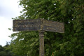
(1) After 250 m, follow the small road on the left which descends towards the Ruisseau de Coingt. You are on theGR®®122, but signposting is sparse or even non-existent. Nevertheless, the route is scenic and easily passable. The path crosses the stream, climbs the hill and descends towards a bridge over the Blonde.

(2) Make your way to the centre of Saint-Clément.

(3) Turn right onto the D74 towards Morgny-en-Thiérache, passing the old school and the town hall. After 150 m, turn left off the D74. Follow the path, which offers sweeping views, as far as Cuiry-lès-Iviers.

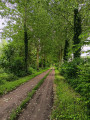
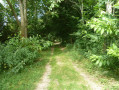
(4) Turn left onto Rue Principale and follow it for about 300 m. Opposite house no. 17, turn left onto a path leading to the Saint-Martin nurseries (noGR®® markings). Walk alongside the nurseries and head up the grassy path.

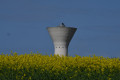
(5) Carry on straight ahead, passing the water tower at the top of the hill. Head back down and return to La Blonde. At the entrance to the hamlet of Corneaux, leave theGR®® path, which branches off to the right, and head up to the left to reach Rue du Franc Bois.

(6) At the crossroads, turn right, then immediately left. Walk on for just under a hundred metres and turn right onto the road leading out of the hamlet. Continue straight on until you reach the RD74 after the hamlet of Ringeat.

(7) Cross the road carefully and continue straight ahead. Once you reach the Ringeat cross, take the dirt track on the left towards Coingt Church and you’ll come to Sainte-Barbe Church (S/E).

Waypoints

  1. S/E : mi 0 - alt. 630 ft - Church of Coingt
  2. 1 : mi 0.26 - alt. 604 ft - Three-way junction, turn left
  3. 2 : mi 1.21 - alt. 495 ft - Blonde (cours d'eau) - Affluent du Coingt
  4. 3 : mi 1.53 - alt. 597 ft - Saint-Clément
  5. 4 : mi 3.56 - alt. 643 ft - Cuiry-lès-Iviers. Near the - Brune (rivière) - Affluent du Vilpion
  6. 5 : mi 4.27 - alt. 705 ft - Junction: straight ahead
  7. 6 : mi 5.26 - alt. 673 ft - Corneaux
  8. 7 : mi 6.36 - alt. 699 ft - D74 / Ringeat
  9. S/E : mi 7.03 - alt. 630 ft - Church at Coingt - Coingt (ruisseau) - Affluent de la Brune

Notes

Water points in the cemeteries.
Otherwise, no refreshments available.

Worth a visit

The charming village of Saint-Clément.
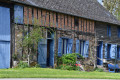
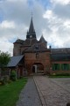
Cuiry-lès-Iviers, with a fortified church featuring a distinctive tower and a 17th-century castle (private).

3 km away: the fortified church of Jeantes with frescoes by Charles Eyck. In the same direction are the fortified churches of Bancigny and Plomion.

Always be cautious and plan ahead when you're outdoors. Visorando and the author of this route cannot be held responsible for any accidents occurring on this route.

The GR® and PR® markings are the intellectual property of the Fédération Française de Randonnée Pédestre.

Other walks in the area

For more walks, use our search engine .

The GPS track and description are the property of this route's author. Please do not copy them without permission.