Country:
 City:


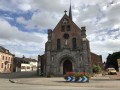
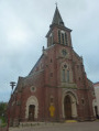
Park at the church square in Étréaupont (free).
(S/E) Head towards the far end of the square, by the chestnut trees, then cross Rue de la Libération (RD38) to take the pavement running alongside the town hall and the post office. At the first junction, turn left onto Rue du Mont d’Origny.
(1) At the far end of the cemetery, walk down the grassy embankment and turn left onto a footpath. Follow this path alongside the River Oise, straight on for 250 m, until you reach the junction with the N2: take care, as there is heavy traffic.
(2) Turn right, cross the River Oise and, immediately after the bridge, turn right onto Rue du Faubourg. Follow this road for 200 m until you reach the first junction
(3) Turn right onto the old railway line, which has been converted into a cycle route (Eurovelo 3: see the ‘Practical Information’ section). Follow this route for over 2 km, passing the first junction on your left.
(4) At the second junction (marked with a Stop sign), carry straight on until you reach another path on your left, just before crossing a bridge.
(5) Follow this track uphill for about thirty metres, then cross the D31 with care. Turn right and, after a few metres along the hard shoulder, turn left onto a stony track called Rue d’en Haut. Follow this fairly steep track uphill until you reach the entrance to the village of Gergny. Continue along a tarmac road until you reach a junction.
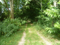
(6) Turn right onto a grassy path and follow it for 70 metres, then turn left into a narrow lane between two hedges of hornbeam and continue until you reach Rue Maillard. Turn right and walk up the street for about 100 metres.
(7) At the first junction, take the path on the left – the CR known as the Coquereau path – and follow it for approximately 1.3 km.
(8) Before reaching the first buildings in the hamlet of La Fourcière, turn left (with the wayside cross on your left) onto a path that descends towards the Ruisseau de la Librette. Please note: you can cross the Librette via a ford, but it is more common to cross over two concrete posts laid flat, about two metres above the stream (no guardrail). Continue to the junction with a tarmac section of the CR known as the ‘de la Fourcière’ and go straight on for about fifty metres.
(9) Turn left onto a path that is grassy in the first section and stony in the second. This leads onto Rue du Lavoir.
(10) Turn right to follow the rural track from Etréaupont to Gergny up to the first junction
(11) Turn left and continue to the D31 (Le Courtil Pally). Caution: sections may be difficult (ruts and mud) about two-thirds of the way along. Cross the D31, turn right, and follow the pavement to the junction with Rue Albert Ledant.
(12) Please note: from this point onwards, there is heavy traffic (lorries). Turn left and continue straight on. Cross the bridge over the River Oise.
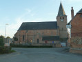
(2) Continue along the same pavement on Rue du Général de Gaulle to reach the church (S/E).

 Visorando Member