Country:
 City:
City:


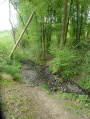
Park in Place Victor Hugo, near the Stade Léo Lagrange (free).
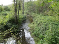
(S/E) Opposite the stadium, turn left onto Rue Émile Zola. After about a hundred metres, take the steps (or the ramp for people with reduced mobility) leading to a metal footbridge spanning the River Gland.
(1) Cross the footbridge, head towards a triple arch, go under it and turn right into Impasse du Château (a cobbled street)
(2) After about thirty metres, leave this cul-de-sac, turn slightly to the right and go through a gate. Continue straight on along a path that runs alongside the river mentioned above. At the second gate, turn left and climb the steps leading onto Rue du Plain.
(3) Turn left and walk down this street to the next junction. Turn right into Rue André Brémont and walk up this street for 300 m until you reach a level crossing. Cross the level crossing and turn immediately left into Chemin de la Derauderie: the first section runs alongside the railway line before veering away from it to the right. After that, ignore Chemin Caton on your left and carry on straight ahead until you reach a tarmac road, Rue du Haut Rouet.
(4) Turn right and continue along this street until you reach the first forest track on your right, after crossing the Ruisseau de la Marquette.
(5) Turn onto this track and follow it, passing several ponds on the right-hand side of the route
(6) Turn left onto another track heading north. Be careful, as the junction is not very obvious. Carry on until you reach a tarmac road. Cross it and take the track opposite until you reach the banks of the Oise.
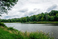
(7) Turn left and follow the River Oise until, after 700 m, you reach a footbridge
(8) Initially, do not cross the footbridge, but carry on straight ahead for 100 m to reach the waterfall. Admire it from above but, above all, from below; head down the path on the left. Return to the footbridge, cross it and turn left onto a footpath that runs alongside the campsite until you reach a tarmac road (Rue Anor d’en Haut).
(9) Turn left, go under the viaduct and continue along this tarmac road, ignoring the first forest track on your left. You’ll come to the second track (marked in yellow and blue).
(10) Take this path and follow it for 1.5 km before reaching Rue Lucien Gabel and, 250 m further on, its junction with Avenue du Maréchal Joffre (RD 363).
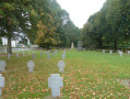
(11) Cross this road: take care, as there is heavy traffic. Set off almost directly opposite onto Rue du Petit Moulin, which runs alongside the cemetery. Enter the cemetery after 150 m, and walk round it using the main path: after about thirty metres inside, turn right then left twice.
(12) On leaving the cemetery, on Rue Jean Pellé, turn right then immediately left onto Rue du Maréchal Leclerc. Continue to Rue Jean Moulin, cross it and carry on along Rue Calmette et Guerin to No. 13, ignoring Rue Jean Richepin on your right. At the next junction, turn left.
(13) After No. 1, turn right into Rue aux Loups, passing between the Brisset d’Hirson Hospital (on the right) and the Brisset Residence (on the left). Before the hospital’s visitors’ car park, turn left onto Rue du 4 Septembre (a one-way street). Follow this street down and cross the bridge over the River Oise.
(14) Turn left into Rue de Guise. Fifty metres further on, turn left again, walk past the front of a few houses before turning into Ruelle de l’Église, which runs alongside the River Oise.
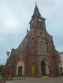
(15) Continue straight on along Ruelle de l’Église, cross Place Émile Villemant, then, opposite, Place Pasteur. At the end of the street, near a bakery, turn right and return to the car park at Place Victor Hugo (S/E).

 Association / Club / Walk leader
 Visorando Member
 Moderate
 Difficult
  AONB
AONB