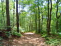
On the paths to the west of Bonsmoulins and around the Bois du Breuil

A walk that allows you to enjoy nature with very little change in elevation: the first part through the woods and the second through the countryside.

Details

n°32100176
Creation:
Last update:
Last review:
  • Walking
    Activity: Walking
  • ↔
    Distance: 4.55 mi
  • ◔
    Average duration: 2h 15 
  • ▲
    Difficulty: Easy

  • ⚐
    Back to start: Yes
  • ↗
    Ascent: + 187 ft
  • ↘
    Descent: - 164 ft

  • ▲
    Highest point: 876 ft
  • ▼
    Lowest point: 679 ft

Description of the walk

Park in the centre of Bonsmoulins, in a small car park overlooking Rue du Pont sur l’Iton.

(S/E) Turn left, towards Moulins-la-Marche. Carry on straight ahead until you leave the village, at the sign for Bonsmoulins.

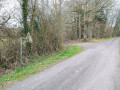
(1) Turn right onto a forest track, going round the Bois du Breuil (private woodland). You’ll reach the end of the track, marked by a cross-path.

(2) Turn left downhill and join the road to Moulins-la-Marche (D28).

(3) Continue left towards Bonsmoulins for about 500 m (the least pleasant part of the route, as it is the busiest road).

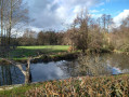
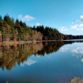
(4) Turn right towards the hamlet of Les Brosses onto the small road, which gradually turns into a footpath. You’ll come to a fork with a lake on your right.

(5) Turn left (with your back to the pond) and head down a muddy forest track. Ignore a path on the right, cross a stream and join a cross-country path.

(6) Head up this path to the left. After a fairly stony stretch, the path becomes grassy. Take a right-hand bend in the path, pass under a power line and arrive at a junction.

(7) Turn left and follow the path uphill; it becomes a quiet road leading to the village of Bonsmoulins at a multi-way junction.

(8) Turn left onto the road to reach Rue du Pont sur l’Iton, then turn right towards the car park (S/E).

Waypoints

  1. S/E : mi 0 - alt. 781 ft - Small car park (Rue du Pont sur l’Iton) - L'Iton
  2. 1 : mi 0.21 - alt. 791 ft - Bois du Breuil circular walk
  3. 2 : mi 1.51 - alt. 827 ft - Junction
  4. 3 : mi 1.77 - alt. 860 ft - Road, on the left
  5. 4 : mi 2.06 - alt. 833 ft - Junction (lake)
  6. 5 : mi 2.57 - alt. 715 ft - Body of water, on the left
  7. 6 : mi 3.13 - alt. 722 ft - Junction on a cross-path
  8. 7 : mi 3.89 - alt. 735 ft - Junction
  9. 8 : mi 4.43 - alt. 810 ft - Road, turn left towards Rue du Pont sur l’Iton
  10. S/E : mi 4.55 - alt. 781 ft - Small car park (Rue du Pont sur l’Iton)

Worth a visit

During the first part of the walk around the Bois du Breuil, you can see the Iton. This river is particularly well known for flowing through Evreux. Here, it is very small as it is close to its source (Mahéru).

Reviews and comments

4.7 / 5
Based on 1 review

Reliability of the description
5 / 5
Ease of following the route
5 / 5
Route interest
4 / 5
benoitrando
benoitrando

Overall rating : 4.7 / 5

Date of your route : Mar 06, 2026
Reliability of the description : ★★★★★ Very good
Ease of following the route : ★★★★★ Very good
Route interest : ★★★★☆ Good
Very busy route : No

At first, I almost hesitated between this route and the one called the Bois du Breuil route in Adduic. After checking the information sheets before setting off, I realised that the Bois du Breuil route is exactly the same as this one, but goes in the opposite direction.
Otherwise, it was a rather pleasant route on which I saw a pair of herons and some deer.
So I opted for the route that was published first.
Thank you, MauvaiseHerbe61.

Machine-translated

Other walks in the area

For more walks, use our search engine .

The GPS track and description are the property of this route's author. Please do not copy them without permission.