Country:

 City:
City:


Parking is available at the Petit Tournon chapel car park.
(S/E) Start the walk by turning left onto the D558 towards the hamlet of Petit Tournon.
(1) At the bend, leave the main road to the right (signposted ‘Les Deux Terres’). Continue in this direction, taking the road immediately on the left (Rue de Varenne) until you reach a tree-lined square. Cross this square to join Rue de la Fontaine.
(2) Shortly afterwards, turn right onto Rue de Champgrand. Leave the hamlet via the path directly opposite. Continue until you reach the steps.
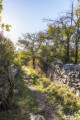
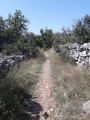
(3) Go down the stairs and take the track to the left. Follow this ascending track, which will gradually turn into a path carved out by water, then into a path through the heath. Once you’ve passed through a coniferous woodland, you’ll reach a wide track: the Voie Royale.
(4) Take this track, heading to the right, downwards. You’ll then pass through a coniferous woodland. The landscape will gradually open up to reveal a lovely view. You’ll arrive at a wide clearing offering sweeping views.
(5) Leave the track and head into the meadow to the left of the track. Cross this meadow to the right until you come to a path climbing alongside a scree slope. Follow this path until you reach another track.
(6) Follow this track to the right until you reach a road. Take this road to the right, heading downhill.
(7) Look out for a concrete EDF pole and take the path on the left immediately after this pole. Continue straight on along the road until you reach the chapel car park (S/E).
 Visorando Member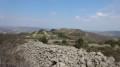
 Moderate


 Association / Club / Walk leader