Country:
 City:
City:


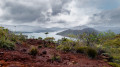
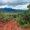
Car park: coming from Nouméa, the car park is on your right after the first bridge spanning a small arm of the lake. Head south towards the Chutes de la Madeleine, and park in the large area of red earth immediately on the right.
(S/E) To start the walk, head back over the same bridge (watch out for cars travelling at speed in this area), then take the first track branching off to your left at the junction. It climbs gently up to a hut and a pylon, where there is a crossroads.
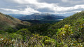
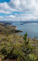
(1) Stay on the track to the left. At the next pylon, veer slightly to the right for a magnificent view. Then retrace your steps a little before continuing along the track heading west, continuing on to the next pylon.
(2) The path is a little further back, on the right. Continue along it until you reach a bend where there are bottles on the ground marking the outer edge of the path. Cross over them and carry on straight ahead along the track that descends towards the lake. This track isn’t marked on the map, but it’s wide and easy to follow.
(3) At the junction, turn right. Then follow the main track to the right. It runs alongside the area known as the “Marais Kiki”; it’s very easy to follow on this section, with no change in elevation.
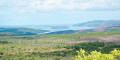
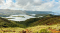
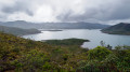
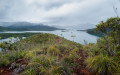
(4) Head up to the right. From there, the wide track turns into a path that is no longer really maintained; the natural vegetation and scrub are reclaiming the area in places. Nothing is insurmountable, and the path remains easy to follow, but if in doubt, refer to the GPS track. Head towards the pylon you passed at the start of the walk, following a ridge that offers another series of magnificent panoramic views of the lake.
(1) Head back down the road you took on the way up, keeping to the left, until you reach the car park (S/E).
 Visorando Member
 Easy
Easy