Country:
 City:
City:


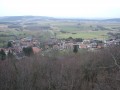
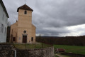
To start the route, head to Romain-la-Roche in the Doubs department, on the RD50 between Villersexel and Baumes-les-Dames. Take the old national road, then turn right onto the street in the centre of the village, which leads to the small car park behind the church.
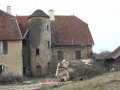
(S/E) Head down towards the bottom of the village; you’ll see the remains of an old fountain on the left, then continue left onto Rue du Chanois. Directly in front of you is an old building with mullioned windows, formerly known as the Château.
(1) Turn right onto Rue des Auges, which continues as a rough tarmac road. On the left, take a moment to look at the limestone cliff and the Rocher de Romain, which you’ll reach at the end of the walk. Passing through meadows and pastures, you’ll arrive at the village school in Mésandans.
Cross Rue des Fontaines and take Rue du Fourneau opposite. You’ll reach a T-junction.
(2) Turn left, then ignore a road on your right and head up towards the water tower. Cross the RD50 carefully near the restaurant Le Mésandans.
(3) Follow the RD 26 for about twenty metres, then turn right onto the red-and-yellow-marked path, which climbs past the great oak of Mésandans. You’ll come to a new tarmac road.
(4) Take the forest track that starts opposite. Leave theGR® markings on your right and continue along this lovely track. After passing through the woods, you’ll emerge into farmland. A little to your right, on the hill, you’ll spot a wind turbine with a reported height of 100 metres.
(5) Turn sharply left onto the forest track, which continues straight ahead. Immediately on your right, at the far end of the copse, take a look at the ‘Trou de J.P. la Virote’, a small funnel-shaped karstic cave. Unlike springs, here the runoff water rushes into this hole to feed an underground river.
Return to the forest track and head straight on to join the D114.
(6). Turn right for about 250 metres and then turn immediately left onto the farm track. Continue along this track until you reach a crossroads just before the first houses in Viéthorey.
(7) Turn right here. At the top of the hill, look out for a large sinkhole on your right: the Creux de Frouquemont. It resembles a volcanic crater, but is in fact a bucket-shaped sinkhole. This depression was formed by the erosion of the surface limestone, followed by the collapse of the roof of a karst cavity.
(8) Return in the opposite direction to the previous junction.
(7) Turn right onto the path and walk through the village of Viethorey, taking note of the beautiful houses with exposed stonework. Walk past the church and then the cemetery, and follow the well-maintained land consolidation track heading east. Pass thefirst pond and continue to the junction at Creux de la Roche Vaudin.
(9) Turn right, passing a large wooden chalet. Go round the sheep paddock by taking the small field path on the right for a few metres. You’ll reach the Creux Caillot. This is a beautiful funnel-shaped karst sinkhole, which serves to drain the stream and act as an overflow for the ponds.
Return to the road. On the other side, in the pasture, there is another small sinkhole: the Creux de la Roche Vaudin. Turn right to reach the hunters’ hut and the junction withthe GR®59.
(10) Turn left onto it and follow the red and white markings. At the junction with the D25, turn left, pass through the village of Gondenans-Montby, leaving first a road on your right and then another on your left. Reach a Y-junction.
:11:: Turn right onto the road leading up towards Montby and its medieval castle. On leaving the castle, rejoin theGR®59, cross the village and continue through a mix of pastures, farmland and small woods. Join the D116. Follow it for a few hundred metres to reach a crossroads with a track.
(12) Leave theGR® here and turn left onto this ascending track. Walk alongside the motocross track. Enter a small copse to quickly reach a crossroads of footpaths.
Take care here: this is the trickiest part of the day in terms of finding your way.
(13) Take the poorly marked path on the right. After about a hundred metres, the path turns westwards. At the edge of the woodland, look out for a fir plantation on the left; follow it to emerge into a pasture. Continue across the pasture, as the land consolidation track between the two fences is impassable. You’ll reach a gate and a path that climbs gently to the entrance of the village of Fontenelle-Montby at the junction with the D25.
(14) Turn right onto this road and head down towards the lower part of the village. You’ll notice a beautiful, stately home with its cylindrical tower and the remains of a venerable lime tree. Turn right at a 90° angle after the town hall and continue towards the large farm shed. At the fork in the road, turn left and rejoin theGRP® trail of the Pays des Sept Rivières, marked with yellow and red signs. Take it to the left and head uphill through the woods. This is the final, short but nonetheless challenging, stretch of the day to reach the highest point, where there is a bench for a short rest.
(15) Continue along the path lined with a low dry-stone wall. Wind your way through the shade of the woods of Fontenelle and then Romain, emerging at a timber storage area. Look out to the right, at the bottom of the valley, for the Gouffre du Crotot – another karst collapse that leads into an underground passage considered one of the most beautiful caves in eastern France.
(16) Return to the main path, continuing to follow the red and yellow markings ofthe GRP® des Sept Rivières, to reach the Campenottes car park. Note: in this area, daffodils are known as ‘campenottes’. There is an information board and a small picnic area.
(17) Leave the road and turn left onto the path that enters the woods. In March, daffodils bloom at the edge of the woods, but please be careful, as this area is a protected site and picking flowers is prohibited. You’ll reach a crossroads at a place called Sur le Mont.
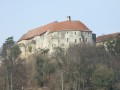
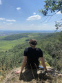
(18) Turn right, through the woods, to emerge above the cliff. A small, inconspicuous path leads to the ‘Roche de Romain’. After admiring the view, head down to the left beneath the rock. Here you’ll find a few small, modest rock shelters. Turn right and walk along the base of the cliff for about thirty metres. Behind a large boulder, there’s a bit of climbing up a small, 3-metre cliff to reach the largest rock shelter on the cliff, where Neanderthals – hunter-gatherers who appear to have been the first to settle in the region – once took shelter. It is known in oral tradition as ‘Jacob’s Well’.
Head back down and, following a rough track winding through the undergrowth, you’ll reach the RD50. Turn right onto the hard shoulder and follow it to the junction with the RD116. Cross the main road with care and head towards the village of Romain and the church car park (S/E).


 Visorando Member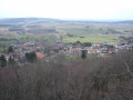

 Moderate
 Easy
Easy 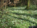
 Tourist office