Country:
 City:
City:


Head to Romain-la-Roche on the D50 between Villersexel and Baumes-les-Dames. Park your car in the car park in the centre of the village, on Rue ‘Au Village’.
(S/E) Facing forwards, walk up Rue de la Distillerie, turn right onto Rue Nationale, and walk past the town hall. Pass Rue des Deux Fontaines on your right and Route de Fontenelle on your left to reach the village exit. Opposite the last house, take the small grassy path on the left – you’ll notice an old pump – and cross the RD50 with the utmost care.
Take the path directly opposite. Enter the woods alongside a pasture. After 200 metres, follow a wide bend to the right heading due south. The terraced path narrows until it reaches a small mound of earth, which you must climb to emerge onto a good path. Turn left. The path joins a tarmac road on the outside of a bend, just before the road leading to the wind turbines.
(1) Go straight on along the path that enters the woodland (red-and-yellowGRP® markings and blue markings for the Wind Turbine Trail). Immediately leave theGRP® on your left and follow the blue markings (Wind Turbine Trail) through the undergrowth. The path gradually approaches the edge of the woods, passing through beautiful holly bushes and the first daffodils and periwinkles.
As you approach the meadow, turn left at a right angle onto a lovely, well-maintained, straight-as-an-arrow track (still following the ‘Sentier des Éoliennes’ markings) which leads onto a gravel track.
(2) Turn right and head towards the hunting car park. At the bend to the left, carry straight on along the correct forest track, which descends slightly before climbing again through the grass towards a crossroads.
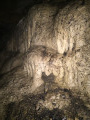
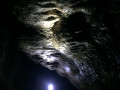
(3) Turn right (signs for the ‘Routes des Éoliennes’ and ‘Routes des 4 Vents’ are upside down) until you reach a red boundary marker (marking the boundary between the municipalities of Romain and Messandans). Then turn right and follow the red-painted boundary markings (number VIII on the right & 1 on the left) to reach, after about fifty metres, the top of a large embankment. The Grotte de la Pucelle, at the far end, requires some effort to reach via a rather difficult path – a poorly marked track through brambles branching off to the right.
(4) Retrace your steps back to the previous junction.
(3) Turn right to follow the signposts for the ‘Sentier des Éoliennes et des 4 Vents’ trail. Leave the woodland, cross a meadow to reach the tarmac road to Fontenelles (D114). Turn left and follow the limestone track leading to a new row of wind turbines.
(5) 80 metres past the first wind turbine, veer right and follow a path which, after 500 metres, leads to the rest area and the hunters’ shelter (tables and benches).
(6) Head right to quickly reach the Vierge de Fontenelle. For the moment, the view of the Vosges is obscured by vegetation.
(7) Retrace your steps.
(6) Once back, carry on straight ahead. Follow the path due west (red-and-yellow markings) to rejoin the limestone track. Cross the track and walk for about a hundred metres.
(8) Turn right onto theGRP® trail marked with red and yellow signs, which is more pleasant than the wind turbine track. You’ll come out onto the D116 departmental road. Follow this road to the right for about 200 metres and turn left onto the land consolidation track, following the GRP®’s red and yellow markings once again. After a few hundred metres across open fields, you’ll come to another road (D125).
(9) Turn left and follow the road. As you come out of a bend on the left, head into the woods; further on, you’ll rejoin the road, which you should cross whilst continuing to follow the markings. Head down into the valley. Ignore the yellow-blue markings and stick to the red-yellow markings, which lead towards the bottom of the cirque. This area is a protected zone, so keep dogs on a lead. On the left, there is a cave below the road. Continue the descent to the Trou du Séri.
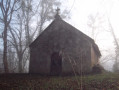
(10) Walk round the Trou du Séri resurgence and follow the path which then leads to the Chapelle de la Trinité.
(11) Turn left and follow the path along the edge of the pasture. Cross the tarmac road, walk a few dozen metres to the left and look for a path on the right that climbs the embankment towards a sign indicating that you are still within the protected area of the Cirque de la Grotte aux Ours, a refuge for several species of bat (dogs must remain on a lead). Off the marked trail, climb to the top of the cliff by following a few faint tracks made by animals.
(12) At the summit, don’t miss the view over the Vosges from the wooden cross. Continue along the path which, running along the edge of the cliff, circles the cirque. Cross two large ditches and enjoy a few more lovely views over Gondenans-les-Moulins and the Vosges. The path leads out onto a good track.
(13) Turn right, heading south. At a clear crossroads, turn right between clearings 20 and 21, then, about a hundred metres further on, turn left between clearings 21 and 22. Continue along the well-maintained path for 1 km.
(14) At the Romain quarry, opposite the entrance, turn left onto the tarmac road until you reach the first road on the right, which leads to the Campenottes car park.
(15) Then follow the straight, red-and-yellow-marked track which heads south between quarries 24 and 25. After a few hundred metres, turn right, heading towards the setting sun, and cut across the woods, following makeshift markings painted in red by a kind soul, to reach a small, inconspicuous path.
(16) At the Roche de Romain, with its beautiful panoramic view to the west,
Optional: head down the rough path to the left. There are already two deep gullies, but you must turn right and walk along the base of the cliff to reach the largest rock shelter on the cliff face. NB: The climb up to the shelter requires a rope.
Climb back up onto the rock and return to the first gully, which you take to the left heading north to join a forest track. Turn left to reach a limestone track suitable for vehicles, which you follow to the left to arrive on the D116 shortly after the water tower. Cross the D50 with care and head towards the village of Romain. Turn right onto Rue Nationale and head to the car park (S/E).



 Visorando Member

 Moderate
 Easy
Easy 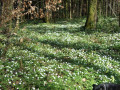
 Tourist office