Country:
 City:
City:



Head to Rougemont (25) between Villersexel and Baumes-les-Dames. Park your car in the square in the centre of the village.
(S/E) Cross the main road and take Rue de l’Église, with its authentic medieval charm, lined with stately homes (yellow and blue signposts to the left of the post office).
(1) Then head up Rue de la Petite Côte until you emerge below the former Cordeliers convent. The slightly steep slope leads to a small square between the church and the Fontaine de la Butte. Continue uphill until you come to two old houses, one of which is an authentic winegrower’s cottage housing the Musée de la Maison d’Autrefois.
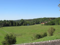
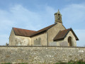
(2) A little further on, turn right and follow the sign for Chemin de Montaucivey (route no. 4, marked in yellow and blue). The only challenging part of the day’s walk is this short climb, which passes by the rest stop and leads to a small meadow in the middle of which stands the Chapelle du Montaucivey, offering views over the Ognon valley and the Vosges.
(3) Continue along the path across the plateau. As you emerge from the woodland, you’ll find a small, well-equipped rest area called the ‘Aire Bernard Bonnot’, ideal for a coffee break.
(4) After a refreshing break, carry on straight ahead towards Croix de Rognon (still following the yellow and blue markings, but now on route no. 8). You’ll notice the Roches de Nans in the distance to the left, then further to the right, the Roche de Romain. Do not head down to the left towards Gouhelans, but carry on straight ahead across the meadow between the hedges. Cross the tarmac road linking Morchamp to Gouhelans. The route continues along a path at the edge of the woods, running alongside a mound of stones. It opens out onto a large meadow, which you must cross to reach the Mont Adam crossroads.
(5) Ignore the path leading down to the left (marked with yellow and red signs) and follow the stony track. On the right, you’ll notice Mr Badger’s work as he prepares his sett for his future family. As you leave the woodland, walk alongside a pasture.
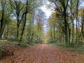
(6) Cross the tarmac road between Morchamp and Puessans and, via an easy path, make your way through Puessans Forest. As you emerge from the woods, leave the path leading down to Puessans on your left and turn right.
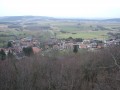
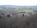
(7) Shortly afterwards, turn left, walk alongside the fence of a meadow to reach the Croix de Rognon viewpoint in 10 minutes (there and back). The descent to the cross is lined with patches of violets that are as pretty as they are fragrant (Viola odorata). The cross is in need of repair, but the view over the village and the valley is magnificent. A small information sign helps you find your bearings.
(8) Retrace your steps.
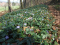
(7) Head towards Mondon/Chazelot. Cross the woodland dotted with clumps of wild garlic. Follow the path which climbs gently up the hill before descending again along a pleasant little track that crosses a field of periwinkles and offers a view of the village of Mondon.
(9) Explore the lower part of the village and the few houses with their remarkable openings (15th- and 16th-century corbelled lintels, period doors and windows). Walk up to the church. If it is open, take a look at the distinctive feature of the altar stone (an oil millstone). Walk round the church, either to the right through the remains of the old graves, or to the left through the new, very well-maintained cemetery. Climb the few steps to reach the tarmac road and turn left, off the marked trail. You’ll rejoin the road leading from the village and the yellow and blue signposts. Carry on to reach the plateau and its picnic area, which is the perfect spot for a lunch break.
(10) Turn left along the hedge, climb to the top of a hillock to take in the panoramic views to the south and west. Views over the Ognon valley and Montbozon. An information board enhances the site. Continue along the hedge, enter the coppice and head down the path, following the yellow and blue markings, until you reach the barbed-wire fence. Go round the pasture to the west, following the markings, to reach a tarmac road below. At the road, turn right until you reach a crossroads.
(11) Continue straight on along the tarmac-surfaced forest road. A keen eye will spot a wild boar trophy. Through the forest, you’ll reach the RD486.
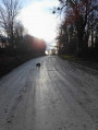
(12) Turn left for 200 metres (take care), then turn right onto the path through the woods. Before reaching the main road, turn left across the meadows and, after a small copse, you’ll emerge onto a lovely forest lane.
(13) Turn left and carry on straight ahead, ignoring the yellow and blue markings which head off to the right towards Chazelot. Follow this lovely road until you reach the edge of the woods.
(14) Ignore the paths leading off towards Montagney and turn right onto a path marked once again in yellow and blue.
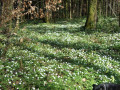
The woodland is dotted with wood anemones (Anemone nemorosa) as far as the eye can see. You’ll emerge onto the pastures overlooking the villages of Chazelot, Montferney and Rougemont. Head down to Chazelot,
(15) Follow the RD301 towards Montferney. Pass the old school, cross the Drigeon stream and then the main road, and head up to the top of the village. On the left is an old building dating from 1775.
(16) Turn right onto the path that crosses the sheep pastures and leads to the Saint-Hilaire Chapel.
(17). Turn left, walk past the village cemetery and then the military cemetery. Join the departmental road.
(18) Turn left onto the old railway line, which has been converted into a cycle path. After the housing estate, turn right to reach the centre of the village (S/E).

 Visorando Member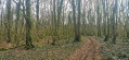
 Easy
Easy 
 Tourist office
 Moderate