On the other side of U Cavu

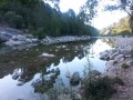
Follow this challenging circular route along the Cinaghja and Barola paths towards Li Ponti di Marionu and return via the path of the same name, which runs along the left bank of the Cavu.

Details

13923985
Creation:
Last update:
Last review:
  • Walking
    Activity: Walking
  • ↔
    Distance: 3.92 mi
  • ◔
    Average duration: 3h 00 
  • ▲
    Difficulty: Moderate

  • ⚐
    Back to start: Yes
  • ↗
    Ascent: + 1,411 ft
  • ↘
    Descent: - 1,411 ft

  • ▲
    Highest point: 1,581 ft
  • ▼
    Lowest point: 413 ft
  • ⚐ Country: France
  • ⚐ City: Zonza (20124|20144)
  • ⚑
    Start/End: N 41.720118° / E 9.301163°
  • ❏
    IGN map(s): Ref. 4253ET, 4253ETR, 4254ET
  • Hour-by-hour weather

Photos

Description of the walk

At the crossroads in the centre of Santa Lucia di Porto Vecchio, turn right if coming from Solenzara, or left if coming from Porto-Vecchio, towards Tagliu Rossu. Drive past the village and continue along the track to the Adventure Park.

No signposting

(S/E) From thefirst car park near the Adventure Park, on your right as you arrive, walk along the wooden fence towards the river. On the riverbank, turn right towards the dam. Cross over the stones and, on the opposite bank, turn left (yellow arrow). Go round the zip-line arrival point on the left and then follow the ‘Paintball’ arrow to a junction.

Markings: Yellow line

(1) Follow the sign for Bocca di Cinaghja 50 by taking the path leading towards the rocks, which starts opposite between the track (on your right) and the path at right angles (on your left). Climb up to a pile of rocks.

(2) Turn left, using the cairn on the tip of a rock as a landmark. Climb up. Depending on your height, you may need to use your hands. Pass some more scree. At the flat rock slab on the ground, make sure you turn left. Continue climbing until you reach a junction with a path on your right.

(3) Stay on your original path and head left towards Fugulina 55. Begin a gentle descent beneath the maritime pines. Cross a stream and pass by magnificent century-old trees. The path becomes a wide track; continue towards Fugulina – Piscia Cava 54.

(4) At the bend, turn left and continue along the path towards Piscia Cava 53. The descent becomes steeper. Walk through open terrain until you reach a junction with a flat rock slab on the ground.

(5) Carry on straight ahead along the path towards Barola – Ponti di Marionu 52. Cross the Piscia Cava stream (dry at the end of August 2021). Head uphill. At the track, turn right until you reach the Ponti di Marionu 41 junction.

(6) Turn left immediately. Descend through open terrain; then, 200 metres further down, turn right and head into the woodland. Continue descending, emerge back into open terrain and carry on down to reach Li Ponte di Marionu.

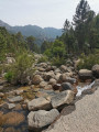
(7) Do not cross the bridge but turn left straight away onto the path leading down alongside it towards Parc Aventure 32. Walk for 1.5 km along the path running along the left bank of the Cavu until you reach a junction. Continue straight on for a further 800 m to return to the starting junction.

Unmarked

(1) At the track, turn right to return to the adventure park car park (S/E).

Waypoints

  1. S/E : mi 0 - alt. 427 ft - 1st Adventure Park car park. Towards the - Cavo (fleuve)
  2. 1 : mi 0.14 - alt. 463 ft - Junction for the outward and return routes
  3. 2 : mi 0.28 - alt. 636 ft - Pile of rocks
  4. 3 : mi 0.91 - alt. 1,519 ft - At the junction, turn left towards Fugulina 55
  5. 4 : mi 1.36 - alt. 1,434 ft - Turn off towards Piscia Cava 53
  6. 5 : mi 1.74 - alt. 1,033 ft - At the junction, go straight on
  7. 6 : mi 1.98 - alt. 1,220 ft - Head towards Ponti di Marionu 41
  8. 7 : mi 2.38 - alt. 584 ft - Path towards the Adventure Park
  9. S/E : mi 3.92 - alt. 427 ft - 1st Adventure Park car park

Notes

Although the walk is signposted in the municipality of Zonza, we are closer to the sea than to Zonza itself, so on your car sat-nav: enter the postcode 20144 and select the hamlet of Taglio Rosso.

Sturdy footwear is recommended as there are several sections over rocky slabs.
This is a challenging route; the association ‘A Punta Bunifacinza’, which has restored these paths, classifies them as ‘difficult’.
There is no drinking water along the route.
You can get something to drink and have a bite to eat at the Adventure Park.
Paid car park in summer: €5 per day (summer 2021).
At (5), you can shorten the route by turning left.

Worth a visit

Along the

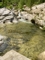
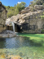
Piscia Cava Stream: this double waterfall flows until around 15 June and can be easily visited via paths below the main trail.

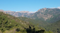
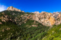
Various viewpoints over the Cavu Valley.

Reviews and comments

4.6 / 5
Based on 3 reviews

Reliability of the description
4.7 / 5
Ease of following the route
4.7 / 5
Route interest
4.3 / 5
User 14513544

Overall rating : 5 / 5

Date of your route : Aug 31, 2026
Reliability of the description : ★★★★★ Very good
Ease of following the route : ★★★★★ Very good
Route interest : ★★★★★ Very good
Very busy route : No

An easy route to get back into shape or get started with trail running

Machine-translated

philevr
philevr

Some updates as at late December 2023:
- The trails are now closed from 15 June to 31 October during the summer season at the municipal car park. To continue beyond this point: a free shuttle service runs to Ranuchjaghja; beyond that, you can continue by mountain bike, e-bike or on foot via the two RD and RG trails from Sainte-Lucie/Cavu
- Regarding the route map on this page (the circular PR5/PR4/PR3 route on the right-hand side of Cavu), please note that it is also possible to return to the Adventure Park after descending from Barola and reaching Marion Bridge by crossing the bridge and taking the path on the right-hand side of Cavu (Ponti di Marionu RD – PR3bis)
- Several trails opened by the “A Punta Bunifazinca” association in 2022/2023: Sapara Vardata (PR9), Lora – San Martinu (PR8), Sainte-Lucie RD (HR14), Cervi (HR32)
- Regarding the circular route described on this page, please note that it can be combined with the Funtanedda Bridge – San Martinu Church section of the Lora–San Martinu trail (PR8) via the Barola side track . A fine example of the many route combinations that can now be improvised in this valley...

Machine-translated

philevr
philevr
• Edited:

Overall rating : 4.3 / 5

Date of your route : Jul 18, 2022
Reliability of the description : ★★★★★ Very good
Ease of following the route : ★★★★☆ Good
Route interest : ★★★★☆ Good
Very busy route : No

Please note for summer 2022:

- The trails are closed (15 June – 15 September) at the municipal car park (€5 per day) just past the Adventure Park
- A free shuttle bus can take people as far as Ranuchjaghja (Trois-Piscines), where the RG and RD trails are closed off by barriers
- Beyond that point, you can only continue on foot (which involves a 1–1½-hour walk each way to reach the upper valley paths (HRxx))
- Do bear in mind, however, that it is possible to approach the area by mountain bike or, in particular, by e-bike, which eliminates this approach walk and allows you to travel much further towards the Finicione and the ‘Carciara’ before starting the walk along the paths

Machine-translated

philevr
philevr

It’s true that, as of this year, the tracks are closed during the summer months and the paths in the upper Cavu valley have become significantly less accessible: you have to allow an extra 1 hour to 1 hour 30 minutes’ walk (one way – plus the return journey) instead of the usual 4x4 journey!
That’s the main drawback of this summer closure, but there are some positive aspects too (no cars parked on the track, no one upstream of the Marionu bridge, etc.).

Machine-translated

lazzerini
lazzerini

Hello philevr,

In August, it’s impossible to get there via the adventure park without having to tackle a lot of tracks
I would have loved to do them, though, as the photos on your two websites make it look so tempting.
Perhaps my husband and I will come in late February/early March… but what’s the weather like in the valley at that time of year?

Machine-translated

philevr
philevr
• Edited:

Overall rating : 4.3 / 5

Date of your route : Jun 04, 2016
Reliability of the description : ★★★★☆ Good
Ease of following the route : ★★★★★ Very good
Route interest : ★★★★☆ Good
Very busy route : No

A fine example of a route you can put together in the lower Cavu valley (downstream of the Marionu bridge) by following the PRx trails, which were created in 2015 by the “A Punta Buifazinca” association in this area, where previously only the Cavu track (D168a) was passable!
This walk is in fact a combination of the PR5 (Cinaghja), PR4 (Barola) and PR3 (Ponti di Marionu) trails, all of which are signposted at trail/track junctions (referred to in the description by their PR number and sequence number on the trail) and marked in yellow according to FFRP standards.
The trails in the lower Cavu valley are all described with maps and text in leaflets available from the Parc-Aventure reception (€2 for the association), and many other routes can be improvised.
For example, the route for this hike (PR5 + PR4), but at the Marionu bridge, instead of taking the PR3, cross the bridge and head to Ranuchjaghja (‘Three Pools’ for tourists), where you can take the PR6 ascent (Ranedda) and follow the route indicated in another Visorando hike (Cavu Valley – Mandria – Oriu Carbunari), which combines the PR6 and Chjassu di i Carbunari: this creates a circular route that takes in both banks of the Cavu, lasting around 4–4½ hours…

With these two walks (Cavu Valley – Mandria – Oriu Carbunari and On the Other Side of U Cavu), the lower Cavu valley is fairly well covered; the only routes missing are I Scarpi–PR1 (not particularly interesting and awaiting revision as 90 per cent of the route is on tracks and roads) and Petra Stretta–PR2 (short and varied).

We’re still waiting for Visorando route descriptions for the upper Cavu Valley using the restored HRxx paths!!

Machine-translated

Other walks in the area

For more walks, use our search engine .

The GPS track and description are the property of this route's author. Please do not copy them without permission.