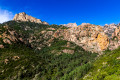
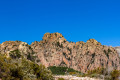
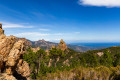
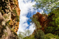
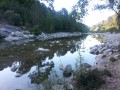
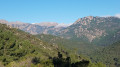
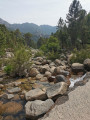
Cavu – Paliri – San-Martinu circular loop

A circular route which, from the Cavu valley, takes you to theGR®20and then on to the Paliri refuge. The return journey follows theGR® towards Conca, then onto a path that descends towards the San-Martinu track in the Cavu valley.

Details

47192137
Creation:
Last update:
Last review:
  • Walking
    Activity: Walking
  • ↔
    Distance: 14.18 mi
  • ◔
    Average duration: 9h 50 
  • ▲
    Difficulty: Very difficult

  • ⚐
    Back to start: Yes
  • ↗
    Ascent: + 3,839 ft
  • ↘
    Descent: - 3,829 ft

  • ▲
    Highest point: 3,465 ft
  • ▼
    Lowest point: 554 ft
  • ⚐ Country: France
  • ⚐ City: Zonza (20124|20144)
  • ⚑
    Start/End: N 41.732571° / E 9.292626°
  • ❏
    IGN map(s): Ref. 4253ET, 4253ETR, 4254ET
  • Hour-by-hour weather

Photos

Description of the walk

Park in the car park by the three swimming pools, situated on the D168A.

(S/E) Keep to the right, heading due north, on the D168A, and make your way to the magnificent Pont de Marion.

(1) Cross the bridge and continue left along the road, overlooking the Cavu, then cross the Pont de Funtanella. Continue slightly uphill to reach a Y-junction.

(2) Take the road straight ahead, crossing thefirst ford. Shortly afterwards, the track gives way to a footpath; continue along this path until you reach another ford at a bend.

(3) Continue straight ahead up the slope to reach the Vega Bianca Ravine.

(4) Caution! Here, the gradient becomes steeper; further on, you’ll emerge at a remarkable viewpoint overlooking the famous Compuleddu hole.

(5) Continue the climb, which remains very steep, to reach theGR®20.

(6) Turn left onto it and continue the ascent – which is easier this time – to reach the i Paliri refuge.

(7) Return, in the opposite direction, to the previous junction.

(6) Carry on straight ahead along theGR®, veering slightly to the left to complete the climb and reach Foce di u Bracciu.

(8) Return to theGR® and continue, on a gentle incline, to reach Bocca di Monte Sordi.

(9) Descend, still following theGR® and its red and white markings, to reach the junction at the Cabanes de Capellu.

(10) Keep to the right on theGR® and, heading due south, reach the junction leading to the San Martinu track.

(11) Leave theGR® here and head straight ahead along the footpath to join the San Martinu track further down.

(12) Take this track and follow it to the track junction at the Radichella Stream.

(13) Turn right (180°) onto the track that leads back to the Y-junction you passed earlier on the way out.

(2) Turn left and retrace your steps along the route you took on the way there to return to the car park by the three swimming pools (S/E).

Waypoints

  1. S/E : mi 0 - alt. 591 ft - Car park at the 3 swimming pools - Cavo (fleuve)
  2. 1 : mi 0.39 - alt. 564 ft - Marion Bridge
  3. 2 : mi 1.3 - alt. 876 ft - Junction of the circular loop
  4. 3 : mi 2.98 - alt. 1,099 ft - Ford
  5. 4 : mi 3.75 - alt. 1,358 ft - Vega Bianca Gorge
  6. 5 : mi 4.42 - alt. 1,936 ft - Viewpoint
  7. 6 : mi 5.43 - alt. 3,179 ft - GR20. Common junction for the out-and-back route at the refuge
  8. 7 : mi 6.37 - alt. 3,461 ft - Refuge de Paliri
  9. 8 : mi 7.93 - alt. 2,999 ft - Foce di u Bracciu - Bocca di Monte Bracciutu
  10. 9 : mi 8.72 - alt. 3,406 ft - Bocca di u Sordu
  11. 10 : mi 9.91 - alt. 2,818 ft - Cabanes de Capellu
  12. 11 : mi 10.57 - alt. 2,267 ft - Towards the San Martinu track
  13. 12 : mi 11.34 - alt. 1,385 ft - San Martinu track
  14. 13 : mi 12.4 - alt. 1,033 ft - Radichella stream
  15. S/E : mi 14.18 - alt. 584 ft - Car park at the 3 swimming pools

Notes

Note: Classified as Very Difficult, as it is a long route with a steep climb between (5) and (6), and take care on the final descent, which is very steep from (12).
We didn’t come across any springs; on the way there, we crossed some fords, but there were none once we were on theGR®. You can stock up on supplies at the refuge, in season.
You can do this walk in the opposite direction; this means tackling the full elevation gain in one go from Cavu to Bocca di u Monte Sordu, whereas going the other way, you avoid this climb, which is a real bonus given the distance.

Worth a visit

(S/E) The restaurant near the car park is open in season.
(4) From this point, the view opens up over the mountains opposite us (the Velaco range), offering a chance to admire the superb Cargiara Pass.
(5) Viewpoint over the Compuleddu hole, misleadingly known as the ‘bomb hole’ – it’s a spectacular sight.
Between (6) and (7), the path runs at the foot of the magnificent Punta di l’Anima Damnata, offering superb views of the Trou de Paliri.
(7) Refuge d’i Paliri – take in the views here:
- over the Eastern Plain to the north,
- the Tafunata d’i Paliri to the east,
- and the Velaco and Campanile de Sainte-Lucie mountain ranges to the south.

Always be cautious and plan ahead when you're outdoors. Visorando and the author of this route cannot be held responsible for any accidents occurring on this route.

The GR® and PR® markings are the intellectual property of the Fédération Française de Randonnée Pédestre.

Reviews and comments

4.5 / 5
Based on 2 reviews

Reliability of the description
4.5 / 5
Ease of following the route
4.5 / 5
Route interest
4.5 / 5
User 14513544

Overall rating : 5 / 5

Date of your route : Aug 31, 2026
Reliability of the description : ★★★★★ Very good
Ease of following the route : ★★★★★ Very good
Route interest : ★★★★★ Very good
Very busy route : No

A really lovely route, with very few people about – no doubt because of the heat. The route remains magical.

Machine-translated

bonachera jean francois

We agree

Machine-translated

philevr
philevr

It’s true that I’m not impartial on this subject! I hate walking on forest tracks, and even more so when they’re suitable for vehicles…
What’s more, I live in Sainte-Lucie all year round and was the driving force behind the creation and restoration of all these paths (there was NOTHING there before 2015!) precisely so that there would be activities other than swimming in the Cavu or walking on tracks alongside 4x4s, quads, forestry machinery and mountain bikes/e-bikes... I therefore encourage everyone to make use of our footpaths and trails and to avoid the GR20, which should only be used occasionally!

Machine-translated

bonachera jean francois

Yes, there are quite a few tracks, and it’s true that it’s not much fun. Sure, you can get closer in a 4x4, but that’s not what I’m after on this hike… and on the way back, after the steep descent, you’re still glad to be back on the track.

Machine-translated

philevr
philevr
• Edited:

Overall rating : 4 / 5

Date of your route : May 10, 2011
Reliability of the description : ★★★★☆ Good
Ease of following the route : ★★★★☆ Good
Route interest : ★★★★☆ Good
Very busy route : No

An interesting route through the Cavu Valley, following the Paliri path (HR31) – restored in September 2019 by the ‘A Punta Bunifazinca’ association – on the way up, then the GR20 down towards Conca and the Niffru valley to join the San Martinu track.
Unfortunately, setting off from Ranuchjaghja (known to tourists as ‘Trois Piscines’) means a long walk along rather uninspiring forest tracks to reach the paths forming the circular route. It is more interesting, where possible, to cross these tracks in a 4x4 to reach the Paliri path at the ford – which is impassable to vehicles – on the stream that precedes the Peru stream on the track leading to the Vega Bianca ravine.
As described in this guide, the route is very long and undoubtedly a bit tedious, as it involves quite a bit of walking along tracks.
In summer, unfortunately, as the tracks are closed to vehicles at the municipal car park (with a shuttle bus to Ranuchjaghja), there is no other way to cover these routes than via the circular route described above – with its unnecessary walking!
Of course, you’ll only come across other people on the GR20, as the paths in the upper Cavu valleys are very quiet!!

This circular route was covered (with a detour via the Brèche de Cervi) by the 2023 Cavu Trail.

It’s also worth noting other, even more interesting circular routes in the valley: the Giru di Altu Cavu on both banks of the Finicione, or the Carciara–Paliri circular route, which involves ascending to the GR20 via the Carciara ravine (HR21/HR22/HR23) and descending via the Paliri path (HR31), which is shown here as an ascent route.

Machine-translated

Other walks in the area

For more walks, use our search engine .

The GPS track and description are the property of this route's author. Please do not copy them without permission.