Luviu sheepfold, starting from Tagliu Rossu

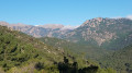
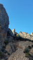
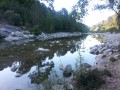
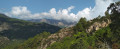
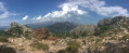
The Luviu sheepfolds are spread out along the ridges of a pine forest, facing Monte Calva. The ascent passes through woods and scrubland, and the route is mostly in the shade. Throughout the walk, you’ll be treated to views of the bays of Pinarello and Saint-Cyprien, the Gulf of Porto Vecchio, and the islands (Monte Cristo, Elba, the Cerbicales and the Lavezzi), stretching as far as Sardinia.

Details

45048600
Creation:
Last update:
Last review:
  • Walking
    Activity: Walking
  • ↔
    Distance: 8.92 mi
  • ◔
    Average duration: 7h 20 
  • ▲
    Difficulty: Difficult

  • ⚐
    Back to start: Yes
  • ↗
    Ascent: + 3,757 ft
  • ↘
    Descent: - 3,730 ft

  • ▲
    Highest point: 3,967 ft
  • ▼
    Lowest point: 430 ft
  • ⚐ Country: France
  • ⚐ City: Zonza (20124|20144)
  • ⚑
    Start/End: N 41.713823° / E 9.302855°
  • ❏
    IGN map(s): Ref. 4254ET
  • Hour-by-hour weather

Photos

Description of the walk

From Sainte-Lucie de Porto Vecchio, follow the D168A, passing through the hamlet of Tagliu Rossu: parking available (out of season) on the left, just after the first bridge. In season, there is a pay-and-display car park 1.2 km further on.

(S/E) Drive up the D168a, passing the concrete track on your left.
Take the path 100 m further on to the left and follow the signs for ‘Chemin de Luviu’ (yellow arrows and markers).

(1) When you reach the mobile phone mast, take the track to your right, then the path on the left 100 m further on. Follow this path, which crosses the track three times: views of Pinarello Bay and its tower. You’ll come to a junction on the plateau.

(2) Follow the path to the left. The trail resumes to the right about fifty metres further on and joins another path which you should follow to the left. At the track, turn right to rejoin the path on the left immediately afterwards. Follow this path, which will cross the track six times in succession before reaching some rocky outcrops: a stunning view between the outcrops of the islands of Monte Cristo and Elba, Pinarello Bay to the east, Saint-Cyprien Bay to the south, the Gulf of Porto Vecchio, the Cerbicales Islands, Lavezzi and Sardinia.

(3) Head down a little to rejoin a small track; follow it to the left for 200 metres and rejoin the path on your left after the bend. Rejoin the track, follow it to the left until you reach a stone reservoir (drinking water fountain, unless there is a drought).

(4) Just before this, the path veers right onto the northern slope, offering magnificent views. Reach a pine forest and continue slightly below a ridge until you can see the Luviu sheepfolds. The path then joins a small track; follow it down to the left to the sheepfolds situated in a superb clearing.

(5) Follow the ascent route in the opposite direction to return to the car park (S/E).

Waypoints

  1. S/E : mi 0 - alt. 430 ft - Bridge, car park
  2. 1 : mi 0.43 - alt. 892 ft - Relay mast
  3. 2 : mi 1.14 - alt. 1,552 ft - Plateau, crossroads
  4. 3 : mi 2.86 - alt. 2,930 ft - Rocky outcrops, views
  5. 4 : mi 3.12 - alt. 3,225 ft - Reservoir and fountain
  6. 5 : mi 4.46 - alt. 3,881 ft - Luviu sheepfold
  7. S/E : mi 8.92 - alt. 430 ft - Bridge, car park

Notes

The difficulty level is due to the fairly steep climb, not because the route is dangerous.

At point (4), you can fill your water bottles (if there is a flow) at the spring.

Reviews and comments

4.5 / 5
Based on 4 reviews

Reliability of the description
4.3 / 5
Ease of following the route
4.8 / 5
Route interest
4.5 / 5
philevr
philevr
• Edited:

Overall rating : 4.3 / 5

Date of your route : Aug 17, 2026
Reliability of the description : ★★★★☆ Good
Ease of following the route : ★★★★☆ Good
Route interest : ★★★★★ Very good
Very busy route : No

Please note that in November 2024, the A Punta Bunifazinca association modified the route of this route and restored it!
This change relates to point 1 of the description: the path (shared by PR2/Petra Stretta and PR7/Chemin de Luviu) no longer goes as far as the telephone relay station and the track, but turns right 30 metres further down and runs parallel to the track before making a 90° left-hand bend to cross the track further up and continue along the path (marked with a yellow bench).

See details of the Chemin de Luviu (PR7) on the association’s website!

Machine-translated

User 14513544

Overall rating : 5 / 5

Date of your route : Aug 17, 2026
Reliability of the description : ★★★★★ Very good
Ease of following the route : ★★★★★ Very good
Route interest : ★★★★★ Very good
Very busy route : No

A really lovely route that stays off the GR20 for most of the way, allowing you to discover some beautiful spots. It’s a route with very few walkers but is well signposted. The app is also a great help.

Machine-translated

philevr
philevr
• Edited:

Overall rating : 4.3 / 5

Date of your route : Feb 04, 2026
Reliability of the description : ★★★★☆ Good
Ease of following the route : ★★★★★ Very good
Route interest : ★★★★☆ Good
Very busy route : No

Please note a minor change to the Luviu trail (PR7) by the "A Punta Bunifazinca" association!
Before reaching the track at the telephone relay station, the route remains below the track until it joins the Petra Stretta trail (PR2) for a descent.
In the middle of this shared PR2/PR7 section, there is an exit on the left (signposted) to join and cross the Luviu track, continuing on the classic climb afterwards...
This means you completely avoid the Luviu track, which you only cross: see Luviu path (PR7).

Machine-translated

philevr
philevr

Overall rating : 4.3 / 5

Date of your route : Feb 16, 2024
Reliability of the description : ★★★★☆ Good
Ease of following the route : ★★★★★ Very good
Route interest : ★★★★☆ Good
Very busy route : No

This path is the restoration of an old transhumance route in the Cavu Valley, shown on the Terrier Map and the Napoleonic Cadastral Map. It was restored in 2020 by the A Punta Bunifazinca association as far as the reservoir (point 4), then extended in 2022 to include the Luviu ridges, which only partially follow the route of the old track, which joined the current track further south.
You can find a detailed description of this route on the association’s website: PR7 – Chemin de Luviu
Please note the times given (4 hours 20 minutes for the ascent): depending on your fitness level, the ascent can take anywhere from 3 to 5 hours. Allow an average of 7 hours 30 minutes for the round trip...
A very beautiful route with magnificent views, unfortunately marred by the motorised forest track built to reach the sheepfolds, which cuts across the historic path 17 times!!

Machine-translated

Other walks in the area

For more walks, use our search engine .

The GPS track and description are the property of this route's author. Please do not copy them without permission.