


Refine your search for walks in Suc du Mounier
Suc du Mounier walks


 Suc du Mounier from Saint-Jeures
 Visorando Member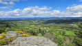
 4.38 mi
 +732 ft
 -741 ft
 2h 40
2h 40
 Easy
Easy
 Departure from Saint-Jeures (Haute-Loire)
Starting from the pretty village of Saint-Jeures, this short, easy circular route will take you to the summit of the Suc du Mounier. Although less famous than its larger neighbour, the Lizieux, it nevertheless offers superb panoramic views.
Walks near Suc du Mounier
Queyrères - Le Puy-en-Velay
 17.34 mi
+1,096 ft
-2,867 ft
8 hrs
17.34 mi
+1,096 ft
-2,867 ft
8 hrs
 Very difficult
Departure from Queyrières (Haute-Loire)
Very difficult
Departure from Queyrières (Haute-Loire)
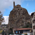
Fifteenth stage of the Way of St James. In the heart of the Meygal, Queyrières, a village in the Haute-Loire department, stands beside its basalt rock. From there, you begin the descent towards Le Puy-en-Velay, passing through Saint-Julien-Chapteuil and its mills that once lined the Sumène. A gentle end to the route with a leisurely finish as you arrive in Le Puy-en-Velay, a major pilgrimage site.
Tence - Queyrières
 11.71 mi
+2,090 ft
-1,033 ft
7h 10
11.71 mi
+2,090 ft
-1,033 ft
7h 10
 Difficult
Departure from Tence (Haute-Loire)
Difficult
Departure from Tence (Haute-Loire)
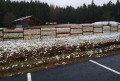
Fourteenth stage of the Way of St James. This fairly short stage (due to the gloomy, snowy weather) feels like a long, continuous climb until reaching the hamlet of Raffy, in the forests of Meygal, at an altitude of over 1,290 m, which is the highest point of this route. A short stop in Saint-Jeures, a small village with a beautiful 12th-century Romanesque church, situated a short distance from the Pic du Lizieux (1,388 m), clearly visible from a long way off before reaching the village.
Les Estables - Goudet
 16.61 mi
+1,010 ft
-2,871 ft
8h 30
Difficult
Departure from Les Estables (Haute-Loire)
16.61 mi
+1,010 ft
-2,871 ft
8h 30
Difficult
Departure from Les Estables (Haute-Loire)
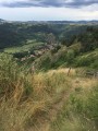
This second stage leads from the Hauts Plateaux du Mézenc to the Loire Valley. It takes you through the Mézenc National Forest and the Breysse woods, a mixture of beech and coniferous trees.The route more or less follows theGR®®40trail, avoiding wide tracks and small roads where possible.