


Circular route to the north-east of the Eau d’Heure lakes


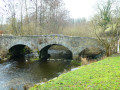
This walk, starting from the Barrage de l’Heure, begins by descending to the foot of the dam to reach the Beaupont district, before heading due east towards the Ry Jaune valley, one of the streams that feed the Eau d’Heure lakes. On the return journey, the route passes through the village of Soumoy to reach the Ry Jaune, runs alongside the lake of the same name and crosses the Bois des Maréchaux back to the starting point. Forest, countryside and lakeside scenery.
Details
Creation:
Last update:
Last review:
–
–
-
 Activity: Walking
 -
 Distance: 10.67 mi
 -
 Average duration: 5h 45
 -
 Difficulty: Moderate
 -
-
 Back to start: Yes
 -
 Ascent: + 958 ft
 -
 Descent: - 942 ft
 -
-
 Highest point: 965 ft
 -
 Lowest point: 597 ft
-
 Country:
Belgium
Country:
Belgium
-

-
 City:
Froidchapelle
City:
Froidchapelle -
 Start/End: N 50.215524° / E 4.398051°
 -


 Hour-by-hour weather


Photos
Waypoints
- S/E : mi 0 - alt. 659 ft - Eau d’Heure Dam
- 1 : mi 1.48 - alt. 646 ft - Beaupont
- 2 : mi 2.94 - alt. 869 ft - Les Violettes
- 3 : mi 4.63 - alt. 771 ft - The Ry Jaune
- 4 : mi 5.35 - alt. 961 ft - Bois du Mont
- 5 : mi 6.26 - alt. 801 ft - Bironfosse Wood
- 6 : mi 7.1 - alt. 732 ft - Soumoy
- 7 : mi 8.81 - alt. 699 ft - The Ry Jaune
- S/E : mi 10.67 - alt. 659 ft - Eau d’Heure Dam
Other walks in the area
From Plate Taille to Eau d'Heure
 Visorando Member
 6.78 mi
+308 ft
-279 ft
3h 25
6.78 mi
+308 ft
-279 ft
3h 25
 Easy
Easy
 Departure from Froidchapelle (Hainaut)
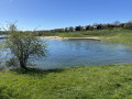
Hike mainly on Ravel routes, through woods, fields and along the shores of Lac de la Plate Taille.
Tivoli and Boulîs via the castle, chapel and jet ski route
 5.80 mi
+312 ft
-295 ft
2h 55
Easy
Departure from Walcourt (Province de Namur)
5.80 mi
+312 ft
-295 ft
2h 55
Easy
Departure from Walcourt (Province de Namur)
Hiking from Anes et Co (Walcourt)
Half-day donkey ride
Route via GR®, fields, woods and village, view of the Eau d'Heure dams
Option to extend to other attractions located around the Eau d'Heure lakes region
Soumoy – Olloy-sur-Viroin
 15.31 mi
+1,020 ft
-1,220 ft
7h 55
15.31 mi
+1,020 ft
-1,220 ft
7h 55
 Difficult
Departure from Cerfontaine (Belgique) (Province de Namur)
Difficult
Departure from Cerfontaine (Belgique) (Province de Namur)
Here is the eleventh stage in a very beautiful region combining woods, fields and meadows. Steep ascents and descents, spectacular farmhouses and stunning landscapes form the backdrop to this walk.
Circular route around Senzeilles
 10.02 mi
+423 ft
-440 ft
5h 00
Moderate
Departure from Cerfontaine (Belgique) (Province de Namur)
10.02 mi
+423 ft
-440 ft
5h 00
Moderate
Departure from Cerfontaine (Belgique) (Province de Namur)
Well ventilated on this plateau favoured by wind turbine installers, the walk takes you through the countryside around Senzeilles, starting from Villers-Deux-Eglises.This village once had two abbeys (Premonstratensian and Benedictine) and therefore two churches. The transfer of rights from one to the other in 1588 brought this situation to an end. There is now only one church, which is monumental in comparison to the size of the village.The wooded stretch between Villers-Deux-Eglises and Soumoy is sheltered from the wind. The section along the old line of the 132 railway line is sheltered too.
In the Land of Walkers in Thy-le-Château
 10.82 mi
+502 ft
-512 ft
5h 25
Moderate
Departure from Walcourt (Province de Namur)
10.82 mi
+502 ft
-512 ft
5h 25
Moderate
Departure from Walcourt (Province de Namur)
A beautiful circular walk starting from Thy-le-Château to discover a little of the region's industrial past as well as its natural (countryside and forests) and human (castles, churches, chapels) treasures.
Along the way, you will have the opportunity to discover the Marches de l'Entre-Sambre-et-Meuse.
In the middle of the fields at Berzée
5.19 mi
+249 ft
-240 ft
2h 35
Easy
Departure from Walcourt (Province de Namur)
A lovely walk through the fields, with a short stretch of road that isn’t very busy. But there’s a rather muddy section when it rains.
Walk in Gourdinne
 10.92 mi
+525 ft
-512 ft
5h 30
Moderate
Departure from Walcourt (Province de Namur)
10.92 mi
+525 ft
-512 ft
5h 30
Moderate
Departure from Walcourt (Province de Namur)
Here is a circular walk that offers a mix of countryside and woodland along paths, tracks, RAVeL routes and small roads in the areas bordering Walcourt and Ham-sur-Heure-Nalinnes.Make the most of nature in spring for the flowers and in autumn for the beautiful colours in the forest.
The Tour Saint-Éloi and the Bois de Norgimont
6.45 mi
+446 ft
-440 ft
3h 20
Moderate
Departure from Walcourt (Province de Namur)
This route crosses the countryside around the village of Laneffe, with a few woods along the way, via beautiful, accessible paths. There is a large car park at the starting point. The walk begins by following part of the Tour Saint-Éloi, a path taken by the Saint-Éloi procession during the village's traditional folk march. From (4), it continues towards the heights of the village, where you can see the surroundings in the direction of Charleroi. The end of the route gives pride of place to the green countryside before returning to the village.
For more walks, use our search engine .
The GPS track and description are the property of this route's author. Please do not copy them without permission.

