From the Demoiselles Coiffées to the balconies of Remollon

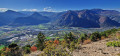
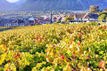
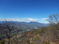
A lovely family walk, allowing you to stroll at the foot of the ‘Demoiselles Coiffées’ and then, from the village’s terraces, enjoy magnificent views over the wooded valley, the vineyards, the three lakes of Rochebrune and, on the horizon, the Parpaillon, Trois Évêchés and Digne Pre-Alps mountain ranges.

Details

65094737
Creation:
Last update:
Last review:
  • Walking
    Activity: Walking
  • ↔
    Distance: 4.87 mi
  • ◔
    Average duration: 3h 50 
  • ▲
    Difficulty: Moderate

  • ⚐
    Back to start: Yes
  • ↗
    Ascent: + 1,837 ft
  • ↘
    Descent: - 1,867 ft

  • ▲
    Highest point: 3,776 ft
  • ▼
    Lowest point: 2,188 ft

Photos

Description of the walk

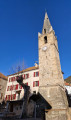
Coming from Gap or Barcelonnette, at Place de l’Hermitane, take Rue de l’Église, pass the community centre, then head up to the church. Park in the car spaces between the church and the cemetery.

(S/E) Follow the sign for the Demoiselles Coiffées and walk uphill along the eastern side of the cemetery.

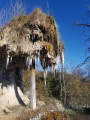
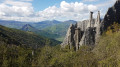
(1) Leave the tarmac road and turn right, opposite the water tank, then head uphill towards the Demoiselles Coiffées or “fairy chimneys”. Information boards, featuring QR codes, are placed along the route: see the “Things to see” section.

(2) Turn round and head back down to the water tank.

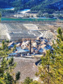
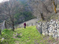
(1) Turn right onto the stony path leading up to the Bas Col, an old mule track once used to transport Remollonais wine to Gap. At the ‘beware of fire’ sign, you can enjoy your first panoramic view of the village and the valley. As you climb, you’ll walk alongside the deep Hermitane ravine on your left.
Carry on until the ravine closes in.

(3) Leave the mule track and take the path on the right, at a small heart carved into the trunk of a pine tree.
Follow this path as it winds its way along the mountainside to the Remollon terraces.

(4) From the terraces, you’ll have a magnificent view of the wooded valley, the vineyards and the three lakes of Rochebrune. On the horizon, starting from the left, you can see the Grand Morgon, the Tête de Louis XVI, the Fort de Dormillouse overlooking the resort of Saint-Jean de Montclar, the Trois Évêchés, the Tête Grosse towering over the resort of Chabanon and, closer to us, the Crête de la Scie and the Cita. Continue along the path until you reach a three-way junction.

(5) Turn right onto the path leading down towards the village of Théus. There are numerous viewpoints overlooking the valley, all easily accessible throughout the descent.

(6) Once at the bottom of the path, cross the Torrent de Malavert, then cross a small field which has gradually encroached on the path – clearly marked on the IGN map – and rejoin the route.

(7) Cross the Torrent du Vallauria and, a few metres further on, turn right onto a farm track bordered by a stone wall, heading towards the plain. Once you reach the tarmac road, turn right onto it, heading towards Remollon, and cross the bridge over the Torrent de Théus, formed by the confluence of the Malavert and the Vallauria. Join the D900b (Route des Trois Alpes).

(8) Follow it, keeping to the right. Then turn right at the town hall and head up to the church (S/E).

Waypoints

  1. S/E : mi 0 - alt. 2,257 ft - Car park - Église Saint-Sébastien (Remollon)
  2. 1 : mi 0.18 - alt. 2,421 ft - Water reservoir – Access to the Demoiselles Coiffées
  3. 2 : mi 0.44 - alt. 2,539 ft - Demoiselles coiffées (Remollon)
  4. 3 : mi 1.17 - alt. 2,779 ft - Junction
  5. 4 : mi 2.28 - alt. 3,763 ft - Remollon Balconies
  6. 5 : mi 2.43 - alt. 3,750 ft - Start of the descent
  7. 6 : mi 3.49 - alt. 2,582 ft - Malavert Torrent
  8. 7 : mi 3.62 - alt. 2,572 ft - Vallauria Torrent
  9. 8 : mi 4.5 - alt. 2,218 ft - D900b road
  10. S/E : mi 4.87 - alt. 2,257 ft - Car park - Église Saint-Sébastien (Remollon)

Notes

In summer, drinking water is available at Place de la Mairie and in the centre of Parc du Bosquet.

In the village, you can quench your thirst and enjoy a bite to eat at the Trois Alpes snack bar and restaurant.

On your right, in summer, the Maison du Vigneron offers a free tour of the museum and a tasting of the excellent mountain wines.
On your left, if you’d like to enjoy a picnic or relax, you can head to the beautiful, shaded Parc du Bosquet, situated below the church.

Worth a visit

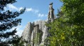
(2) Demoiselles Coiffées: these are also known as ‘fairy chimneys’. The Montagne des Assaillous, which overlooks the village to the north, features two major clusters of Demoiselles Coiffées (the West and East sites), totalling several dozen of these astonishing formations. Rain erosion has carved through the thick layer of clay-limestone soil and moraine boulders deposited by the Durance glacier, which cover the mountain’s flanks. As the rock blocks protect the ground immediately below them, erosion gradually clears the surrounding terrain, forming over the centuries these tall columns topped by their own rock.

We also recommend a visit to the old village, which is listed as a site of outstanding heritage interest.

In summer, the Maison du Vigneron offers a tour of the museum and a tasting of the excellent mountain wines. Wine can be purchased on site.

You can cool off at the ‘petrifying’ waterfall at the western entrance to the village (car park 30 metres from the waterfall). Water from a major spring cascades down the hillside through an open channel, crosses the county road before reaching the Moulin district, where it once powered a grain mill. It forms the waterfall where the wooden channel that carried it to the mill’s waterwheel has now disappeared.
After flowing beneath the mill, it ends its journey in the Durance valley, plunging from the top of a tufa cliff. The water, laden with dissolved limestone and gypsum, creates petrifying fountains, which coat leaves, twigs or any object it touches with mineral deposits.

We also recommend a visit to the Saint Roch Chapel at the eastern entrance, below the shopping area, which is easily accessible by car.
Perched on its rocky mound, a little upstream from the village, the Saint-Roch Chapel overlooks the vast orchards of the Durance plain.
Its official name is actually Notre-Dame de Clémence, but popular tradition has retained only that of Saint Roch, no doubt in memory of the circumstances that led to its construction.
In 1854, a terrible cholera epidemic that originated in Marseille decimated the population of Provence before spreading upstream along the Durance, claiming many victims in the Embrun and Gap regions. Yet there were no victims in the village of Remollon, despite its high risk of exposure!

Reviews and comments

4.6 / 5
Based on 3 reviews

Reliability of the description
4.3 / 5
Ease of following the route
4.7 / 5
Route interest
4.7 / 5
Jean Marc1
Jean Marc1

Overall rating : 4 / 5

Date of your route : Dec 02, 2024
Reliability of the description : ★★★★☆ Good
Ease of following the route : ★★★★☆ Good
Route interest : ★★★★☆ Good
Very busy route : Yes

A lovely walk with beautiful scenery.

Machine-translated

patembrun
patembrun

Overall rating : 4.7 / 5

Date of your route : Nov 23, 2024
Reliability of the description : ★★★★☆ Good
Ease of following the route : ★★★★★ Very good
Route interest : ★★★★★ Very good
Very busy route : No

A lovely walk on the day after it had snowed.

Machine-translated

Catdebarci
Catdebarci

Overall rating : 5 / 5

Date of your route : Nov 03, 2024
Reliability of the description : ★★★★★ Very good
Ease of following the route : ★★★★★ Very good
Route interest : ★★★★★ Very good
Very busy route : No

A really lovely walk. The view was absolutely stunning, with clear skies and a view all the way to Morgon. The path wound its way through the pine trees. I thoroughly enjoyed it. We carried on as far as the Bas Col and then returned along the original route. A lovely afternoon.

Machine-translated

Other walks in the area

For more walks, use our search engine .

The GPS track and description are the property of this route's author. Please do not copy them without permission.