Serre des Aigles via Serre Lan

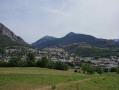
A hike to one of the peaks overlooking the town of Briançon along aGR® route with a very scenic ridge walk offering a stunning panorama of the Cerces and the Écrins.
The route crosses rocky sections which may be daunting for walkers prone to vertigo.

Details

n°281418
Creation:
Last update:
Last review:
  • Walking
    Activity: Walking
  • ↔
    Distance: 5.72 mi
  • ◔
    Average duration: 4h 40 
  • ▲
    Difficulty: Difficult

  • ⚐
    Back to start: Yes
  • ↗
    Ascent: + 2,323 ft
  • ↘
    Descent: - 2,323 ft

  • ▲
    Highest point: 8,396 ft
  • ▼
    Lowest point: 6,073 ft

Photos

Description of the walk

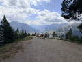
Access: From the roundabout near the Centre Commercial Nord in Briançon, take the N94 towards Italy, then, on the uphill stretch, turn left towards the hospital. After passing the hospital, head down the road to the left towards Grenoble. Take the third road on the right, the D232T ‘route du Poët Ollagnier’, towards Serre Lan and the Croix de Toulouse. As you leave the hamlet, park on the right-hand side of the lane. (Space for 5 to 6 vehicles)

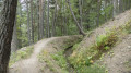
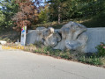
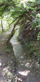
(S/E) From the Serre Lan car park, take theGR®5calternative route heading east. After two hairpin bends, the track turns south-east and climbs gently through a forest of Scots pine and larch. This track, which can also be driven up in a 4x4, leads to a plateau with a radio relay station situated near the Croix de Toulouse viewpoint, the finishing point of the famous Briançon Via Ferrata.

(1) On the plateau, take a sharp left-hand bend and continue along theGR®5c. The path winds its way up beneath the Crête de la Pinée ridge and then along the hillside before reaching Fort de l’Enrouye or Fort de Malafosse.

(2) After a short descent along this path, reach the ridge line and cross the small pass or gap linking the Crête du Pinet to the Crête de Malefosse.
The view opens out onto the eastern peaks, and you can see Mont Chaberton, Montgenèvre and the Piedmont.
Climb up the rocky ridge of Malefosse until you reach the Croix du Serre des Aigles.
During this ascent, follow the path carefully, particularly at the point where you come across two cairns and where you must remember to turn right.

(3) Return via the same route in the opposite direction to the car park (S/E).

Waypoints

  1. S/E : mi 0 - alt. 6,073 ft - Car park
  2. 1 : mi 0.73 - alt. 6,447 ft - Hairpin bend
  3. 2 : mi 2.21 - alt. 7,480 ft - Fort de l’Enrouye
  4. 3 : mi 2.86 - alt. 8,396 ft - Summit cross at Serre des Aigles
  5. S/E : mi 5.72 - alt. 6,073 ft - Car park

Notes

I’ve made a video that captures the atmosphere of this route.

This route complements the Peyrolle ridges route well. These two routes allow you, in two outings,
to explore the entire ridges.

The walk is entirely on paths. However, theGR® passes through rocky sections with steep gradients, particularly along the jagged Malefosse ridge.
You’ll need to climb a series of steps and may occasionally need to use your hands a little.

Always be cautious and plan ahead when you're outdoors. Visorando and the author of this route cannot be held responsible for any accidents occurring on this route.

The GR® and PR® markings are the intellectual property of the Fédération Française de Randonnée Pédestre.

Reviews and comments

5 / 5
Based on 1 review

Reliability of the description
5 / 5
Ease of following the route
5 / 5
Route interest
5 / 5
Valerie D
Valerie D

A lovely, quiet walk with breathtaking views,
The last hundred metres are high up and quite daunting for anyone who’s afraid of heights!!!

Machine-translated

adubout
adubout

Overall rating : 5 / 5

Date of your route : Aug 14, 2018
Reliability of the description : ★★★★★ Very good
Ease of following the route : ★★★★★ Very good
Route interest : ★★★★★ Very good

A superb hike!!!
A stunning 360° panorama of the Écrins, the Cerces and all the way to the Viso, and a magnificent view overlooking Briançon.
The approach route is a real taster of the hike itself, as it’s so steep that you find yourself hoping not to meet anyone on it ; fortunately, the area seems relatively quiet.
The final section requires careful attention (navigating the path, steep sections where you need to use your hands) and should be considered difficult (technically challenging) despite the relatively modest elevation gain.
At the same time as us, a group was doing a circular route to the summit, returning via the Petite Peyrolle and the Bois de l’Ours (taking a path not shown on the IGN map).

Machine-translated

Other walks in the area

For more walks, use our search engine .

The GPS track and description are the property of this route's author. Please do not copy them without permission.