Country:

 City:
City:


Start from the car park of the Géant Casino shopping centre.
(S/E) Head north, leaving the wide Avenue du Dauphiné on your right and following the Chemin de Fortville.
(1) Turn left onto the bridge over the Guisane and head towards the hamlet of La Ribère.
(2) When the road bends to the right, turn left onto a track. Rejoin the road further on and follow it to the left. Ignore a turn-off on the right, then take the hairpin bend near the Chabas chapel. Take thefirst footpath on the left after the bend and you’ll soon reach the Canal des Queyrelles.
(3) Turn left (south) and walk alongside the canal on your right. Pass under the Porel cable car line and emerge onto a road.
(4) Follow the road to the left and walk through the village of Les Queyrelles. At the junction of the Chemin des Queyrelles and the Chemin de Saint-Jean, turn right onto a dirt track. Continue along a small road that bends to the left. At the crossroads, turn right and follow the road for about 75 metres.
(5) Just before No. 74, leave the road and take a path on the right. Reach the hamlet of Rochas Garnier and continue along the tarmac road. At the junction, turn right onto the Route de Saint-Pierre until you reach the Canal Neuf.
(6) Cross the canal and, just after the bridge, leave the road and take a path which climbs to the right towards Puy-Saint-Pierre (signposted route; the only difficult section of the walk). At the end, follow a small road to the right. Leave this quickly to take a path on the right and head back down.
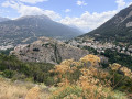
(7) At the Fork in the road, turn left and head uphill. Follow a few hairpin bends (viewpoint) and cross a road.
(8) At a junction, turn left, immediately rejoin a road and follow it uphill. Turn left towards the church to reach a viewpoint.
Retrace your steps.
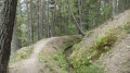
(8) Take the path on the left again. Cross a road once more and continue downhill. Pass under the cable car line again. At the next junction, carry straight on. Follow a pleasant forest track heading north then north-west.
(9) At the junction at the 1424-metre mark, turn right onto the path that descends steeply towards Pramorel. At the T-junction, turn left and you’ll soon reach a road. Follow the road to the right and take thefirst left.
(10) Roughly directly beneath a power line, take the track on the right. Cross a stream and pass an oratory. Cross the Guisane.
(11) As you come off the bridge, turn right. Pass through the hamlet of Le Martinet.
(1) At the junction, carry on straight ahead to return to the starting point (S/E).

 Visorando Member
 Easy
Easy