


Refine your search for walks in Serralongue
Serralongue walks


 Tours of Cabrenç from Serralongue
 Visorando Member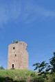
 11.19 mi
 +2,841 ft
 -2,818 ft
 7h 35
7h 35
 Difficult
 Departure from Serralongue (Pyrénées-Orientales)
First, following the description, there is the Tower (signal tower), the Keep (garrison), then the Castle.Magnificent landscapes along the path connecting these buildings.- Do not underestimate this long hike. The GPX track will be a great help on this route with its many crossroads and junctions. The descent from the castle is very tricky.- There are many places and viewpoints from which to admire the landscape.- Short version options * in Practical Information.Classified as difficult because of the route between the tower, the keep, the castle and the descent from it.- The five fords ** may be problematic after heavy rain (observed on 15 June 2023).
From Tech to Serralongue
 4.85 mi
+1,512 ft
-1,512 ft
3h 35
4.85 mi
+1,512 ft
-1,512 ft
3h 35
 Moderate
Departure from Le Tech (Pyrénées-Orientales)
Moderate
Departure from Le Tech (Pyrénées-Orientales)
A beautiful getaway in the Haut Vallespir, starting from the village of Le Tech, which will take you to the magnificent panorama of the Conjurador de Serralongue.
To reach the starting point, enter the village of Le Tech, then turn immediately left to cross the Tech river via a concrete ford and finally park in the car park next to the tennis court.
Montferrer - Puig de Vilafort - La Soca - El Castell
 9.40 mi
+2,762 ft
-2,776 ft
6h 45
Difficult
Departure from Montferrer (Pyrénées-Orientales)
9.40 mi
+2,762 ft
-2,776 ft
6h 45
Difficult
Departure from Montferrer (Pyrénées-Orientales)
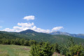
A circular hike in Vallespir starting from the mountain village of Montferrer (830m), built on a rocky outcrop known as "lo Cingle", which offers stunning views from the foot of the feudal castle over the Roussillon plain to the sea.Beautiful landscapes can be seen throughout this hike.
The ruins of Montferrer Castle
4.61 mi
+1,060 ft
-1,050 ft
3h 05
Moderate
Departure from Montferrer (Pyrénées-Orientales)
A pleasant, bucolic walk in the Haut Vallespir in Montferrer to explore the ruins of Montferrer Castle (el Castell Mollet).
Montferrer castle
 Association / Club / Walk leader3.46 mi
+725 ft
-741 ft
2h 15
Moderate
Departure from Montferrer (Pyrénées-Orientales)
Association / Club / Walk leader3.46 mi
+725 ft
-741 ft
2h 15
Moderate
Departure from Montferrer (Pyrénées-Orientales)
This walk takes about an hour and a half to two hours including time to explore the castle. The way up is fairly steep but should be fine for people who are moderately fit.
Coll de la Rua – Font Brigader – Sant Guillem Refuge – Cortal Allosat
 10.78 mi
+2,785 ft
-2,789 ft
7h 25
Difficult
Departure from Montferrer (Pyrénées-Orientales)
10.78 mi
+2,785 ft
-2,789 ft
7h 25
Difficult
Departure from Montferrer (Pyrénées-Orientales)
A variation on my previously published hike. It allows you to start higher up, passing by the Font del Brigader and the Coll de l’Estanyol. From the Sant Guillem Refuge: a return route via the semi-underground sheepfold, which is nearly sixty metres long. Beautiful scenery all along the way and lovely spots for breaks. A warm welcome at the refuge.
⚠️ Warning: observed on 3 September 2026 => The track from Coll de la Rua (S/E) to the Atri del Brigarder (2) has not been cleared. Following several storms, a large number of fir trees are completely blocking the track as soon as it enters the forest. => This circular route cannot be completed until further notice.
Lamanère – Baget via the Col de Malrems
 10.39 mi
+3,438 ft
-3,438 ft
7h 45
Difficult
Departure from Lamanère (Pyrénées-Orientales)
10.39 mi
+3,438 ft
-3,438 ft
7h 45
Difficult
Departure from Lamanère (Pyrénées-Orientales)
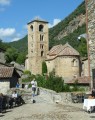
This hike, which follows theGR®83, takes you from the southernmost village in France to a small, typically Spanish village that has been fully restored, via the Col de Malrems.
The Cabrenç towers starting from Lamanère
 8.04 mi
+1,952 ft
-1,932 ft
5h 25
Moderate
Departure from Lamanère (Pyrénées-Orientales)
8.04 mi
+1,952 ft
-1,932 ft
5h 25
Moderate
Departure from Lamanère (Pyrénées-Orientales)
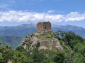
Here is another classic hike starting from Lamanère: the three towers of Cabrenç. These signal towers, built in the 10th century, were used to warn of Saracen invasions from the sea. Magnificent views guaranteed.
The bench at the end of the world in Lamanère
 7.00 mi
+1,568 ft
-1,545 ft
4h 35
Moderate
Departure from Lamanère (Pyrénées-Orientales)
7.00 mi
+1,568 ft
-1,545 ft
4h 35
Moderate
Departure from Lamanère (Pyrénées-Orientales)
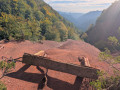
This hike is an opportunity to enjoy a picnic on a wooden bench while looking out over the Muga valley, from its source to its estuary in the Bay of Roses. Best done on a clear day to enjoy the view.
Puig de Coma Negra from Lamanère
 9.13 mi
+2,779 ft
-2,772 ft
6h 35
Difficult
Departure from Lamanère (Pyrénées-Orientales)
9.13 mi
+2,779 ft
-2,772 ft
6h 35
Difficult
Departure from Lamanère (Pyrénées-Orientales)
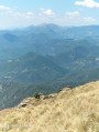
A fairly challenging hike with a magnificent route along the border ridge.The walk starts from the southernmost village in France.The climb along the GRT83 (¹) towards the Col de Malrems on the border is very pleasant.Passes by the Capelle Santa Cristina.A good sense of direction is absolutely essential (rated as difficult). The route on the Visorando app or on a GPS is very useful. See the ‘Practical Information’ section.
Path of Remembrance in Lamanère
 Local authority3.62 mi
+784 ft
-761 ft
2h 20
Moderate
Departure from Lamanère (Pyrénées-Orientales)
Local authority3.62 mi
+784 ft
-761 ft
2h 20
Moderate
Departure from Lamanère (Pyrénées-Orientales)
This commemorative walk follows the route taken by Spanish refugees in 1939 after the fall of Barcelona.
You will pass through Pla de la Coma, where there is a commemorative plaque recalling the tragic events of that period. This walk is suitable for everyone and can be done in either direction.
Lamanère to Notre Dame du Coral
2.48 mi
+1,115 ft
-105 ft
2h 05
Moderate
Departure from Lamanère (Pyrénées-Orientales)
A lovely walk up through the forest to the Ermitage de Notre Dame du Coral followed by lunch at the Auberge and the same walk back down to Lamanère.
The Roque Coucoulère loop via the Sant-Guillem refuge
 9.85 mi
+2,992 ft
-3,018 ft
7h 10
Difficult
Departure from Le Tech (Pyrénées-Orientales)
9.85 mi
+2,992 ft
-3,018 ft
7h 10
Difficult
Departure from Le Tech (Pyrénées-Orientales)
Loop around the Sant-Guillem Chapel offering beautiful views of the Vallespir.Caution: the Torrent de la Coumelade cannot be crossed during snowmelt or after heavy storms.
The Sant Guillem refuge via the Coll de la Rua - La Soca - l'Estanyol
 9.23 mi
+3,323 ft
-2,041 ft
7h 10
Difficult
Departure from Le Tech (Pyrénées-Orientales)
9.23 mi
+3,323 ft
-2,041 ft
7h 10
Difficult
Departure from Le Tech (Pyrénées-Orientales)
First day of: Two days exploring the Sant Guillem Refuge, including the ascent to the Sant Guillem Refuge.Do not underestimate this day. The estimated time is accurate.From the La Llau hikers’ car park, head up to the Coll de la Rua.Continue along a narrow grassy track to the shelter and the Font del Brigadier.Then climb up a very steep path to La Soca.Then head for the Coll de l’Estanyol.Further on, begin a lovely descent to the Sant Guillem Refuge.Vast landscapes on this first day of your exploratory hike.
⚠️ Warning: observed on 3 September 2026 => The track from Coll de la Rua (3) to the Abri del Brigader (4) has not been cleared. Following a series of storms, a large number of fir trees are completely blocking the track as soon as you enter the forest. => This section cannot be completed until further notice. This section from (3) can be adapted by using one of my walks: The Sant-Guillem Refuge via Coll de Rua – Cortal d’Allosat from La Llau
The Sant-Guillem Refuge via Coll de Rua - Cortal d'Allosat from La Llau
 6.94 mi
+1,631 ft
-1,654 ft
4h 35
Moderate
Departure from Le Tech (Pyrénées-Orientales)
6.94 mi
+1,631 ft
-1,654 ft
4h 35
Moderate
Departure from Le Tech (Pyrénées-Orientales)
A hike in the Haut Vallespir along a small road, forest tracks and a PR® trail.The route takes in beautiful pastures, a sheepfold, the Sant Guillem mountain hut and chapel, and an arboretum.See the section ‘During the hike or nearby’.This hike is the shorter version of my hike ‘The St-Guillem refuge via the Coll de Rua and the Estanyol from La Llau’
Coll de la Rua, from Estanyol – El Brigader – Pla de Rodes – Sant Guillem
 10.45 mi
+2,930 ft
-2,930 ft
7h 20
Difficult
Departure from Le Tech (Pyrénées-Orientales)
10.45 mi
+2,930 ft
-2,930 ft
7h 20
Difficult
Departure from Le Tech (Pyrénées-Orientales)
From La Llau, the ascent via the Coll de la Roua, the Haut Vallespir State Forest, La Fontaine and the Abri del Brigader is steady. After that, the climb is steep until you reach the Pla de Rodes and the Coll de l’Estanyol, where there are still large areas of active pastureland. Finally, the last climb from the Coll de l’Estanyol is magnificent. This is followed by the descent to the Sant-Guillem refuge and chapel, nestled in a beautiful pasture.
⚠️ Warning: observed on 3 September 2026 => The track from the Coll de la Rua (3) to the Abri del Brigader (6) has not been cleared. Following a series of storms, a large number of fir trees are completely blocking the track as soon as it enters the forest. => This circular route cannot be completed until further notice.
More walks in Serralongue
Select a point of interest below: