Country:

 City:
City:


From Perpignan, head towards Le Boulou (D900) then Céret, Amélie-les-Bains and Arles-sur-Tech (D115). Continue on the D115. On leaving Le Tech, turn sharp right and head uphill along the D74a towards the hamlet of La Llau (L’Allau on IGN maps). Caution: the 7 km road, which is in good condition, is narrow in places. Drive past the hamlet and continue for 500 m; after the road bridge, you will find a car park on the right-hand side.
Off the marked trail
(S/E) From the walkers’ car park, retrace your steps along the D74.
(1) Ignore the return path on the left and carry on along the road to the hamlet of La Llau.
(2) On leaving the hamlet, at the tapped spring, turn left and head uphill along the small, rough road to the Coll de la Roua (elevation 1013), where the road ends.
Old and very sparseyellow markings
(3) Leave the stony track leading to the Sant-Guillem Refuge on your left.
Head due north, crossing and closing an electric fence behind you. Follow the Piste Forestière de la Pinousette through the Haut Vallespir State Forest. This narrow, grassy track climbs steadily. At around 1,090 m, the track is better maintained and widens. As you pass the Còrrec de la Barda, this track turns due east then heads south-east, crossing two further còrrecs. These three torrents form the Ribera de la Fou, which further down carves out the Gorges de la Fou (closed to the public).
(4) Pass a boundary marker (no. 21) repainted white on the right-hand side, and a trough on the left-hand side.
(5) At around 1,190 m, leave the narrower track that descends to the right.
Continue south-east. The landscape opens out onto beautiful pastures. You’ll reach two buildings on your right-hand side, forming the Mas Lleguer, which is in very good condition. The track then turns north to reach a junction with another track on the left. Continue straight ahead for a few metres.
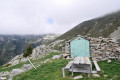
(6) On the left, higher up, there is a very clean shelter (as observed in November 2024), but the Fontaine del Brigader at track level is no longer flowing. A lovely spot for a break: repainted benches and a table (as observed in November 2024). Continue for about thirty metres to a junction of three tracks. Directional signs.
Yellow PR®markings
(7) Head up to the left along a rough track closed to motor vehicles. Follow the signs for Pla de Rodes. This pastoral track climbs steeply and offers beautiful views. The track levels out slightly before reaching the vast grazing area of Torres d’en Costa (altitude: 1,502 m). Directional sign.
Off the marked trail
(8) Pass the climb to La Souque on your right.
Signpost: follow Coll de l’Estanyol – Sant Guillem Mountain Hut.
The sheep track now heads westwards, across open ground, leading to the magnificent Pla de Rodes.
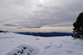
(9) At this crossroads of tracks, at an elevation of 1,546 m, head straight ahead, due north, along a stony track. After 500 m, the track turns westwards, climbing more steeply, and reaches the Coll de l’Estanyol at an elevation of 1,684 m at the junction of tracks and paths. Junction with theGRP®® trails. A lovely spot for a lunch break.
Red and yellow markings of the GRP® Tour du Canigó and Vallespir (as far as the Chapel of Sant-Guillem)
(10) Pass the path to the Batère Refuge straight ahead and aPR®® signpost to Leca on the right.
Behind a rock, you’ll find a square wooden post signposting the Sant-Guillem Refuge to the left.
Head up to the left and you’ll find a cylindrical post marking the exact location of Coll de l’Estanyol.
Now continue south-west along a sheep track. The scenery is magnificent.
At around 1,740 m, the track ends and becomes a narrow stony path heading due west. Continue like this for 300 m until you reach a junction at the 1,772 m mark.
(11) Ignore the path straight ahead and a signpost indicating: La Cabane Vieille (note: sign missing in November 2024).
Turn left and head down a steep slope for a few metres. Stay on theGRP®®®.
Please stick to the path and do not try to cut across; there is significant erosion in this area. Thank you.
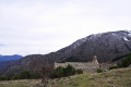
This is followed by a long descent through the forest along a very pretty path. Much further down, the roof of the Sant-Guillem Chapel comes into view. You’ll come to a track suitable for vehicles, an orientation table and a cross, at around 1,320 m.
Yellow markings
(12) Walk past the chapel on the right, taking care to respect the tranquillity of the place. Thank you.
Further down, join the access track and turn right. The area is fenced off (as of November 2024); continue along the track and descend a steel staircase to reach the refuge’s terrace.
(13) At the Sant-Guillem refuge, food and drinks are available. Very warm welcome.
At the bottom of the stairs, follow the yellow markings, which are in good condition and lead through the well-maintained arboretum. Descend, crossing two ‘còrrecs’. Make sure you close the electric fences properly after passing through them.
Take care when crossing the second ‘còrrec’; the path is very rutted and requires a degree of caution. Join the D74.
Off the marked trail
(1) Turn right onto this road and, 200 metres further on, you’ll reach the car park (S/E).
 Visorando Member
 Moderate