A circular walk covering seven Crêts du Pilat starting from Doizieux

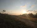
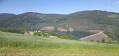
Set in the heart of the Pilat Regional Nature Park, this is a 20-kilometre hike with over 1,000 metres of elevation gain. The walk offers magnificent views of the Alps, notably Mont Blanc, stretching as far as the Vaucluse region and Mont Ventoux. To the west, on a very clear day, you can also catch a glimpse of the Auvergne Mountains.

Details

n°88600590
Creation:
Last update:
Last review:
–
  • Walking
    Activity: Walking
  • ↔
    Distance: 12.61 mi
  • ◔
    Average duration: 8h 50 
  • ▲
    Difficulty: Very difficult

  • ⚐
    Back to start: Yes
  • ↗
    Ascent: + 3,465 ft
  • ↘
    Descent: - 3,458 ft

  • ▲
    Highest point: 4,692 ft
  • ▼
    Lowest point: 1,867 ft

Photos

Description of the walk

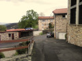
Park in the car park in the centre of Doizieux.

(S/E) Cross the Ruisseau du Dorlay and turn left onto Rue du Moulin. At the junction opposite the school, turn right. At the hairpin bend, continue to the right until you reach Rue de la Tour. Turn left, reach Rue de la Bredouze, follow it to the right and you will soon find the start of a footpath on the left.

(1) Take this path and follow it, ignoring all turn-offs to the right or left, until you reach the hamlet of La Roche.

(2) Turn left to walk along the edge of the woodland, then enter it. Continue uphill through the woodland until you reach the GR®7, marked in white and red. You’ll arrive at the shepherd’s hut.

(3) Continue along the GR®, heading due south, until you reach a four-way junction.

(4) Turn slightly right to climb up to the Crêt de la Perdrix.

(5) Return to the previous crossroads.

(4) Leave the GR®, turn right and then immediately left to reach the Crêt de la Chèvre.

(6) Turn almost 180° to the left, pass the Crêt de l’Arnica, then reach the Chalet Bourguisan junction.

(7) Turn right and walk through the forest to the Col d’Étançon.

(8) Continue straight ahead across open ground to reach the Crêt de l’Étançon.

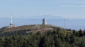
(9) Descend slightly to reach the Crêt du Rachat and its transmission masts.

(10) Continue north-east, now through the forest, until you reach the Crêt de Botte and its square tower.

(11) Join the road, cross the car park, and carry on to reach the Crêt de l’Œillon and its many facilities.

(12) Turn left at a 90° angle, heading due north, down a long, gentle descent followed by a final climb to reach the Col de la Trève du Loup.

(13) Continue due north. Stay on this path, ignoring the turn-offs to the right and left, until you reach the Collet de Doizieux crossroads with its many directions.

(14) Head straight ahead, due north, along the yellow-marked forest path and follow it to the Doizieux car park (S/E).

Waypoints

  1. S/E : mi 0 - alt. 1,867 ft - Car park at the entrance to Donzieux
  2. 1 : mi 0.34 - alt. 2,070 ft - Path junction
  3. 2 : mi 1.78 - alt. 3,097 ft - The hamlet of La Roche
  4. 3 : mi 3.88 - alt. 4,291 ft - Shepherd's hut - Gier (rivière) à finaliser
  5. 4 : mi 4.43 - alt. 4,593 ft - Four-way junction
  6. 5 : mi 4.61 - alt. 4,692 ft - Crêt de la Perdrix (1432m)
  7. 6 : mi 5.21 - alt. 4,682 ft - Crêt de la Chèvre (1427m)
  8. 7 : mi 5.46 - alt. 4,659 ft - Chalet Bourguisan
  9. 8 : mi 5.94 - alt. 4,478 ft - Col d'Etançon (1365m)
  10. 9 : mi 6.22 - alt. 4,560 ft - Crêt de l'Étançon
  11. 10 : mi 6.49 - alt. 4,528 ft - Crêt du Rachat (1380m)
  12. 11 : mi 6.94 - alt. 4,537 ft - Tower - Xrêt de Botte (1387m)
  13. 12 : mi 7.63 - alt. 4,462 ft - Branch - Crêt de l'Œillon (1364 m)
  14. 13 : mi 8.63 - alt. 4,026 ft - Col de la Trève du Loup (1219m)
  15. 14 : mi 10.03 - alt. 3,104 ft - Collet de Doizieux (945m)
  16. S/E : mi 12.61 - alt. 1,867 ft - Car park at the entrance to Donzieux

Notes

Additional details describing the terrain of this walk:
- From the start in Doizieux to km 6.2, you’ll walk along a long, continuous, steady climb, mostly through woodland, with a few slightly steeper sections, up to the shepherd's hut (inn). This section accounts for nearly three-quarters (722 m) of the day’s total ascent and takes 2 hours to 2 hours 15 minutes.
- From km 6.2 to km 12, the path is much less steep, often rocky, and first passes through the Crêt de la Perdrix – the highest point of the walk – before winding its way through heather moorland and woodland to connect the other six crêts, ending at the Crêt de l’Œillon.
-from km 12 to km 16.3, the path first follows a short scree slope and then descends, with a few short ascents, to the small pass of Doizieux (inn). This section of the path is quite often rocky, with some fairly steep sections through the woods that require careful footing.
-
From km 16.3 to the finish, the path first follows a forest track and remains generally in very good condition, with few rocky sections apart from a short stretch right at the very end, before reaching the village of Doizieux.

(11) Crêt de Botte: during a medical evacuation between Luxeuil and Istres on1 November 1944, the five crew members of an American Douglas C-47 Skytrain and 15 wounded Allied and German soldiers were killed in a crash between the Crêt de la Perdrix and the Crêt de Botte. Two memorials mark the site of this accident: one near the shepherd's hut and the other on a path between the shepherd's hut and the Col de la Botte (source: Wikipedia).

Worth a visit

Between (3) and (4): in the meadow on the right, you can see the Source du Gier.

Always be cautious and plan ahead when you're outdoors. Visorando and the author of this route cannot be held responsible for any accidents occurring on this route.

The GR® and PR® markings are the intellectual property of the Fédération Française de Randonnée Pédestre.

Other walks in the area

For more walks, use our search engine .

The GPS track and description are the property of this route's author. Please do not copy them without permission.