Valsesia Alagna Glaciological Trail

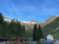
This trail will take you into the Alta Valsesia Nature Park, at the bottom of the valley beyond the village of Alagna.
This route features eight information boards describing the glacier’s evolution as it passes through the Alpe Bors cirque.

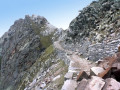
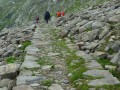
The Glaciological Trail forms part of the Alta Valsesia Nature Park, beyond Alagna. Along the route, you’ll have the chance to stop at a number of information boards (eight in total) situated at vantage points offering a clear view of the glacier’s evolution and the glacial cirque, which is clearly visible from Alpe Bors, halfway along the trail.

Details

37144761
Creation:
Last update:
Last review:
  • Walking
    Activity: Walking
  • ↔
    Distance: 4.75 mi
  • ◔
    Average duration: 4h 05 
  • ▲
    Difficulty: Moderate

  • ⚐
    Back to start: Yes
  • ↗
    Ascent: + 2,228 ft
  • ↘
    Descent: - 2,205 ft

  • ▲
    Highest point: 6,772 ft
  • ▼
    Lowest point: 4,882 ft

Photos

Description of the walk

By car, drive past the village of Alagna and park at the final car park, Wold (Parcheggio del Wold). Then take the shuttle bus (€3 per person) along the 3 km road to the Acqua Bianca waterfall.

(S/E) At the information boards, take the path towards the Pastore Refuge.

(1) After about 10 minutes, you’ll come to a junction indicating two routes to the Pastore Hut. Turn right onto path 207a (formerly 7a) to continue the winding ascent towards Alpe Fum Bitz.

(2) At the junction, turn left towards Alpe Fum (towards Rifugio Pastore) and leave the path that continues the ascent (Monte Rosa Tour – Colle di Turlo). Once you reach the mountain pasture, you can take a break to visit the botanical garden and the Alta Valsesia Nature Park visitor centre (Giardino botanico e Centro Visite Parco Naturale dell’Alta Valsesia).
Then continue down towards the Rifugio Pastore, leaving the path that climbs to the right towards the Rifugio Barba Ferrero.

(3) At the junction, continue to the right towards Rifugio Pastore (mountain hut). Cross the covered footbridge (Ponte delle Pile) over the impressive Sesia torrent. When you reach the vicinity of Alpe Pile (a flat area with smooth rocks), leave the Pastore refuge on your left (you’ll return here on the way back) and follow the path to the right which follows the Sesia upstream towards the Crespi Calderini refuge. You’ll then enjoy a splendid view of the south face of Monte Rosa (Mont Rose). Follow the signposts for path 206 (formerly 6) via Alpe Casera Lunga. Continue to the small bridge over the Bors torrent (rio Bors).

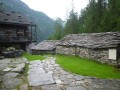
(4) At the junction after the bridge, turn left onto path 210 (formerly 10), which begins to wind upwards towards Alpe Bors (Rifugio Crespi Calderini). Just before the end of the switchbacks, you can venture into the open tunnel of an old mine (Miniera San Maurizio). You finally reach the Alpe Bors plateau. Walk past the few houses on this mountain pasture (you can take a break at the Crespi Calderini refuge – 1,829 m) and enjoy the view across the whole plateau.

(5) Just before the refuge, take path 210a (formerly 10a) which leads to Alpe Fun d’Ekku (2,070 m), the final stage of the glaciological route.

(6) Pass by a viewpoint (called “K2” – 1,895 m) equipped with picnic tables. Leave the path that branches off to the right and continue along the ridge to Alpe Fondecco, Fun d’Ekku. From there, you can enjoy the majestic panorama of the glaciers and the creaking sounds of the south face of Monte Rosa. Please note that it is best to arrive in the morning to admire Monte Rosa and avoid the clouds that form from midday onwards.

(7) Then head back down via the same ridge path to the previous junction.

(6) Instead of heading back down towards Alpe Bors, turn sharply left towards the north. Follow the path, which is less well-trodden than the previous ones, to a small, barely visible junction.

(8) Turn right towards the east to follow the streams to Alpe Muflicat.

(9) You can stop off to have a look at the Val Malfatta stream, but do not cross the bridge heading north, as you must continue down the Sesia on path 206 (formerly 6) towards the Bors stream (bridge) which you passed on the way there.

(4) Take path 206 back in the opposite direction to the outward journey, towards Alpe Casera Lunga and then Rifugio Pastore.
After the refuge, continue along the original route, cross the bridge and rejoin the junction you passed on the way there.

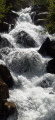
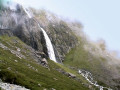
(3) This time, take the path on the right leading down, which will take you past the Caldaie del Sesia (a waterfall with an information board explaining how waterfalls are formed).

(1) Finally, continue along the path to the starting point (S/E).

Alternative route: please note that you can also ascend or descend from the Pastore refuge to the Wold car park without taking the tarmac shuttle road. There is a path via Alpe Stiga (with a view of the Acqua Bianca waterfalls) which joins the tarmac road at a place called Sant’Antonio (where there is a small chapel).

Waypoints

  1. S/E : mi 0 - alt. 4,882 ft - Acqua Bianca - Cascata dell'Acqua Bianca (cascade)
  2. 1 : mi 0.09 - alt. 5,016 ft - Junction for the ascent to Alpe Fum Bitz - Cascata dell'Acqua Bianca (cascade)
  3. 2 : mi 0.49 - alt. 5,312 ft - Crossroads at the top of Alpe Fum Bitz - Giardino botanico e Centro Visite Parco Naturale dell'Alta Valsesia (Alpe Fum Bitz - 1600 m)
  4. 3 : mi 0.61 - alt. 5,213 ft - Lower junction at Alpe Fum Bitz - Ponte delle Pile
  5. 4 : mi 1.46 - alt. 5,597 ft - Bridge over the Bors stream (rio Bors) - Cascata di Bors (cascade)
  6. 5 : mi 1.67 - alt. 6,066 ft - Alpe Bors - Miniera San Maurizio
  7. 6 : mi 1.81 - alt. 6,148 ft - K2 Viewpoint (1,895 m)
  8. 7 : mi 2.18 - alt. 6,768 ft - Alpe Fondecco
  9. 8 : mi 2.87 - alt. 6,211 ft - Small pass at the top of Alpe Muflicat
  10. 9 : mi 3.14 - alt. 5,896 ft - Alpe Muflicat junction
  11. S/E : mi 4.75 - alt. 4,882 ft - Acqua Bianca - Cascata dell'Acqua Bianca (cascade)

Notes

Recommended period: from late spring to early autumn.

It is possible to park before the village of Alagna if you do not wish to pay for the car park. A few spaces are available at the end of the road (Acqua Bianca – start of the trail) but these should be avoided, and the road is closed to traffic during the tourist season.

Rifugio F. Pastore: Food and drink available. Varallo CAI Section Tel. 016391220; info@rifugiopastore.it.
Rifugio Crespi Calderini (mountain hut – 1,836 m) Food and drink available. Varallo CAI Section Tel. 016351530; info@caivarallo.it.

Worth a visit

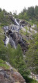
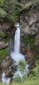
  • Cascata dell’acqua bianca (waterfall).
  • Brunnenwasser Waterfall.
  • Botanical Garden and Visitor Centre of the Alta Valsesia Nature Park (Alpe Fum Bitz – 1,600 m).
  • Ponte delle Pile (covered footbridge).
  • Rifugio F. Pastore (mountain refuge – 1,575 m).
  • Bors Waterfall (waterfall).
  • San Maurizio Mine (former mine).
  • Crespi Calderini Mountain Hut (mountain hut – 1,836 m).
  • Alpe Fondecco – Fun d’Ekku (mountain pasture – 2,070 m)
  • Caldaie del Sesia (waterfall)

Reviews and comments

4.7 / 5
Based on 3 reviews

Reliability of the description
4.7 / 5
Ease of following the route
4.7 / 5
Route interest
4.7 / 5
ALEX69
ALEX69

Overall rating : 5 / 5

Date of your route : Aug 17, 2026
Reliability of the description : ★★★★★ Very good
Ease of following the route : ★★★★★ Very good
Route interest : ★★★★★ Very good
Very busy route : Yes

A lovely walk, easy to follow as there are plenty of people around – especially in summer – and the markings are clear. The return journey via the alternative route is beautiful, and we were almost on our own! There’s a shuttle bus from the car park (around 6 euros per person), and the car park is also pay-and-display.
Even though this walk comes at a cost, I’d still recommend it! It’s magnificent.

Machine-translated

diggi
diggi

It’s true that there isn’t much of interest in the “Alpe Muflicat” section, but it does add some variety to the return journey by following the Sesia torrent along a stretch that is, in fact, less busy

Machine-translated

Keeshond
Keeshond

Overall rating : 4.7 / 5

Date of your route : Jul 05, 2026
Reliability of the description : ★★★★★ Very good
Ease of following the route : ★★★★★ Very good
Route interest : ★★★★☆ Good
Very busy route : Yes

A lovely walk. Very busy, as you’d expect on a Sunday!
The section via Alpe Mulificat isn’t particularly interesting; in fact, we were the only ones on that stretch.
Perfectly manageable for us septuagenarians;

Machine-translated

diggi
diggi
• Edited:

Hello CAT71,
Your comment does not relate to the route I described, as it does not require any special equipment other than walking shoes (hiking on trails) and is not particularly physically demanding (less than 700m of elevation gain, which I completed with my 10-year-old son).
You are probably referring to the ascent of Monte Rosa (Mont Rose) with a descent via the "Tête Noire" (Corno Nero), which is not the purpose of this "family" hike!

Machine-translated

CAT71
CAT71

Overall rating : 4.3 / 5

Date of your route : Sep 22, 2025
Reliability of the description : ★★★★☆ Good
Ease of following the route : ★★★★☆ Good
Route interest : ★★★★★ Very good
Very busy route : No

A very beautiful hike that requires good equipment and physical fitness.
The descent via the "Tête Noire" passes through numerous scree slopes and waterfalls.

Machine-translated

Other walks in the area

For more walks, use our search engine .

The GPS track and description are the property of this route's author. Please do not copy them without permission.