Refine your search for walks in Ponte delle Pile
Ponte delle Pile walks


 Valsesia Alagna Glaciological Trail
 Visorando Member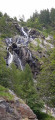
 4.75 mi
 +2,228 ft
 -2,205 ft
 4h 05
4h 05
 Moderate
 Departure from Alagna Valsesia (Piedmont)
This trail will take you into the Alta Valsesia Nature Park, at the bottom of the valley beyond the village of Alagna.
This route features eight information boards describing the glacier’s evolution as it passes through the Alpe Bors cirque.
The Glaciological Trail forms part of the Alta Valsesia Nature Park, beyond Alagna. Along the route, you’ll have the chance to stop at a number of information boards (eight in total) situated at vantage points offering a clear view of the glacier’s evolution and the glacial cirque, which is clearly visible from Alpe Bors, halfway along the trail.
From the Great Saint Bernard Pass to the Simplon Pass
 132.64 mi
+49,747 ft
-48,494 ft
12 days
132.64 mi
+49,747 ft
-48,494 ft
12 days
 Very difficult
Departure from Bourg-Saint-Pierre (Valais)
Very difficult
Departure from Bourg-Saint-Pierre (Valais)
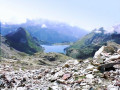
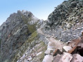
How to connect two legendary mountain passes between Italy and Switzerland! Most of the proposed route is in Italy (from the Great Saint Bernard Pass to the Monte Moro Pass), with the last two stages in Switzerland following the traditional "Chamonix-Zermatt-Simplon" route.
Walks near Ponte delle Pile
Pastore Refuge - Macugnaga
 11.67 mi
+3,960 ft
-4,856 ft
10 hrs
Very difficult
Departure from Alagna Valsesia (Piedmont)
11.67 mi
+3,960 ft
-4,856 ft
10 hrs
Very difficult
Departure from Alagna Valsesia (Piedmont)
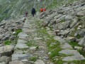
Another change of valley to reach the large village of Macugnaga at the foot of Monte Rosa via the Col Turlo. The wide path used is absolutely remarkable as it was built by the Italian army to hoist cannons for the defence of the area and for firing exercises.
Oreste Hütte - Refuge Pastore
 7.56 mi
+2,300 ft
-5,689 ft
10 hrs
Very difficult
Departure from Gressoney-La-Trinité (Aosta Valley)
7.56 mi
+2,300 ft
-5,689 ft
10 hrs
Very difficult
Departure from Gressoney-La-Trinité (Aosta Valley)
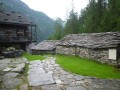
Head towards the Alagna Valley, passing the Col d'Alen and the Lac del Corno. The final descent via Alpe Balma through wild countryside takes you directly to the Refuge Pastore, nestled in a magnificent mountain pasture at the foot of the north face of Monte Rosa.
Rifugio Gabiet - Rifugio Pastore
 8.88 mi
+3,077 ft
-5,636 ft
6h 45
8.88 mi
+3,077 ft
-5,636 ft
6h 45
 Difficult
Departure from Gressoney-La-Trinité (Aosta Valley)
Difficult
Departure from Gressoney-La-Trinité (Aosta Valley)
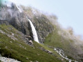
This stage passes through the Col d'Olen, on the border between the Aosta Valley and Piedmont.
Hike with a brief description, to be followed with the Visorando app.
Staffal and the Alta Luce summit
7.41 mi
+5,013 ft
-3,412 ft
7h 45
Moderate
Departure from Gressoney-La-Trinité (Aosta Valley)
A circular loop that takes you to the Alta Luce summit with a view of the glacier and back down via the A Staffal/Greyssonney la Trinité cable car. The route is very well marked: follow several trails: 7a to the summit, then descend to the pass and take the 6b to the cable car that takes you back to the starting point.
Macugnaga - Saas Fee
 7.83 mi
+5,364 ft
-2,438 ft
10 hrs
Very difficult
Departure from Macugnaga (Verbano-Cusio-Ossola)
7.83 mi
+5,364 ft
-2,438 ft
10 hrs
Very difficult
Departure from Macugnaga (Verbano-Cusio-Ossola)
This stage takes you through Switzerland via the Grand Col du Monte Moro, followed by a beautiful descent to Lake Mattmark. Once you reach the lake, take the bus to Saas Fée.
Macugnaga - Saas Almagell
 12.52 mi
+5,548 ft
-4,314 ft
10h 35
Very difficult
Departure from Macugnaga (Verbano-Cusio-Ossola)
12.52 mi
+5,548 ft
-4,314 ft
10h 35
Very difficult
Departure from Macugnaga (Verbano-Cusio-Ossola)
During this stage, at Passo di Monte Moro, you cross from Italy (Piedmont) to Switzerland (German-speaking Valais).
Hike with a brief description, to be followed with the Visorando app.
From Gressoney-La-Trinité to Claval/Staffal via Lago Gabiet
5.95 mi
+2,490 ft
-1,873 ft
4h 55
Moderate
Departure from Gressoney-La-Trinité (Aosta Valley)
The beginning of the route is easy enough (follow route 4 to Lake Gabiet), but it's more than a 600-meter climb!
The lake is beautiful, and you can see the snow on top of the Monte Rosa in the distance.
Gressonney - Di Frachey Refuge
 Association / Club / Walk leader10.85 mi
+5,758 ft
-3,533 ft
10h 00
Very difficult
Departure from Gressoney-Saint-Jean (Aosta Valley)
Association / Club / Walk leader10.85 mi
+5,758 ft
-3,533 ft
10h 00
Very difficult
Departure from Gressoney-Saint-Jean (Aosta Valley)
That’s the end of the southern section. This hike takes in a different landscape, with the Swiss Alps in view. It feels like we’re in Germany. It’s a lovely day. After the climb, the hike descends back into the valley. As with Eaux Rousses, it’s best to book in advance as the refuge is very popular. In fact, there are two of them and they’re full by early July.