Country:
 City:
City:


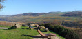
Car park along the Moselle.
(S/E) With your back to the Moselle, head towards the centre of Ahn via Rue de Niederdonven. Look out for thefirst house on the right-hand side of the street, where a small sign shows the height reached during a record flood of the Moselle. Walk up the hill and, further up, turn left onto Rue de la Résistance. At the junction, carry on straight ahead into Rue Aly Duhr. Keep to the right until you reach the CR 142, then turn right. Walk downhill to No. 25.
Signage: White ‘SR’ on a purple background
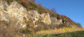
(1) Go down the steps opposite No. 25. Cross the bridge and turn left. Enter a Protected Area, following the Donverbach stream. View of the limestone cliffs. Look out for the cross at the very top – you’ll be there soon. Walk alongside the vineyard and enter the copse. Head uphill and continue to the left. Head back under the trees and climb the winding path. At the top, turn left until you reach the information board – lift it up.
(2) Turn right and head uphill. When you reach the road, keep to the right. Ignore the path leading into the vineyard and head up to the left, keeping as close to the cliff as possible. Carry on along the cliffs, pass between two rows of vines and, at the Riesling sign, turn right. Take the path between the first two rows of vines in the next plot. You’ll come to a shelter with a picnic table, benches and a deckchair near the road.
(3) Carry on to the left and head uphill. At the junction, take the road to the left. At the bend, take the stony path to the right as far as halfway up the slope, then take the footpath on your right. Walk through the old juniper bushes. At the end of the path, take the steps built into the dry-stone walls on your left. Climb up to rejoin the path, which you’ll follow to the right. Walk past the ‘Chalet Diana’ house.
(4) At the bend, carry on straight ahead under the trees. Descend the wet and slippery path as it winds downwards. Once back on a path, continue to the left. At the wide path, also continue to the left. At the Fork in the road, turn left. A path (not shown on the map) joins from your right. At the wide track, not far from a house, turn left. Leave the woodland and turn left onto the open track running alongside the fields. At the road, level with Chalet Diana, turn right. View of Niederdonven. Walk down the road to the corner of the field on your left, before the bend and the green fence.
(5) Climb the embankment of the field and take the path branching off to the left. At the road, turn left. The road becomes a dirt track. Turn onto the first track on the right, after an information board. Walk to the end of the copse and the faint grassy path starting opposite an information board about Niederdonven.
(6) Turn left onto the faint grassy track. Enter the boxwood thicket and the Palmberg-Ahn Nature Reserve. Pass by the foot of the cross you saw at the start and head down between the boxwood trees. At the junction with an information board, continue to the right, still amongst the boxwood. You’ll come across further information boards. Walk to a Fork in the road (not shown on the map) and carry on to the right.
At the vineyard, keep to your right and walk alongside it. When you reach the hunter’s chair, turn right and head uphill. At the top, continue left onto the stony path. At the junction, continue left until you reach the steps on your left.
(7) Go down the steps and cross some terraced plots that have been abandoned for a long time but have now been cleared. Go straight down each flight of steps and, for the final descent, head left before taking a sharp right-hand bend. Walk to the far end of the plot, keeping a clearly visible sign in your sights, and go through the gate. Make sure you close it behind you. Walk down to the building.
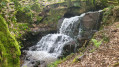
(8) Turn left just before this final flight. Wade across the Donverbach stream over the large stones. Go through the gate on the other bank. Make sure you close it properly behind you. A little further on, wade across again when you see the road’s crash barriers higher up on your right. Walk past the view of the waterfall. At the fork in the road (not shown on the map), keep to the right. The path turns right and passes by folded rock formations and scree. Descend as close as possible to the stream, wade across and cross back to the other side. Turn right and walk to the road.
(9) Continue to the right and cross the bridge. Take the steps and follow the road to the right. Cross the road at the end of the safety railing and take the path opposite, heading uphill. Halfway up the slope, the path veers slightly to the left and then follows the contour line. At the road, turn left and then immediately right. At the next road, cross over and carry on straight ahead. At the bend, take the road on the left and walk downhill to the building with the initials ‘JK’ painted on the gable.
(10) Turn right before the building. Walk past a brasserie and, at the terrace with the small seating area, turn left. Go down the stairs and turn right. At the hedge, take the entrance on your left and enter the maze. Keep to your left. When you reach the road, head down to the right towards the church. At the junction, turn right and walk back down Rue de la Résistance. At the crossroads, turn right and head towards the Moselle and your car park (S/E).

 Visorando Member
 Easy
Easy