Country:
 City:
City:


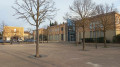
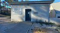
Park next to the primary school: parking is free and the car park entrance is under CCTV surveillance (cameras on the post).
(S/E) On leaving, turn right onto the Carraire du Moulin, then head up Boulevard Jules Ferry towards the town centre. Go round the junction on the right, cross at the pedestrian crossing and follow the Chemin des Écoliers, which leads to the library and then to the Place de la Mairie.
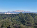
On the square, you’ll find a café and a bar-tobacconist’s. If you have time, you can pop into Saint-André Church and the castle by heading to the right.Otherwise, head south to reach the end of the esplanade, where the view opens out onto the Chaîne de l’Etoile, with its famous Pilon du Roi, shaped like a baby’s tooth.
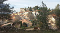
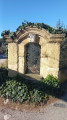
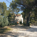
(1) Head to the Croix de Lorraine car park. Take the path to the left of the dovecote, climb a few steps and continue towards the chapel: this dovecote is used to collect the eggs laid and to limit the population. Along the way, on your right, admire the view of the rock and the old village.
(2) Once you reach the Chapel of Notre-Dame de l’Espérance, take the time to walk around it. Then, heading south, look out for the Lafarge factory at La Malle in the distance. After the chapel, pass the ruined tower, then follow the blue signposts carefully to reach the crossroads in the clearing.
(3) Keep to the left to begin the long circular loop on the descent.
(4) Along the way, on your left, you’ll see essential public services (sewage treatment, waste disposal centre), which can sometimes be noisy. Continue to follow the blue markings to complete a circular route and return to the clearing.
(3) Turn left again on the descent. After about 200 metres, you’ll come out onto Avenue du Général de Gaulle; turn right onto the pavement.
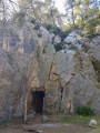
(5) As you walk uphill, you’ll be able to catch a glimpse ofthe magnificent Albertas Gardens on your left:take great care if you cross the road to get closer to them. After taking a quick look, return to the pavement and continue uphill.Opposite the “Côté Jardin” restaurant, cross carefully towards the small square, walk to the far end, then head right along the road for about 50 m, before turning left onto the path, which is blocked by a low barrier that you can step over. After about 200 m, just where the road bends to the right (the signposting does not indicate this), take a descending path on the left to reach the ice house. This remarkable ice house, the forerunner of the fridge, was used to preserve perishable foodstuffs.
(6) Return to the main path by going back up the same track and head off to the left. The path leads onto a small road that takes you back up to the village. Pass the Moussou sports ground on your left: basketball, volleyball, pétanque, etc.Head up towards the village until you can no longer continue straight on.
(7) Turn left onto the Cours du Ferrage, which climbs steeply. As you walk past the village, take a moment to look back and take in the surroundings.When you reach the end of the Cours du Ferrage, cross at the pedestrian crossing. Before turning left down the slope, take a moment to snap a photo of Saint-André Church.
(8) As you head downhill, turn right into the cemetery square. On your right, the Missak Manouchian Garden is a site of Armenian remembrance.At the far end of the square, walk along the right-hand side of the cemetery, go down the small flight of steps and turn right onto Boulevard de l’Égalité. At the end, cross at the pedestrian crossing to take Cours Jules Ferry on your left. Continue along this road towards the Terres Blanches Sports Complex – Salle Charles Aznavour
(9)If the door is open, enter the hall and admire the magnificent portrait of the artist on your right.On your way out, try this experiment: sit on the stone bench in the ‘Round Courtyard of Secrets’ and, from one end of the bench to the other, whisper sweet nothings or secrets. No one will hear you, apart from those sitting on the bench. Walk past the sports complex on your right and go through the gate. Pass the Maison du Combattant and the Souvenir Français on your right.
Then take the sensory trail that climbs the hill, leaving the Les Pins primary and nursery schools on your right. At the top, rejoin the Carraire du Moulin and turn right as you head downhill. Before hurrying back to the car, take a few steps along Rue des Frères Lévrino and note the carved door. Turn back and head back to the car park (S/E).

 Visorando Member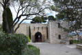

 Moderate