Between the lake and Grande Maine

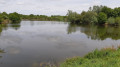
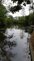
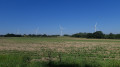
A lovely ride through the countryside, following several watercourses and skirting the lakes in the area.
This mountain bike route takes in minor roads, tracks and trails.

Details

n°2756169
Creation:
Last update:
Last review:
  • Mountain biking
    Activity: Mountain biking
  • ↔
    Distance: 22.18 mi
  • ◔
    Duration according to the author: 3 hrs 
  • ▲
    Difficulty: Moderate

  • ⚐
    Back to start: Yes
  • ↗
    Ascent: + 427 ft
  • ↘
    Descent: - 427 ft

  • ▲
    Highest point: 276 ft
  • ▼
    Lowest point: 115 ft
  • ⚐ Country: France
  • ⚐ City: Treize-Septiers (85600)
  • ⚑
    Start/End: N 46.983678° / W 1.231425°
  • ❏
    IGN map(s): Ref. 1324SB, 1325E

  • ◶
    Type of surface: Not specified
  • ⇧
    Bike carrying: Not specified
  • ▲
    Difficulty: Not specified
  • Hour-by-hour weather

Photos

Description of the route

Park near the church in Treize-Septiers.

(S/E) Take the small lane to the left of the roundabout towards Rue Principale. Turn left onto it, heading west towards Montaigu. Atthe second roundabout, turn right into the Papinière neighbourhood. Keep to the right to go round the neighbourhood. You’ll come to a right-angled junction.

(1) Here, rejoin the small road, turn right and pass the above-ground tanks, then turn left onto the small path
From here, follow the yellow signposts for the footpath. Continue generally southwards to reach the Bonninière crossroads.

(2) Turn right onto the path that runs alongside the house and, 300 metres further on, the path passes between two posts just before the pond at the edge of the hedge. You’ll reach the Guyonnière sports centre.

(3) Leave the Yellow trail here to cross the village heading south towards the lake. Join Rue du Lac, follow it due south, go past the roundabout and you’ll soon reach the Chemin des Morts junction.

(4) Turn left onto it, passing between the houses. Make your way to the campsite, taking great care when crossing the D23 road.
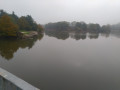
At the entrance to the campsite, take the path that goes round it on the left, then walk round the lake.

(5) After the small bar by the car parks, head back towards La Friborgère and then La Caffinière; enter the village and follow the mountain bike trail marked in yellow which leads to La Maine.

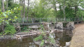
(6) Cross the river via a small footbridge: please note that this is impassable during high water.
As you leave the footbridge, follow the yellow trail, which soon joins the Sèvre et MaineGRP®. Turn left onto thisGRP®, marked in red and yellow. At a place called Gros Buisson, take a detour to the right then left to rejoin theGRP® at the entrance to La Dragonnière.
Return to theGRP®, cross La Dragonnière and you’ll soon reach a pond.

(7) Turn left to cross the Maine again and head back up into the village. Stay on theGRP®, which gradually moves away from the Maine. Cross the Route du Logis de la Fortécuyère. Pass thefirst junction to reach asecond one.

(8) Turn right, still following the red and yellow-markedGRP® trail. Reach the car park on the edge of the Retenue de la Bultière. Turn right onto the path here, leaving theGRP® trail to go round the reservoir. Cross the Maine at the Moulin de Corbeau. Stay on the left bank of the lake to reach the Preuilly bridge.

(9) Cross the lake and head back to the car park. Stay on the path to the left; at the next bay, rejoin the GRP®. Turn left onto it and head back to the junction you passed earlier.

(8) Turn right, heading due north, until you reach the hamlet of La Tardaudière.

(10) Take the road on the left, then the one on the right – this is a path lined with rows of pine trees. Continue on, crossing the Ruisseau de la Lignée before coming out onto the D62 road.

(11) Follow the road on the right towards La Boissière de Montaigu. Atthe second junction, turn left onto the small road leading to the hamlet of Cléon Gautret. Continue to the right to reach the hamlet of La Chunelière.

(12) Follow the path opposite, running alongside the houses, then turn right at the junction marked by an abandoned house in a field on the left. You’ll come out onto the D23 road.

(13) Cross it, pass through the hamlet of Bordage de la Rondardière, and at the next crossroads turn slightly right. Pass the houses of La Rondardière and then the small stream feeding a pond. You will then come to another crossroads.

(14) Turn left onto this road. You’ll reach the hamlet of L’Étang. Pass through it and then continue almost due west to reach the hamlet of La Grillière.

(15) Change direction by 90°, heading due north. Discover the hamlet of La Ronde, then, turning another 90° to the right, the hamlet of La Bremière.

(16) Turn left to enter the Treize Septiers industrial estate after crossing the Ruisseau d’Asson.

(17) Follow the sign for the sewage treatment works on the left and continue along the path, passing to the left of the works to enter the woodland, which emerges near the care home, and head towards the church car park (S/E).

Waypoints

  1. S/E : mi 0 - alt. 210 ft - Car park at the church in Les Treize-Septiers
  2. 1 : mi 1.01 - alt. 236 ft - La Papinière
  3. 2 : mi 2.45 - alt. 213 ft - La Boninière
  4. 3 : mi 3.06 - alt. 223 ft - La Guyonnière Sports Centre
  5. 4 : mi 3.69 - alt. 223 ft - Chemin des Morts
  6. 5 : mi 4.91 - alt. 223 ft - Lac de la Chausselière
  7. 6 : mi 6.48 - alt. 115 ft - Footbridge - Maine (rivière)
  8. 7 : mi 8.86 - alt. 138 ft - Pont de la Grande Maine
  9. 8 : mi 9.88 - alt. 240 ft - Crossroads: the lake circular route
  10. 9 : mi 12.83 - alt. 203 ft - Preuilly Bridge
  11. 10 : mi 15.57 - alt. 243 ft - La Tardaudière
  12. 11 : mi 16.33 - alt. 226 ft - Route de la Boissière D62
  13. 12 : mi 17.36 - alt. 246 ft - La Chunelière
  14. 13 : mi 17.85 - alt. 272 ft - D23 road
  15. 14 : mi 18.98 - alt. 266 ft - Crossroads towards the Étang
  16. 15 : mi 20.32 - alt. 256 ft - La Grillière
  17. 16 : mi 21.17 - alt. 220 ft - La Bremière
  18. 17 : mi 21.63 - alt. 220 ft - Treize-Septiers Industrial Estate
  19. S/E : mi 22.18 - alt. 210 ft - Car park at the church in Les Treize-Septiers

Notes

The route can be extended at Lac de la Bultière by heading to the far end of the lake (a steeper section), adding about 10 km.
This is a mountain bike route featuring plenty of paths and small roads, but with a few more challenging sections, including steep climbs and descents over roots and rocks.

Worth a visit

On Sunday afternoons in the summer, a bar is open at Lac de la Chausselière, and during July and August a water sports centre is also open at Lac de la Bultière.

Reviews and comments

4 / 5
Based on 2 reviews

Reliability of the description
4 / 5
Ease of following the route
3.5 / 5
Route interest
4.5 / 5
Guyom85
Guyom85

Hello
Thank you for your comment
I’ve just had another look at the map and you’re right – the route is incorrectly shown between points 2 and 3. The path to follow is the dotted one that runs alongside the hedge and the pond
My apologies for the inconvenience
If this section is too tricky, an alternative route is to take the tarmac road, heading straight to point 2 and turning right at the junction with the main road; this will take you to the centre of La Guyonière
Enjoy your walk
Kind regards
Guillaume

Machine-translated

Eb4
Eb4

Overall rating : 3.3 / 5

Date of your route : Jul 24, 2022
Reliability of the description : ★★★☆☆ Average
Ease of following the route : ★★★☆☆ Average
Route interest : ★★★★☆ Good
Very busy route : No

An interesting route.
However:
- Visibility issues with the markings between points 2 and 3, as previously reported. We wasted a good 20 minutes looking for them.
- Some sections are difficult to cycle through (narrow bridges in particular).
- Allow more than 3 hours to complete the route.

Furthermore, there’s an issue with the cursor indicating your position on the app – it’s out of sync with your actual location, leading to navigation errors.

Machine-translated

Guyom85
Guyom85

Hello
Thank you for your comment
It really is a very varied walk, and now that nature is coming to life, it’s a real pleasure
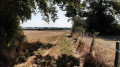
Between points two and three, the path is normally maintained by the local council, which makes it clear that the path starts on the left between the fences,
My apologies for this inconvenience
See you soon in the countryside

Machine-translated

manuuher
manuuher

Overall rating : 4.7 / 5

Date of your route : May 07, 2021
Reliability of the description : ★★★★★ Very good
Ease of following the route : ★★★★☆ Good
Route interest : ★★★★★ Very good
Very busy route : No

A superb route today, taking in two bodies of water.
It was magnificent.
It alternated between footpaths, dirt tracks and roads. No time to get bored.
The lake at the end of the walk is magnificent.
It’s a shame there aren’t many picnic tables, unlike at the first pond.
There are just a few benches.
Right at the junction between (2) and (3), there’s a discrepancy between the route on the map and the actual path. I had to search carefully for the right way. A waypoint might be a good idea.
Perhaps this one has been moved?
I’m adding a photo to clearly show the discrepancy (which can be seen on the OpenStreetRando map but not on the IGN map).

Machine-translated

For more walks, use our search engine .

The GPS track and description are the property of this route's author. Please do not copy them without permission.