Memorial Trail – Ski Scout Section – Costa de Beauregard

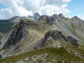
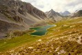
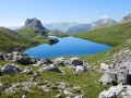
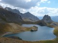
This is a walk in the footsteps of history. In June 1940, fierce fighting took place on this mountainous site between the French and Italian armies. As you walk along this path, I invite you to take a moment to think of those soldiers. When you visit the interior of the blockhouses, just for a moment, think of the soldier who looked through that rifle scope…. But don’t forget to look up, as the view is magnificent.

Details

n°50366416
Creation:
Last update:
Last review:
  • Walking
    Activity: Walking
  • ↔
    Distance: 3.80 mi
  • ◔
    Average duration: 2h 55 
  • ▲
    Difficulty: Moderate

  • ⚐
    Back to start: Yes
  • ↗
    Ascent: + 1,322 ft
  • ↘
    Descent: - 1,306 ft

  • ▲
    Highest point: 6,811 ft
  • ▼
    Lowest point: 5,495 ft

Photos

Description of the walk

On the D900, in the village of Larche, park in the Town Hall car park.

(S/E) Follow the D900 towards Meyronnes, leave the village and look out for the start of a track on the right.

(1) Turn right onto it and head uphill, passing close to an aerial, then continue uphill until you reach a group of blockhouses. This group of blockhouses, the Larche Outpost, is the largest defensive structure on this walk.

(2) Carry on climbing until you reach a flat area; look out for a rock on the right with a door cut into it. Head towards it – this is Le Truc. It has been hollowed out and fitted with a firing slit.

(3) Return to the path, passing close to the ruins of the Colombier farm, which was destroyed by the Germans. Climb up following the track, then, at a hairpin bend, leave the track and follow the path along the hillside to reach a flat area. Here, look out for another blockhouse, Strongpoint 1893, which played a very important role on 20 June 1940 in holding back the Italian attack.

(4) Turn left onto the path leading uphill over a small ridge – this is theGR®5– and you will very quickly reach another junction of paths.

(5) Leave theGR® and continue first on level ground, then climb briefly up a ridge before finally traversing the hillside to a new blockhouse, known as Strongpoint 2018.

(6) Continue along the hillside path until you reach a track and theGRP®, at the L’Ausse Blanche junction.

(7) Turn almost 180° to the right, follow the Rouchouse stream, then reach the Génie Dam, where only a few stakes, tied in pigtails, remain to hold up the old barbed-wire barrier.

(8) Continue downhill to the Prés Bas crossroads. Keep straight ahead on theGRP®, reaching the footbridge over the Ravin du Combal and the end of a track.

(9) Ignore this footbridge and continue straight on along the wide track that forms part of theGRP®, marked with yellow and red signposts. At the end of the descent, you’ll reach Larche and the town hall car park (S/E).

Waypoints

  1. S/E : mi 0 - alt. 5,505 ft - Town Hall car park
  2. 1 : mi 0.23 - alt. 5,505 ft - Crossroads by the D900
  3. 2 : mi 0.53 - alt. 5,692 ft - Blockhaus at the Larche Outpost
  4. 3 : mi 0.86 - alt. 5,883 ft - Rocher du Truc Blockhouse and Ferme du Colombier
  5. 4 : mi 1.54 - alt. 6,332 ft - Blockhaus at the - Point d'appui 1893
  6. 5 : mi 1.74 - alt. 6,647 ft - GR trail junction
  7. 6 : mi 2 - alt. 6,749 ft - Blockhaus at Support Point 2018
  8. 7 : mi 2.37 - alt. 6,811 ft - L’Ausse Blanche crossroads
  9. 8 : mi 2.64 - alt. 6,558 ft - Engineers’ Barrage
  10. 9 : mi 3.3 - alt. 5,758 ft - Crossroads, footbridge, track
  11. S/E : mi 3.8 - alt. 5,505 ft - Town Hall car park

Notes

There is no drinking water along the route.
Route:PR® marked in yellow andGRP® marked in yellow and red.
You may enter the fortifications. Please respect these sites.
Information boards are provided at the sites.
(6) A picnic table is available at Blockhaus 2018.
In the Town Hall car park, there is an information board about the Ski Scouts Section and the events of the 1940 war.
Please do find out more about the Battle of the Alps and the Ubayen soldiers.

Worth a visit

(S/E) The village of Larche and its distinctive architecture, particularly the church. As the village was bombed in 1945, it has since been rebuilt.
On the D900 towards Italy, the Larche border pass.

Always be cautious and plan ahead when you're outdoors. Visorando and the author of this route cannot be held responsible for any accidents occurring on this route.

The GR® and PR® markings are the intellectual property of the Fédération Française de Randonnée Pédestre.

Reviews and comments

4.7 / 5
Based on 1 review

Reliability of the description
5 / 5
Ease of following the route
5 / 5
Route interest
4 / 5
sadded
sadded

Overall rating : 4.7 / 5

Date of your route : Aug 15, 2025
Reliability of the description : ★★★★★ Very good
Ease of following the route : ★★★★★ Very good
Route interest : ★★★★☆ Good
Very busy route : No

A fairly easy hike (400 metres nonetheless) with beautiful views.
We appreciated the informative historical and technical explanations.

Machine-translated

Other walks in the area

For more walks, use our search engine .

The GPS track and description are the property of this route's author. Please do not copy them without permission.