


 Country:

 City:
City:


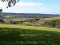
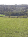
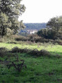
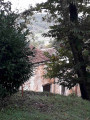
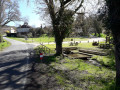
Park in the village of Grignols, in the few angle-parking spaces to the left of the Salle des Fêtes. There are signposts indicating the two circular walks and the links to Manzac and Vallereuil.
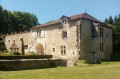
(S/E) Take the narrow lane on the left (red and whiteGR®361markings) then, at the top, turn left onto the road leading up to the castle (yellow markings). This road passes beneath the castle, then continues along the ridge.
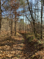
(1) At the Pontout three-way junction, leave theGR® and take the path on the left (Impasse Soutenac). When you see a house, turn onto the path on the right which runs alongside a laurel hedge and continues into the woods. At a T-junction (not shown on the IGN map), turn left and you’ll soon reach another junction.
(2) Pass the circular Chaulnes loop on your left and turn right, following signs for the “historic trail” and “Vallereuil link”. Further on, join a wider track, where you continue to the left, skirting a vineyard.
(3) When you reach a road, turn right: if you go left, you’ll soon reach the Jaure circular loop. Continue for a good kilometre along the same road until you reach the Stop sign on the D107: signposted “route de Villamblard”. Turn right (no signpost) for a few tens of metres: be careful, as it’s a busy road.
(4) Turn left onto the Chemin de Haut Fourcaud, then carry on straight ahead at the next crossroads. Shortly after a ruined farm, you’ll see the castle on your right. At the next crossroads, go straight on, towards “Fourcaud”.
(5) Leave the main track and turn right, towards “historic trail, Saint-Léon-sur-l’Isle, Saint-Astier”. Shortly afterwards, at a three-way junction not shown on the map, head straight ahead. When you reach a pidgeon hunting hut, follow the path opposite: there’s a ‘discreet’ signpost on the right, leaning against a tree. You’ll come to a road above a farm, at a place called Varenas.
(6) Turn right and head straight down to the Route de Vallereuil. Follow this road, taking care to keep to the right, for about 200 metres.
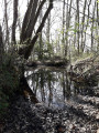
(7) Turn left onto Impasse du Moulin d’Acquit, pass between the buildings and continue along the path. Cross the Vern, then turn left at the T-junction.
(8) Leave the path running alongside the fence and turn right onto a path through the fields. When you reach the road (D44), cross carefully and take the Route des Métayers opposite. At the junction with the Route du Mas, turn left, pass through the hamlet, then continue along the Route de Puyloupat, which climbs to the right. Pass the Grange du Bost.
(9) Turn right onto Impasse des Vignauds (signpost at the corner). At the rest stop, there’s a view over the Vern Valley – which flows into the Isle at Neuvic – as well as over the village of Grignols and its castle. When you reach the houses, continue along the path. After a climb, you’ll reach the first house, which you go round to the left: it feels a bit like you’re on private property, but the signposting is clearly visible. Join a road and follow it to the right. At the next junction, turn right onto the Route des Plateaux for about 200 metres, and rejoin the Chaulnes circular route that you left at the start of the walk.
(10) Take the path on the right, following the sign for “Bourg de Grignols”.
(11) As you emerge from the woods, continue to the right along the track: another viewpoint over the valley. Follow the track which runs alongside the fence and descends back into the valley. You’ll reach the junction with the D44.
(12) Cross carefully and follow the road opposite, which crosses the River Vern. Shortly afterwards, turn right to return to the starting point (S/E).



 Visorando Member
 Easy
Easy 
 Tourist office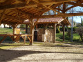
 Difficult
