Grignols – Toupy Circular Loop

A short circular loop to get back into the swing of things in a charming valley.

Details

5943306
Creation:
Last update:
Last review:
  • Walking
    Activity: Walking
  • ↔
    Distance: 5.17 mi
  • ◔
    Average duration: 3h 00 
  • ▲
    Difficulty: Easy

  • ⚐
    Back to start: Yes
  • ↗
    Ascent: + 755 ft
  • ↘
    Descent: - 745 ft

  • ▲
    Highest point: 669 ft
  • ▼
    Lowest point: 253 ft

Description of the walk

Park in the village square of Grignols near the town hall.

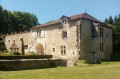
(S/E) Take the uphill lane to the left of the square, heading towards the castle. Leave the road and turn right onto the path leading to the houses. Continue towards the castle along a grassy path. Walk past the castle via the esplanade in front of it and you’ll immediately reach a road.

(1) Turn right onto this road and you will soon reach the hamlet of Pontout.

(2) Turn left onto the path and carry on, passing to the right of the hamlet of Soutenac. Continue through the woodland until you reach a crossroads with several paths – signposted – near the houses at Puy de Lagarde.

(3) Join the road and follow it generally northwards. Further on, you’ll come to another crossroads.

(4) Turn left, then leave the road at the next junction by turning right onto a track through the pastures. Follow this track north-westwards to reach the hamlet of Pont du Bruc.

(5) Turn right onto the road and cross the Vern via the bridge. Turn right at the crossroads by the wash house, then left onto the track leading to the Bruc stadium. You will then begin a somewhat steep and stony climb. Follow the edge of a wood, continue into the wood and then back along the edge to reach another crossroads.

(6) Turn left here, passing between some houses. At the next junction, turn right onto the road and, a few hundred metres further on, you’ll come to another junction with several directions.

(7) Turn left towards Toupy, as indicated on a sign. Stay on the left-hand road at the next junction, then walk alongside the hamlet of Toupy. Continue downhill and, after a short, gentle climb, you’ll reach the junction with the D107.

(8) Turn right onto this road to reach a path junction at thefirst house.

(9) Leave the road here and turn right onto the footpath. Follow an easy climb to reach the tennis courts. Turn left onto the path marked in yellow. Cross the D44 road with care and enter Grignols via the Ponts Rouges neighbourhood. At the road, turn right to return to the car park at Place de Grignols (S/E).

Waypoints

  1. S/E : mi 0 - alt. 262 ft - Car park on the Place de Grignols
  2. 1 : mi 0.29 - alt. 443 ft - Road junction after the castle esplanade
  3. 2 : mi 0.41 - alt. 489 ft - Pontout
  4. 3 : mi 1.08 - alt. 541 ft - Puy de Lagarde crossroads
  5. 4 : mi 1.41 - alt. 305 ft - Road junction
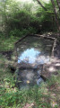
  6. 5 : mi 1.93 - alt. 259 ft - The Pont du Bruc on the - Vern (rivière)
  7. 6 : mi 3 - alt. 669 ft - Junction towards the D107
  8. 7 : mi 3.35 - alt. 653 ft - Crossroads towards Toupy
  9. 8 : mi 4.06 - alt. 410 ft - D107
  10. 9 : mi 4.47 - alt. 305 ft - Crossroads, signposted path
  11. S/E : mi 5.17 - alt. 266 ft - Car park on the Place de Grignols

Reviews and comments

3.7 / 5
Based on 5 reviews

Reliability of the description
3.4 / 5
Ease of following the route
3.4 / 5
Route interest
4.4 / 5
tupac
tupac
• Edited:

A landowner appears to have blocked off every possible route by erecting multiple barbed-wire fences across a path that was once accessible but is now an obstacle course.

Faced with the barriers, we had to venture deeper into the woods, skirting the edge of his fence. This makeshift route requires a bit of resourcefulness, but is still manageable. However, on the way out: watch out for the bend further down, with a treacherous ditch hidden beneath the tall grass – a real trap for unsuspecting walkers.

And then, further into the undergrowth… a shocking sight: thousands of shards of glass, rusty scrap metal and other metallic rubbish litter the ground. The ground seems literally poisoned, transformed into an illegal tip.

This is the state of a hiking trail today: between hostile fences and dangerous pollution, all that remains is anger and outrage.

Machine-translated

crouzatier monique
crouzatier monique

Overall rating : 3 / 5

Date of your route : Nov 04, 2024
Reliability of the description : ★★★☆☆ Average
Ease of following the route : ★★☆☆☆ Disappointing
Route interest : ★★★★☆ Good
Very busy route : No

The directions aren’t precise enough
When I reach point 6 on the route description, I come across the path!!! It’s blocked by a wide green string and a sign
“CAUTION: BULLS”
It’s the farmer who puts this up to let the cows through, and there’s an electric fence as well
I had to turn back

Machine-translated

Redbearb
Redbearb

Overall rating : 4.7 / 5

Date of your route : Oct 28, 2024
Reliability of the description : ★★★★☆ Good
Ease of following the route : ★★★★★ Very good
Route interest : ★★★★★ Very good
Very busy route : No

A landowner has effectively taken over a right of way by installing an electric gate. This is understandable, given that the path runs right through the middle of his farm. Perhaps it would be sensible to suggest a bypass route. The problem is, he’s putting up fences with barbed wire.
We made our way through the woods towards the road below, skirting his fence – it’s quite easy if you’re resourceful. Be careful when you reach the bend in the road: there’s a small ditch to jump over amongst the grass.
Back in the woods once more, a decomposing duck carcass…

Machine-translated

pasbro
pasbro

Overall rating : 4.3 / 5

Date of your route : Aug 18, 2024
Reliability of the description : ★★★★☆ Good
Ease of following the route : ★★★★☆ Good
Route interest : ★★★★★ Very good
Very busy route : No

A lovely walk, but there’s one annoying problem: near marker 6, the path is blocked by a landowner using a rope and threatening signs saying ‘dangerous dog’… but if you force your way through, the path continues onto a public road.

Machine-translated

manick0224
manick0224

Overall rating : 3 / 5

Date of your route : Apr 11, 2022
Reliability of the description : ★★★☆☆ Average
Ease of following the route : ★★☆☆☆ Disappointing
Route interest : ★★★★☆ Good
Very busy route : No

The signposts have been tampered with by farmers (or hunters). It’s a real shame, and we turned back.

Machine-translated

JoséBis
JoséBis

Overall rating : 3.7 / 5

Date of your route : Dec 21, 2021
Reliability of the description : ★★★☆☆ Average
Ease of following the route : ★★★★☆ Good
Route interest : ★★★★☆ Good
Very busy route : No

Hello,
A lovely route, with beautiful woodland and rolling hills offering some lovely views.
However, watch out for dogs running loose.
Well worth a walk, even in winter.

Machine-translated

Other walks in the area

For more walks, use our search engine .

The GPS track and description are the property of this route's author. Please do not copy them without permission.